More From Contributor

£10.99
The beautiful London Postcards by Cavallini & Co. feature colourful Vintage London’s Posters prints. Packed in a stylish silver tin, the 18 postcards come in 9 different designs, each measuring 10x 14.5 cm. These postcards are truly unique, send them or frame them, they will be treasured. ...
Archived Product
£9.95
Containing 20 detachable postcards featuring leading fashion illustrator Jason Brooks` stunning work from his London Sketchbook. ...
Archived Product
£5.99
This title features 25 illustrated cards which are partly coloured but allow the sender to complete the colouring in their own style. 22 of the cards have one of the famous London landmarks on each of them, from the Houses of Parliament & Buckingham Palace to taxis & guardsmen in uniform. The reverse sides have space for the sender to write descriptions of what they have seen & done. It

Includes::
helpful suggestions on what to write. It features three cards that have a blank space for the sender to draw & colour their own picture of what they have seen.

...
Archived Product
£6.50
Postcode & Administrative Boundaries map of London by the Geographers' A-Z Map Company at 1:64, 000, in colour & double sided covers Greater London & it extends to Chesham & Epping in the north, Guildford & Reigate in the south & Windsor & Gravesend to the west & east respectively. On one side the map shows postal county, posttown & postcode boundaries in coloured lines & postal county posttown names & postocode numbers. On the other side the map shows county & unitary authority boundaries, district boundaries, county names, unitary authority names & district names. On both sides these details are overlaid on a slightly fainted London road map which features motorways, A & B roads, Railway & Underground lines & stops. in addition, congestion charging & low emission zones are clearly marked. This map was published in 2011. ...
Archived Product
£16.99
The London Postcode District Jigsaw is a 120 pieces puzzle, featuring a map of London with postcodes, the names of the different boroughs, & 47 places of interests marked with red illustrations. This is a fun jigsaw for anyone who loves London & who wants to explore & getting to know better the city. The finished puzzle measures Approx. 45x 45cm & the coverage extends from Hanwell W7 & Mortlake SW14 in the west & to East Ham E6 & Thamesmead SE26 in the east, & from Southgate N14 in the north to South Norwood SE25 in the south. Please note only the first part of the postcodes is provided. ...
Archived Product
£11.99
A-Z Premier Map of London at 1:21, 477 (3 inches to 1 mile), waterproof & tear-resistant version, from Geographers` A-Z Map Company, designed to cover an area around at least a six-mile radius from Charing Cross, with a separate 124-page index booklet attached to the map cover. Coverage extends to Collindale, Muswell Hill, Walthamstow, Wanstead, Woolwich, Eltham, Sydenham, Wimbledon, Richmond, Wembley & Harrow. The map uses the same cartography as A-Z’s range of street atlases; the index in this version is printed in black (i.e. without highlighting districts & places of interest/facilities). Current edition of this version was published in 2012. The Premier Map of London is also available in a paper version or as a wall map, but please note that edition dates may vary.A-Z street atlases & street maps of London use the same basic cartography, enlarged or reduced according to the requirements of each title, so the print size of street names & other named features will vary according to the map scale. The mapping show A & B roads with route numbers, indicating as appropriate selected house number of easier identification of addresses. One way streets are marked & on A road, where useful, traffic flow direction. Colouring also indicates pedestrianized or restricted access streets & the maps show Congestion Charging Zone boundary, selected car parks, park & ride facilities & locations of speed cameras. In addition of railway & London Transport stations, the maps also show tramlink routes with stops, & river bus stops. Colouring indicates various types of buildings: places of interest, shopping centres & markets, leisure facilities, medical centres, etc. Also marked are public toilets, indicating facilities of disabled users. Unless indicated to the contrary, the index shows districts & various facilities or places of interest in colour to make them easy to see. All versions all include a diagram of London Transport’s Underground/ Overground/DLR network. Stanford’s presentation of the individual atlases

Includes::
an image showing the extent of the coverage. Street maps adapt the basic cartography to present various aspects of capital. Forpublication dates & other special features of each title please see the individual description.

...
Archived Product
£24.99
London Premier Wall Map, size 121 x 96cm
- encapsulated version, from Geographers` A-Z Map Company at 3 inches to 1 mile (1:21,
...
Archived Product
£6.99
London Premier Wall Map, size 121 x 96cm
- paper version, from Geographers` A-Z Map Company at 3 inches to 1 mile (1:21, 477),
...
Archived Product
£6.50
London Premier Street Plan at 3 inches to 1 mile (1:21, 477) from Geographers' A-Z Map Company, designed to cover an area around at least a six-mile radius from Charing Cross, with a separate 124-page comprehensive index booklet listing streets, places & areas, industrial estates, selected flats & walkways, junction names & selected places of interest, shown where appropriate with their postcodes. The plan shows A & B roads annotated with selected house numbers for easier identification of addresses. One way traffic, restricted access, pedestrianized streets, junction names, selected car parks & the boundary of the Congestion Zone are marked. Railway, Underground, Docklands Light Railway & River Bus stations/stops are shown with names. Colouring and/or symbols indicate public building, services & facilities, including shopping centres or market streets, industrial buildings, hospitals or healthcare, educational establishments, etc. Public toilets are marked, indicating those with facilities for the disabled. The map also shows local authority & postcode boundaries, plus national grid lines. The index is in a separate, 128-page booklet attached to the map cover &

Includes::
additional lists of hospitals/walk-in medical centres/hospices, plus railway/ Underground/ Docklands Light Railway/river bus stations. This is the 2011 edition of this map. This title is also available in a waterproof & tear-resistant version, or as a wall map on paper or encapsulated.

...
Archived Product
£24.99
London Premier Wall Map, size 121 x 96cm, encapsulated version, from Geographers' A-Z Map Company at 3 inches to 1 mile (1:21, 477), designed to cover an area around at least a six-mile radius from Charing Cross, with a separate 124-page comprehensive index booklet listing streets, places & areas, industrial estates, selected flats & walkways, junction names & selected places of interest, shown where appropriate with their postcodes. The plan shows A & B roads annotated with selected house numbers for easier identification of addresses. One way traffic, restricted access, pedestrianized streets, junction names, selected car parks & the boundary of the Congestion Zone are marked. Railway, Underground, Docklands Light Railway & River Bus stations/stops are shown with names. Colouring and/or symbols indicate public building, services & facilities, including shopping centres or market streets, industrial buildings, hospitals or healthcare, educational establishments, etc. Public toilets are marked, indicating those with facilities for the disabled. The map also shows local authority & postcode boundaries, plus national grid lines. The index is in a separate, 124-page booklet &

Includes::
additional lists of hospitals/walk-in medical centres/hospices, plus railway/ Underground/ Docklands Light Railway/river bus stations. This title is also available on paper, or as a folded map on paper or waterproof.LAMINATED & ENCAPSULATED WALL MAPS:- laminated wall maps have a thin layer of plastic usually applied to the printed side only. They can be written on with suitable marker pens without any damage to the map but, unless laminated on both sides, they are not damp-proof.- encapsulated wall maps are sealed between two sheets of plastic. They are more rigid & heavier than laminated maps of the same size. They are damp-proof & do not crinkle in humid conditions. Encapsulation gives the map a shiny surface, similar to being displayed behind glass.- please note: many publishers & retailers often use these two terms interchangeably. Our map titles & descriptions follow the definitions provided above.

...
Archived Product

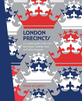
London Precincts: A Curated Guide To The City`s Best Shops, Eateries,
Bars And Other Hangouts

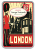
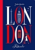
London is one of the world`s greatest cities. It`s iconic and dynamic; a vibrant city where the past and present meet in an explosion of art and culture. It`s also a city that is constantly on the move. From its earliest explorers, London has never been afraid to venture to new worlds and discover new and wonderful things. This hasn`t changed through the centuries. London continues to create and innovate with cutting edge ideas, especially in its food scene where you can literally taste the world from its diverse offerings, or even be transported to another world completely! Likewise with London`s libations. Pubs are the beating heart of London and there`s practically one on every corner (kind of like churches in Rome). But the beverages on offer would make any heart beat faster. And
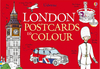
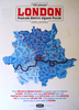
once you`re full of good food and wine, it`s time to hit the shops and enter another stratosphere altogether. Oliver Twist`s immortal question has never been more resonant, because you`ll definitely want to have more of London! This book features the best eating, drinking and shopping across 18 London precincts, including Covent Garden, King`s Cross, Soho and Piccadilly.Precinct maps make this a handy and useful guidebook, while the hardback cover creates a beautiful keepsake. London Precincts is the 6th book in Hardie Grant Travel`s Precinct series, which has been shortlisted for the 1010 Printing Best Designed Series (Including Classics) award in the 2016 Australian Book Design Awards. The winners will be announced on Friday 13 May in Melbourne.
RIP - This product is no longer available on our network. It was last seen on 25.09.2019

This page now acts as a permanent archive for this product. Add more information using the comments box below to ensure it can still be found by future generations.

Use our search facility to see if it is available from an alternative contributor.
  • Availability: Out Of Stock
  • Supplier: Stanfords
  • SKU: 9781741174991
Availability: In Stock
£17.99

Product Description

London is one of the world`s greatest cities. It`s iconic & dynamic; a vibrant city where the past & present meet in an explosion of art & culture. It`s also a city that is constantly on the move. From its earliest explorers, London has never been afraid to venture to new worlds & discover new & wonderful things. This hasn`t changed through the centuries. London continues to create & innovate with cutting edge ideas, especially in its food scene where you can literally taste the world from its diverse offerings, or even be transported to another world completely! Likewise with London`s libations. Pubs are the beating heart of London & there`s practically one on every corner (kind of like churches in Rome). But the beverages on offer would make any heart beat faster. & once you`re full of good food & wine, it`s time to hit the shops & enter another stratosphere altogether. Oliver Twist`s immortal question has never been more resonant, because you`ll definitely want to have more of London! This book features the best eating, drinking & shopping across 18 London precincts, including Covent Garden, King`s Cross, Soho & Piccadilly. Precinct maps make this a handy & useful guidebook, while the hardback cover creates a beautiful keepsake. London Precincts is the 6th book in Hardie Grant Travel`s Precinct series, which has been shortlisted for the 1010 Printing Best Designed Series (Including Classics) award in the 2016 Australian Book Design Awards. The winners will be announced on Friday 13 May in Melbourne.

Reviews/Comments

Add New

Intelligent Comparison

Oooops!
We couldn't find anything!
Perhaps this product's unique.... Or perhaps we are still looking for comparisons!
Click to bump this page and we'll hurry up.

Price History

Vouchers

No voucher codes found.
Do you know a voucher code for this product or supplier? Add it to Insights for others to use.

Facebook

Jargon Buster

Wine - An alcoholic drink made from fermented grapes.
Garden - An outside area with grass and foliage
garden - A planned space used for the display, cultivation and enjoyment of plants and other forms of nature.
World - A physical grouping, commonly used to describe earth and everything associated with ti
King - The figure head of a monarch
edge - Enhanced data rates for GSM evolution also known as enhanced GPRS. A mobile phone technology with improved data transmission rates.
edge - The point at which two surfaces meet
cutting - The seperation of an object usually using a cutting tool such as a knife
Heart - An organ that pumps blood around the body. Usually related to love.
Hardback - Referring to books something that is made from thick stiff card
Design - A drawing or styles that shows the look and functionality of something before its made.
Wonderful - Another word for describing something that is extremely good, marvellous.

Supplier Information

Stanfords
Stanfords was established in 1853 and opened their iconic Covent Garden flagship store in 1901. They have become the top retailer of maps, travel books and accessories in the UK and arguably offer the largest selection of maps and travel books worldwide. Famous names such as Captain Robert Falcon Scott, Ranulph Fiennes and Michael Palin have purchased from Stanfords. They now have a shop in Bristol and both stores together with other venues operate a calendar of events including talks, book signings and exhibitions. As a specialist map retailer, the map selection is comprehensive and includes road maps, street maps and walking maps from worldwide destinations, as well as a selection of world atlases and wall maps. Books include travel guides and travel literature. Stanfords also stock globes, from miniatures made of blue marble to magnificent floor-standing globes. The website features a selection of interesting articles on travel topics.
Page Updated: 2023-11-12 20:15:36

Community Generated Product Tags

Oh No! The productWIKI community hasn't generated any tags for this product yet!
Menu