
 United Kingdom
 France
 Germany
 Netherlands
 Sweden
 USA
USA
 Italy
Italy
 Spain
Spain
More From Contributor


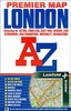
London Postcode And Administrative Boundaries Map
Postcode and Administrative Boundaries map of London by the Geographers' A-Z Map Company at 1:64, 000, in colour and double sided covers Greater London and it extends to Chesham and Epping in the north, Guildford and Reigate in the south and Windsor and Gravesend to the west and east respectively. On one side the map shows postal county, posttown and postcode boundaries in coloured lines and postal county posttown names and postocode numbers.On the other side the map shows county and unitary authority boundaries, district boundaries, county names, unitary authority names and district names.On both sides these details are overlaid on a slightly fainted London road map which features motorways, A and B roads, Railway and Underground lines and stops. Additionally, congestion charging
and low emission zones are clearly marked.This map was published in 2011.
and low emission zones are clearly marked.This map was published in 2011.
Product Description
Reviews/Comments
Add New
Intelligent Comparison
Archived Product
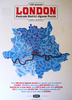
London A-Z Postcode & Administrative Boundaries Stanfords
£6.95
Archived Product
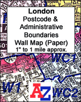
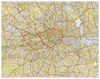
London A-Z Postcode & Administrative Boundaries Wall Map PAPER Stanfords
£6.99
Archived Product
London A-Z Postcode & Administrative Boundaries Wall Map ENCAPSULATED Stanfords
£24.99
Vouchers
No voucher codes found.
Do you know a voucher code for this product or supplier? Add it to Insights for others to use.
Do you know a voucher code for this product or supplier? Add it to Insights for others to use.
 Denmark