
 United Kingdom
 France
 Germany
 Netherlands
 Sweden
 USA
USA
 Italy
Italy
 Spain
Spain
More From Contributor

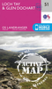
Loch Tay And Glen Dochart WATERPROOF
Map No. 51, Loch Tay and Glen Dochart, in a waterproof and tear-resistant version of the Ordnance Survey Landranger series at 1:50, 000, including Loch Lomond and the Trossachs National Park, Tay Forest Park, Glen Ogle, Glen Lednock, Glen Lochay, Glen Lyon, Rannoch with Rannoch Moor, the peaks of Ben More, Creag Each, Ben Chonzie, Beinn Heasgarnich, Meall Ghaordaidh, Ben Lawers, and Carn Mairg, Loch Lednock Reservoir, Lochs Earn, Voil, Lyon, An Daimh and Rannoch, plus Killichonan, Bridge of Gaur, Kinloch Rannoch, Tummel Bridge, Invervar, Keltneyburn, Kenmore, Fearnan, Innerwick, Gallin, Acharn, Ardtalnaig, Ardeonaig, St Fillans, Comrie, Killin, Lochearnhead, Ardchyle and Balquhidder. Edition B2; Revised for selected changes 2007; Copyright date 2007
This title is also available on our website in a paper version.Maps in this series are only published folded. Stanfords can also print flat versions of Ordnance Survey maps through the OS Select system, centring the map on a location of your choice and with a picture provided by you on the cover. For more information please click on the link at the bottom of this description.About Ordnance Survey
This title is also available on our website in a paper version.Maps in this series are only published folded. Stanfords can also print flat versions of Ordnance Survey maps through the OS Select system, centring the map on a location of your choice and with a picture provided by you on the cover. For more information please click on the link at the bottom of this description.About Ordnance Survey
Product Description
Reviews/Comments
Add New
Intelligent Comparison
Archived Product
Loch Tay And Glen Dochart Stanfords
£5.59
Archived Product
Loch Tay And Glen Dochart OS ACTIVE Map Stanfords
£9.09
Vouchers
No voucher codes found.
Do you know a voucher code for this product or supplier? Add it to Insights for others to use.
Do you know a voucher code for this product or supplier? Add it to Insights for others to use.
 Denmark