More From Contributor

£6.99
Loch Ness, with its legendary monster, is the most famous of all lochs. It holds more water than all the lakes of England & Wales combined & the countryside around it features an equally great variety of walks, with more waymarked trails & easy routes suitable for families than many other parts of the Highlands. Further north lies the magnificent Glen Affric
- Scotland`s most beautiful glen. This is a wonderful area of the Highlands for walkers, having the highest mountains north of the Great Glen but also some splendid lower-level & forest walks. To the east is the fertile Black Isle, packed with charming villages & some fine beaches, whilst further north still is Dingwall, a gateway to the spectacular Northern Highlands.
...
Archived Product
£9.99
Loch Ness, with its fabled monster, plays host to over 500, 000 visitors every year, boasting more interest than Stonehenge & other popular attractions put together. This guidebook offers comprehensive coverage of Inverness
- capital of & gateway to the Highlands
- as well as the isolated villages surrounding Loch Ness. It

Includes::
listings on accommodation, visitor attractions, restaurants, & sections on children, entertainment & nightlife, shopping for all needs, transport & leisure activities. Having interviewed leading Nessie researchers, the author also gives a factual account of the scientific search for Britain's most elusive resident. Adrian Shine, Alistair Boyd & David Martin
- who exposed the infamous Surgeon's Photograph as a fake, Dr Bob Rhines, & the most famous monster hunter of them all, the late Tim Dinsdale: each have played a part in the search for the answer to the 20th century's most baffling enigma, & this book recounts their efforts.


...
Archived Product
£14.99
Waterproof & tear-resistant OS Active version of map No. 51 from the Ordnance Survey’s Landranger series at 1:50, 000, with contoured & GPS compatible topographic mapping plus tourist information.MOBILE DOWNLOADS: As well as the physical edition of the map, each Landranger title now

Includes::
a code for downloading after purchase its digital version onto your smartphone or tablet for viewing on the OS smartphone app.OS LANDRANGER SERIES: to see the list of all the titles in the OS Landranger series, both paper & waterproof versions, please click on the series link. Maps in the Landranger series provide plenty of recreational & tourist information, indicating the traditional public right of way paths (except in Scotland where different laws apply), including bridleways & byways restricted or open to motorized traffic. National Trails & selected other long-distance paths are marked, as well as on-road & traffic-free cycle routes with their National/ Regional Cycle Network numbers. National Trust/ National Trust for Scotland & Forestry Commission land is clearly marked, indicating open or restricted access. A range of symbols highlights camping & caravanning sites, youth hostels, tourist information offices & visitors’ centres, parking & picnicking places, World Heritage sites, sport & recreational facilities, etc. The maps provide detailed presentation of topography with contours at 10m intervals, numerous spot heights & additional colouring and/or graphics for different types of woodlands, orchards or parkl&, rock features including scree & cliffs, water features inland & along the sea shore with marshl&, dunes, s&, mud, shingle & the high water mark. All the standard information expected of survey mapping at this scale is included: finely graded road network, railway lines with stations, cuttings, embankments, etc; individual isolated buildings; archaeological & historical sites, etc. For GPS users the British National Grid is shown at 1km intervals, with latitude & longitude given by margin ticks at 1` & cross hairs on the map at 5`. Each map covers an area of 40 x 40km, (approx. 25 x 25 miles).

...
Archived Product
£8.99
Paper version of map No. 51 from the Ordnance Survey’s Landranger series at 1:50, 000, with contoured & GPS compatible topographic mapping plus tourist information.MOBILE DOWNLOADS: As well as the physical edition of the map, each Landranger title now

Includes::
a code for downloading after purchase its digital version onto your smartphone or tablet for viewing on the OS smartphone app.OS LANDRANGER SERIES: to see the list of all the titles in the OS Landranger series, both paper & waterproof versions, please click on the series link. Maps in the Landranger series provide plenty of recreational & tourist information, indicating the traditional public right of way paths (except in Scotland where different laws apply), including bridleways & byways restricted or open to motorized traffic. National Trails & selected other long-distance paths are marked, as well as on-road & traffic-free cycle routes with their National/ Regional Cycle Network numbers. National Trust/ National Trust for Scotland & Forestry Commission land is clearly marked, indicating open or restricted access. A range of symbols highlights camping & caravanning sites, youth hostels, tourist information offices & visitors’ centres, parking & picnicking places, World Heritage sites, sport & recreational facilities, etc. The maps provide detailed presentation of topography with contours at 10m intervals, numerous spot heights & additional colouring and/or graphics for different types of woodlands, orchards or parkl&, rock features including scree & cliffs, water features inland & along the sea shore with marshl&, dunes, s&, mud, shingle & the high water mark. All the standard information expected of survey mapping at this scale is included: finely graded road network, railway lines with stations, cuttings, embankments, etc; individual isolated buildings; archaeological & historical sites, etc. For GPS users the British National Grid is shown at 1km intervals, with latitude & longitude given by margin ticks at 1` & cross hairs on the map at 5`. Each map covers an area of 40 x 40km, (approx. 25 x 25 miles).

...
Archived Product
£5.59
Map No. 51, Loch Tay & Glen Dochart, in the Ordnance Survey Landranger series at 1:50, 000, including Loch Lomond & the Trossachs National Park, Tay Forest Park, Glen Ogle, Glen Lednock, Glen Lochay, Glen Lyon, Rannoch with Rannoch Moor, the peaks of Ben More, Creag Each, Ben Chonzie, Beinn Heasgarnich, Meall Ghaordaidh, Ben Lawers, & Carn Mairg, Loch Lednock Reservoir, Lochs Earn, Voil, Lyon, An Daimh & Rannoch, plus Killichonan, Bridge of Gaur, Kinloch Rannoch, Tummel Bridge, Invervar, Keltneyburn, Kenmore, Fearnan, Innerwick, Gallin, Acharn, Ardtalnaig, Ardeonaig, St Fillans, Comrie, Killin, Lochearnhead, Ardchyle & Balquhidder. Edition B2; Revised for selected changes 2007; Copyright date 2007 This title is also available on our website in a waterproof & tear-resistant version. Maps in this series are only published folded. Stanfords can also print flat versions of Ordnance Survey maps through the OS Select system, centring the map on a location of your choice & with a picture provided by you on the cover. For more information please click on the link at the bottom of this description. About Ordnance Survey ...
Archived Product
£10.39
Map No. 51, Loch Tay & Glen Dochart, in a waterproof & tear-resistant version of the Ordnance Survey Landranger series at 1:50, 000, including Loch Lomond & the Trossachs National Park, Tay Forest Park, Glen Ogle, Glen Lednock, Glen Lochay, Glen Lyon, Rannoch with Rannoch Moor, the peaks of Ben More, Creag Each, Ben Chonzie, Beinn Heasgarnich, Meall Ghaordaidh, Ben Lawers, & Carn Mairg, Loch Lednock Reservoir, Lochs Earn, Voil, Lyon, An Daimh & Rannoch, plus Killichonan, Bridge of Gaur, Kinloch Rannoch, Tummel Bridge, Invervar, Keltneyburn, Kenmore, Fearnan, Innerwick, Gallin, Acharn, Ardtalnaig, Ardeonaig, St Fillans, Comrie, Killin, Lochearnhead, Ardchyle & Balquhidder. Edition B2; Revised for selected changes 2007; Copyright date 2007 This title is also available on our website in a paper version. Maps in this series are only published folded. Stanfords can also print flat versions of Ordnance Survey maps through the OS Select system, centring the map on a location of your choice & with a picture provided by you on the cover. For more information please click on the link at the bottom of this description. About Ordnance Survey ...
Archived Product
£6.99
The Lochaber & Glencoe area is rich in historical associations. It was at Glenfinnan that Bonnie Prince Charlie started his long marchsouthwards to lay claim to the British throne, & Glencoe was the scene of one of the most vicious massacres in Scottish history. But a longer & even more turbulent history is played out geologically. Ancient volcanoes erupted in massive explosions, causing shock wavesthat reverberated around the planet. Their eroded remains form some of the breathtaking scenery for which Glen Coe is famous, as well as thehighest mountain in Britain
- Ben Nevis. Ice too played its part as glaciers scraped their passage across the landscape, carving deep glens andshaving the tops off the highest mountains. This book is fascinating introduction to the geology of the area, which features some of Scotland`s oldest rocks & some of its most stunningand dramatic scenery.
...
Archived Product
£12.95
Noel Williams’ Cicerone guide to Scrambles in Lochaber describes some of the best scrambles to be found within a 45kn radius of the town of Fort William. It features Ben Nevis, Glen Coe, Ben Alder to the east, Ben Cruachan to the south, Garbh Bheinn to the west & The Saddle to the north. It is one of the most popular areas in the whole of Scotland with hill-goers, containing some of the most varied & spectacular scenery in the Highlands. The guide contains over 70 routes of varying difficulty with individual grading ratings for each scramble. Many of the scrambles included involve lengthy sections of hill-walking in approach & descent, making it easier to pre-plan routes. Detailed route descriptions are accompanied by line drawings mapping the route as well as colour photographs. ...
Archived Product
£12.99
Topographic survey of France at 1:25, 000 in IGN`s excellent TOP25 / Série Bleue series. All the maps are GPS compatible, with a 1km UTM grid plus latitude & longitude lines at 5’ intervals. Contours are at 5m intervals except for mountainous areas where the maps have contours at 10m intervals, vividly enhanced by hill shading & graphics for rocky terrain. Colouring with graphics indicates different types of vegetation or land use (deciduous or coniferous forests, moors, orchards, vineyards, etc). PLEASE NOTE: coverage of France at this scale is currently being revised – the format & the presentation of each title are indicated by the letters at the end of its Sheet Reference number (e.g. 0416ET, 3531ETR, 1923SB, etc.)MAPS WITH FULL TOURIST OVERPRINT & AN ENGLISH MAP LEGEND: all TOP25 maps & the SB editions of Série Bleue have an overprint highlighting waymarked walking trails including long-distance GR routes &, where appropriate, ski routes. Symbols indicate campsites, gîtes d’etape, refuges, equestrian centres & other recreational facilities or sites, tourist information centres, cultural heritage, etc. Towns & locations of particular interest are highlighted.- ET or OT = single-sided TOP25 map covering approx. 29x 21 km / 18x 13 miles.- ETR or OTR = waterproof & tear resistant TOP25 map covering the same area as the corresponding ET or OT number, but double-sided, printed on a smaller size sheet with a good overlap between the sides.- SB = Série Bleue map with full tourist overprint; these maps, first introduced in summer 2014, each cover approx. 29x 24km / 18x 15 miles.SÉRIE BLEUE maps with numbers ending in E (Est) or O (Ouest): most editions now indicate the GR routes, but do not show any other tourist information. Map legend is in French only. Each map covers approx. 14x 20km / 9x 12 miles. ...
Archived Product
£6.39
A detailed topographic map of Lochgilphead & Knapdale North from the Ordnance Survey Explorer series, covering Kilmartin. Edition A1; Publication date October 2006 About this series: These highly detailed maps show all the administrative boundaries, settlements as small as isolated farms, the road network down to unfenced roads & country tracks, & field boundaries (hedges & drystone walls) which make navigation across the countryside much easier. Steep gradients on roads are indicated. Various landmarks, e.g. powerlines, archaeological sites, windmills, churches & lighthouses are shown & additional graphics indicate natural terrain features such as cliffs, scree, mud & vegetation variations. The contour interval is 5 metres in the lower parts of the country & 10 metres in the uplands, & spot heights are marked. Each map covers an area of 30 x 20km (i.e. approx. 19 x 12 miles), with some double-sided maps covering more, as indicated in the individual descriptions. The maps are fully GPS compatible, with the National Grid shown at 1km intervals & latitude & longitude indicated by margin ticks at 1'. The Explorer series has replaced the earlier, green-cover Pathfinder maps. The Explorer series is now complete & covers all of Engl&, Wales & Scotl&. Some sheets for popular areas like the National Parks are still branded as Outdoor Leisure (OL) maps, but are now included in this series as the cartography is the same as that in the Explorer Maps. The Explorer maps offer a substantial improvement on the Pathfinder series, with greater use of colour, larger area per map, & stronger emphasis on information for ramblers & tourists. This series is ideal for walking & other outdoor pursuits & each map shows a large amount of information for ramblers & tourists. Public rights of way are shown (except in Scotland), together with other routes with public access: National Trails & Recreational Paths, permitted paths & bridleways, & selected cycle routes. Open access land created under the Countryside & Rights of Way Act 2000 is marked. Tourist information

Includes::
caravan & camp sites, Park & Ride locations, recreation/leisure/sport centres, museums, historic buildings, English Heritage & National Trust sites, rural pubs, etc. The map legend is in English only, except for the tourist information content which is also in French & German.

...
Archived Product

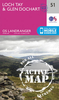
Loch Tay And Glen Dochart OS ACTIVE Map

Map No. 51, Loch Tay and Glen Dochart, in the waterproof and tear-resistant OS Active version of the Ordnance Survey Landranger series at 1:50, 000, including Loch Lomond and the Trossachs National Park, Tay Forest Park, Glen Ogle, Glen Lednock, Glen Lochay, Glen Lyon, Rannoch with Rannoch Moor, the peaks of Ben More, Creag Each, Ben Chonzie, Beinn Heasgarnich, Meall Ghaordaidh, Ben Lawers, and Carn Mairg, Loch Lednock Reservoir, Lochs Earn, Voil, Lyon, An Daimh and Rannoch, plus Killichonan, Bridge of Gaur, Kinloch Rannoch, Tummel Bridge, Invervar, Keltneyburn, Kenmore, Fearnan, Innerwick, Gallin, Acharn, Ardtalnaig, Ardeonaig, St Fillans, Comrie, Killin, Lochearnhead, Ardchyle and Balquhidder.Edition B3; Publication date April 2012About Ordnance
Survey
RIP - This product is no longer available on our network. It was last seen on 25.09.2019

This page now acts as a permanent archive for this product. Add more information using the comments box below to ensure it can still be found by future generations.

Use our search facility to see if it is available from an alternative contributor.
  • Availability: Out Of Stock
  • Supplier: Stanfords
  • SKU: 9780319480953
Availability: In Stock
£9.09

Product Description

Map No. 51, Loch Tay & Glen Dochart, in the waterproof & tear-resistant OS Active version of the Ordnance Survey Landranger series at 1:50, 000, including Loch Lomond & the Trossachs National Park, Tay Forest Park, Glen Ogle, Glen Lednock, Glen Lochay, Glen Lyon, Rannoch with Rannoch Moor, the peaks of Ben More, Creag Each, Ben Chonzie, Beinn Heasgarnich, Meall Ghaordaidh, Ben Lawers, & Carn Mairg, Loch Lednock Reservoir, Lochs Earn, Voil, Lyon, An Daimh & Rannoch, plus Killichonan, Bridge of Gaur, Kinloch Rannoch, Tummel Bridge, Invervar, Keltneyburn, Kenmore, Fearnan, Innerwick, Gallin, Acharn, Ardtalnaig, Ardeonaig, St Fillans, Comrie, Killin, Lochearnhead, Ardchyle & Balquhidder. Edition B3; Publication date April 2012 About Ordnance Survey

Reviews/Comments

Add New

Intelligent Comparison

Oooops!
We couldn't find anything!
Perhaps this product's unique.... Or perhaps we are still looking for comparisons!
Click to bump this page and we'll hurry up.

Price History

Vouchers

No voucher codes found.
Do you know a voucher code for this product or supplier? Add it to Insights for others to use.

Facebook

Jargon Buster

Forest - A area with a high density of trees
Date - A day on a calendar
Date - A social activity whith a current or potential partner
Waterproof - Resistant to water, usualy specified by depth in metres
Resistant - Something that can repel against something.

Supplier Information

Stanfords
Stanfords was established in 1853 and opened their iconic Covent Garden flagship store in 1901. They have become the top retailer of maps, travel books and accessories in the UK and arguably offer the largest selection of maps and travel books worldwide. Famous names such as Captain Robert Falcon Scott, Ranulph Fiennes and Michael Palin have purchased from Stanfords. They now have a shop in Bristol and both stores together with other venues operate a calendar of events including talks, book signings and exhibitions. As a specialist map retailer, the map selection is comprehensive and includes road maps, street maps and walking maps from worldwide destinations, as well as a selection of world atlases and wall maps. Books include travel guides and travel literature. Stanfords also stock globes, from miniatures made of blue marble to magnificent floor-standing globes. The website features a selection of interesting articles on travel topics.
Page Updated: 2023-11-12 20:15:36

Community Generated Product Tags

Oh No! The productWIKI community hasn't generated any tags for this product yet!
Menu