
 United Kingdom
 France
 Germany
 Netherlands
 Sweden
 USA
USA
 Italy
Italy
 Spain
Spain
More From Contributor


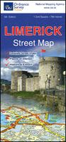
Limerick Street Map
Limerick on an indexed street plan at 1:13, 000 from the Ordnance Survey of Ireland, with an enlargement showing the city centre in greater detail plus reproductions of historical mapping from 1840 and 1870. OSI street plans highlight main traffic arteries in each town: national primary and secondary routes, regional roads and main streets, with one way and pedestrianized streets. Colouring indicates public buildings, highlighting the more important ones, railway/bus stations and medical centres. A range of symbols indicate various facilities, including An Óige or independent hostels, tourist offices, museums and galleries, shopping centres, sport grounds, etc.The city centre enlargement highlights 28 places of interest and/or facilities. The index is on the reverse where this
5th edition of this title also includes reproductions of an Ordnance Survey map of Limerick from 1840 and a plan of the King John’s Castle surveyed in 1870.
5th edition of this title also includes reproductions of an Ordnance Survey map of Limerick from 1840 and a plan of the King John’s Castle surveyed in 1870.

Product Description
Reviews/Comments
Add New
Vouchers
No voucher codes found.
Do you know a voucher code for this product or supplier? Add it to Insights for others to use.
Do you know a voucher code for this product or supplier? Add it to Insights for others to use.
 Denmark