
 United Kingdom
 France
 Germany
 Netherlands
 Sweden
 USA
USA
 Italy
Italy
 Spain
Spain
More From Contributor

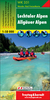
Lecco - Valle Brembane
Map No. 105, Lecco - Valle Brembane, from Kompass, now published on sturdy, waterproof and tear-resistant plastic paper, in a series providing detailed coverage of the Dolomites and Lake Garda area and supplementing their main series of walking maps of Italy at 1:50, 000. Maps in this series have a more detailed base and smaller contour interval than coverage at 1:50, 000.The series covers the northern part of the Italian Alps, the lake region of Lombardy, the Dolomites, Italian Riviera, selected parts of Tuscany and Umbria, the Sorrento Peninsula, and the islands of the Tyrrhenian Sea. Coverage of the Dolomites by Kompass at more detailed scales (mainly 1:25, 000) is listed on our website in a separate series.Cartography: contour interval varies from 100 metres in mountainous
areas to 25 metres in the hills around Florence and Siena. All the maps highlight local hiking paths and, where appropriate, long-distance routes or via ferrata trails, and show various types of accommodation such as selected inns and hotels, campsites, mountain huts and refuges, etc. Some titles also highlight cycle or mountain bike trails or ski routes. Selected titles include on the reverse panorama drawings of the area, as indicated in the individual descriptions.Geographical coordinates: this title has no geographical coordinates.Map legend includes English.PLEASE NOTE BEFORE ORDERING! Booklets: many titles come with booklets describing the area and/or various hiking routes. These booklets are in Italian and German only, apart from a handful of titles where an English language
booklet is specifically indicated in the individual description. So, unless English language booklet is actually mentioned, the map can only be supplied with an Italian/German booklet. These booklets are not necessary to use the maps since, as stated above, full English language map legend is provided.
Product Description
Reviews/Comments
Add New
Intelligent Comparison
Archived Product
Lecco - Valle Brembane SUPERCEDED Stanfords
£7.95
Archived Product
Lecco - Valle Brembane Kompass 105 Stanfords
£13.99
Vouchers
No voucher codes found.
Do you know a voucher code for this product or supplier? Add it to Insights for others to use.
Do you know a voucher code for this product or supplier? Add it to Insights for others to use.
 Denmark