More From Contributor

£10.99
Lecce on an indexed street plan at 1:10, 000 from Litografia Artistica Cartografica in their Globalmap imprint, with a detailed enlargement of the city’s historic centre at 1:6, 000. 39 monuments including historic buildings & churches, cultural or educational institutions, & important municipal buildings or facilities are numbered & listed next to the plan. Litografia Artistica Cartografica (LAC) are Italy’s leading publishers of street plans with an extensive range of titles. Where appropriate, the plans include an enlargement showing the historic centre in greater detail. On each plan monuments including historic buildings & churches, archaeological sites, cultural or educational institutions, & important municipal buildings or facilities are numbered & listed next to the plan. Unless indicated to the contrary in the individual description, one way streets are not marked. Street index is on the reverse. ...
Archived Product
£8.99
Lecce & the Salento Peninsula Smart Map at 1:175, 000 from the Touring Club Italiano, printed on light waterproof & tear-resistant synthetic paper, with street plan of central Lecce, annotated with several sights, plus 10 more recommendations of places worth visiting. Cartography is from TCI’s excellent regional series at 1:200, 000, enlarged here to 1:175, 000 & with an additional overprint to highlight the publishers’ recommendations. On the reverse are notes, based on Touring Editore’s vast experience of presenting the country’s heritage & culture, about various aspects of the region: nature, art, local festivals, etc, or, since all the text is in Italian only: natura e ambiente, arte e cultura, manifestazioni, sapori e ambiente, & tempo libero. Map legend & all the text are in Italian only. To see the list of titles in this series please click on the series link. ...
Archived Product
£12.99
Lecce Province at 1:150, 000 in a series of handy size provincial road maps from Litografia Artistica Cartografica (LAC) with more minor local roads & country tracks than can be found on most regional maps from other publishers. This title is now available in a digitally produced edition.LAC’s provincial series is gradually being changed to a new style of digitally derived cartography, so presentation of adjoining titles may vary. All the maps have hill shading to represent the general relief with spot heights for selected peaks, & show a few more local roads & rough tracks than the other road map series. Intermediate road distances are indicated. Regional, provincial & communal borders are marked, & railways, funiculars, airports, sea ferry links & campsites are shown. The legend is in Italian only. The new, digitally produced editions are indexed & have enhanced, more finely drawn cartography: the hill-shading is less bold, motorway service areas are marked, natural parks are highlighted & an expanded range of symbols indicates various landmarks & sites, e.g. antiquities, churches, etc. Two styles of the new cartography are produced, differing only in the colour of the predominant background shading: grey or yellow/green. Some of the new editions include geographical coordinates for the map corners. The index of localities is on the reverse. To see all the titles in this series please click on the series link. ...
Archived Product
£10.50
Map No. 105, Lecco
- Valle Brembane, from Kompass, now published on sturdy, waterproof & tear-resistant plastic paper, in
...
Archived Product
£13.99
Map No. 105, Lecco
- Valle Brembane, from Kompass, now published on sturdy, waterproof & tear-resistant plastic paper, in
...
Archived Product
£22.99
The best rides in the freeride hot spots of the Alps – this is the simple formula of the Freeride Maps. The first map available to freeriders is making the locals freeride knowledge available to a broad public. All ridable slopes, drops & couloirs are marked as freeride corridors in different colours for three difficulty ratings: blue for technically easy terrain, yellow requires advanced to very advanced ability & red is extremely difficult terrain that is partially exposed & therefore reserved to crack riders. Short ascents are marked with red lines. The Freeride Maps are based on topographic maps 1:25, 000. They contain all essential information about the terrain that is necessary for planning & going freeriding. The maps are printed on water resistant & indestructible paper. On the back side, the maps include all relevant planning, safety & rescue information. ...
Archived Product
£9.99
Lechtaler
- Allgäuer Alpen
- Oberstdorf
- Landeck area of the Austrian & Bavarian Alps presented at 1:50, 000 in a series


...
Archived Product
£11.99
Lechtaler Alps: Arlberg area of the Alps in a hiking edition at 1:25, 000 from a series of detailed, GPS compatible maps published by the DAV
- Deutscher Alpenverein & produced by the German & Austrian Alpine Clubs using cartography from their respective survey organizations. Maps in this series have topography vividly presented by contours at 20 metres intervals, enhanced by shading & finely drawn graphic relief. An overprint highlights hiking paths and/or ski routes (please see the note below), campsites & various types of mountain huts & refuges. The area covered by each map varies according to the scale; for 1:25, 000 maps it is Approx. 25x 18 km (15 x 11 miles). The maps have a 1-km UTM grid, plus margin ticks with latitude & longitude at intervals of 1`. Map legend is in German only.PLEASE NOTE – THE OVERPRINT FOR HIKING and/or SKI ROUTES: all Sheet Ref. numbers shown on the accompanying grid are available with an overprint highlighting hiking trails, indicating sections with fixed climbing ropes &, where appropriate, the waymarking route numbers. Several titles are now published with both hiking & ski routes on them. Other areas are covered by two separate maps: a hiking edition plus a ski edition. The type of the overprint is indicated in our title of each map. To see the list of titles in this series please click on the series link.
...
Archived Product
£11.99
Lechtaler Alps: Arlberg area of the Alps in a ski edition at 1:25, 000 from a series of detailed, GPS compatible maps published by the DAV
- Deutscher Alpenverein & produced by the German & Austrian Alpine Clubs using cartography from their respective survey organizations. Maps in this series have topography vividly presented by contours at 20 metres intervals, enhanced by shading & finely drawn graphic relief. An overprint highlights hiking paths and/or ski routes (please see the note below), campsites & various types of mountain huts & refuges. The area covered by each map varies according to the scale; for 1:25, 000 maps it is Approx. 25x 18 km (15 x 11 miles). The maps have a 1-km UTM grid, plus margin ticks with latitude & longitude at intervals of 1`. Map legend is in German only.PLEASE NOTE – THE OVERPRINT FOR HIKING and/or SKI ROUTES: all Sheet Ref. numbers shown on the accompanying grid are available with an overprint highlighting hiking trails, indicating sections with fixed climbing ropes &, where appropriate, the waymarking route numbers. Several titles are now published with both hiking & ski routes on them. Other areas are covered by two separate maps: a hiking edition plus a ski edition. The type of the overprint is indicated in our title of each map. To see the list of titles in this series please click on the series link.
...
Archived Product
£11.99
Lechtaler Alps: Heiterwand
- Muttekopf area of the Alps in a combined hiking & ski edition at 1:25, 000 from a series of detailed,
...
Archived Product

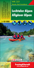
Lecco - Valle Brembane SUPERCEDED

Map No. 105, Lecco - Valle Brembane, from Kompass in a series of walking maps of selected areas of Italy at 1:50, 000, with hiking routes on a topographic base, various types of accommodation, recreational facilities, places of interest, etc. Kompass are Europe
RIP - This product is no longer available on our network. It was last seen on 25.09.2019

This page now acts as a permanent archive for this product. Add more information using the comments box below to ensure it can still be found by future generations.

Use our search facility to see if it is available from an alternative contributor.
  • External links may include paid for promotion
  • Availability: Out Of Stock
  • Supplier: Stanfords
  • SKU: 9783854912446
Availability: In Stock
£7.95

Product Description

Map No. 105, Lecco
- Valle Brembane, from Kompass in a series of walking maps of selected areas of Italy at 1:50, 000, with hiking routes on a topographic base, various types of accommodation, recreational facilities, places of interest, etc. Kompass are Europe

Reviews/Comments

Add New

Intelligent Comparison

Oooops!
We couldn't find anything!
Perhaps this product's unique.... Or perhaps we are still looking for comparisons!
Click to bump this page and we'll hurry up.

Price History

Vouchers

No voucher codes found.
Do you know a voucher code for this product or supplier? Add it to Insights for others to use.

Facebook

Jargon Buster

Hiking - An outdoor activity envolving walking in nature
Italy - a country in Europe.
Accommodation - A room in which someone can live in, for example in a hotel

Supplier Information

Stanfords
Stanfords was established in 1853 and opened their iconic Covent Garden flagship store in 1901. They have become the top retailer of maps, travel books and accessories in the UK and arguably offer the largest selection of maps and travel books worldwide. Famous names such as Captain Robert Falcon Scott, Ranulph Fiennes and Michael Palin have purchased from Stanfords. They now have a shop in Bristol and both stores together with other venues operate a calendar of events including talks, book signings and exhibitions. As a specialist map retailer, the map selection is comprehensive and includes road maps, street maps and walking maps from worldwide destinations, as well as a selection of world atlases and wall maps. Books include travel guides and travel literature. Stanfords also stock globes, from miniatures made of blue marble to magnificent floor-standing globes. The website features a selection of interesting articles on travel topics.
Page Updated: 2023-11-12 20:15:36

Community Generated Product Tags

Oh No! The productWIKI community hasn't generated any tags for this product yet!
Menu