
 United Kingdom
 France
 Germany
 Netherlands
 Sweden
 USA
USA
 Italy
Italy
 Spain
Spain
More From Contributor


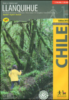
Lake Llanquihue And Surrounding Region
Lake Llanquihue and Surrounding Region at 1:150, 000/1:50, 000 on a waterproof and tear-resistant map in a series of contoured, GPS compatible trekking and exploration maps at various scales form Trekkingchile. The main map at 1:150, 000 covers the lake and the area to the east of it, extending south to Puerto Montt. Contours are at 100m intervals. Road network includes 4WD tracks and local paths. Symbols highlight various accommodation facilities (hotels, B&Bs, cabins, campsites, refuges), sport and recreational sites, various tourist services and facilities, etc. The map has a UTM grid, plus margin ticks for latitude and longitude at 20’ and 10’ respectively.On the reverse the principal trekking areas are shown in greater detail at 1:50, 000: Volcán Calbuco, Volcán
Osorno and the trek between Lago Rupanco, and Lago Todos los Santos. Also provided is a street plan highlighting main tourist facilities in Puerto Varas.Maps in the Trekkingchile series use satellite imagery as a base, with contour lines and colouring to indicate different types of terrain and habitats. Unless indicated to the contrary in the individual descriptions, the maps have a UTM grid, plus margin ticks for latitude and longitude. The maps are annotated with tourist information and most titles include a street plan of the region’s main town. Many are illustrated with drawings of local fauna or flora. Map legends and other text include English.To see the other titles in this series please click on the series link.
Osorno and the trek between Lago Rupanco, and Lago Todos los Santos. Also provided is a street plan highlighting main tourist facilities in Puerto Varas.Maps in the Trekkingchile series use satellite imagery as a base, with contour lines and colouring to indicate different types of terrain and habitats. Unless indicated to the contrary in the individual descriptions, the maps have a UTM grid, plus margin ticks for latitude and longitude. The maps are annotated with tourist information and most titles include a street plan of the region’s main town. Many are illustrated with drawings of local fauna or flora. Map legends and other text include English.To see the other titles in this series please click on the series link.

Product Description
Reviews/Comments
Add New
Vouchers
No voucher codes found.
Do you know a voucher code for this product or supplier? Add it to Insights for others to use.
Do you know a voucher code for this product or supplier? Add it to Insights for others to use.
 Denmark