
 United Kingdom
 France
 Germany
 Netherlands
 Sweden
 USA
USA
 Italy
Italy
 Spain
Spain
More From Contributor


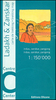
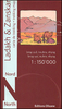


Ladakh And Zanskar South: Upper Zanskar - Rupshu
Southern Ladakh and Zanskar: Upper Zanskar - Rupshu area in a series of excellent topographic trekking maps from the Geneva based Editions Olizane on light, waterproof and tear-resistant plastic paper. Each map is double-sided, covering a large area of 90km x 240km. The maps have exceptionally clear cartography with contours at 100m intervals, enhanced by relief shading, additional spot heights for peaks and passes, plus colouring indicating glaciers, marshes, protected zones and forested or cultivated areas. Population centres are graded into towns, villages, hamlets and settlements and names of local regions are shown.Roads, tracks and numerous trails are clearly highlighted and symbols indicate various places of interest: forts, palaces and ruins: religious sites; old trade
routes; caves and hot springs; checkpoints and military posts, etc. The maps have a UTM grid and latitude/longitude margin ticks at intervals of 9
routes; caves and hot springs; checkpoints and military posts, etc. The maps have a UTM grid and latitude/longitude margin ticks at intervals of 9
Product Description
Reviews/Comments
Add New
Intelligent Comparison
Archived Product

Ladakh And Zanskar South: Upper Zanskar - Rupshu Stanfords
£22.99
Vouchers
No voucher codes found.
Do you know a voucher code for this product or supplier? Add it to Insights for others to use.
Do you know a voucher code for this product or supplier? Add it to Insights for others to use.
 Denmark