More From Contributor

£22.99
Detailed ski map at 1:50, 000 from Swisstopo, the country’s national survey organization, showing routes for skiing and/or snowboarding, access by public transport, recommended itineraries, lists of mountain huts, etc. The series uses the cartography of Switzerland’s topographic survey, with additional colouring to show slopes steeper than 30°. An overprint highlights ski routes, indicating suggested direction, difficult passages & sections which must be covered on foot. Also marked are areas where it is forbidden to leave the routes shown on the map. The maps also highlight roads with bus routes, indicating individual bus stops, show ski lifts & funiculars, plus mark locations of refuges or other mountain accommodation. Each title has the Swiss national grid at intervals of 1km, plus latitude & longitude margin ticks at 1’. Some titles cover a larger area, with a part of an adjoining sheet printed on the reverse of the main map as indicated on our series grid. Where appropriate, ski information extends across the border to France & Italy. On the reverse are itineraries of routes recommended by the Swiss Alpine Club, indicating the degree of difficulty, plus lists of alpine huts with contact details. Map legend for the overprint

Includes::
English. The text about the routes & accommodation is in the main language of the area covered by the map. To see the list of all the titles in this series please click on the series link.

...
Archived Product
£8.99
Lacul Rosu Lake & Surroundings at 1:15, 000 in a series of detailed contoured maps covering popular hiking areas of Transylvania published by Dimap, one of Hungary’s leading publishers specializing in mapping of that region. The maps show local hiking routes & provide tourist information such as campsites, places of interest, etc. Many titles include street plans and/or English language descriptions of recommended hiking trails.* In this title:* hiking map with contours at 20m intervals, showing local footpaths & trails with their waymarking signs. Symbols mark various types of accommodation, restaurants & inns, springs & waterfalls, caves, places of interest, petrol stations, etc. Also highlighted on map are 11 rock faces for which this area is famous. Six diagrams, annotated by a separate legend, show various climbing routes across them. The map has no geographical coordinates. * Both map legends & the notes on the reverse of the map are in Romanian, Hungarian & German only.* ...
Archived Product
£4.95
Small but informative visitors' guide to Ladakh presenting geographical & historical information on the region with advices on general practicalities for tourists & travellers (destinations, hotels, transportations & activities), plus car tours across the area. The Guide takes into account both the first time traveller & the seasoned one, offering trails that lead to the most popular destinations in the region, supplementing essential travel information with inputs on culture, crafts, shopping & sightseeing, but also giving an insider's perspective on Ladakh & suggesting off the beaten track obscure little places for people looking for a holiday with a difference. The rest of the book describes 7 driving itineraries & their respective attractions, ranging in length from about 150km to 950km. Annotated throughout with additional insights on cultural & historical aspects.
Includes: list of hotels in the region.
...
Archived Product
£21.00
Comprehensive, illustrated guidebook to the magical land of Ladakh in the far north of India, beyond the Himalayas. Up to date information on hotels & transport & practical advice on planning & budgeting your trip. Detailed explanatory descriptions of the regions' famous Buddhist monasteries & other sights besides the stupendous road journeys to Ladakh from Manali & Kashmir, with entire sections on these two regions. There are extensive sections on Zanskar, Nubra, & the Pangong-Tsomoriri lakes, besides a chapter on the treks in Ladakh. Also included is a detailed introduction to Tibetan Buddhism & a section on the people & history of Ladakh. Apart from a foldout map of the Ladakh-Kashmir region at the back, there are some 25 other maps in the books, & about 270 colour photographs. ...
Archived Product
£10.99
Ladakh & Zanskar at 1:350, 000 on a contoured & GPS compatible, double-sided map from Nelles, now published on a light, waterproof & tear-resistant synthetic paper. Coverage extends from Kulu in the south to the Baltoro Range & the Nubra Valley in the north, with an inset extending the map westwards to include Srinagar, Jammu & Pathankot. Also provided is a street plan of Leh. The map shows the region’s mountainous topography by contours at 200m intervals with very effective relief shading, plus spot heights & mountain passes. In addition to roads & local cart tracks, trekking trails are also marked. Symbols indicate various facilities & places of interest including campsites, temples, hot springs & waterfalls, etc. Latitude & longitude lines are drawn at 10’ intervals. Map legend

Includes::
English. The street plan of Leh shows location of numerous hotels &

Includes::
an enlargement for the old town. This title supplements the publishers’ coverage of India on regional maps at 1:1, 500, 000
- to see other titles in this series please click on the series link.


...
Archived Product
£22.99
Central Ladakh & Zanskar: Indus
- Zanskar
- Pangong area at 1:150, 000 in a series of excellent topographic trekking maps from

...
Archived Product
£19.25
Northern Ladakh & Zanskar: Brog-Yul
- Nubra
- Shyog area in a series of excellent topographic trekking maps from the Geneva

...
Archived Product
£22.99
Northern Ladakh & Zanskar: Brog-Yul
- Nubra
- Shyog area at 1:150, 000 in a series of excellent topographic trekking maps

...
Archived Product
£19.25
Southern Ladakh & Zanskar: Upper Zanskar
- Rupshu area in a series of excellent topographic trekking maps from the Geneva based
...
Archived Product
£22.99
Southern Ladakh & Zanskar: Upper Zanskar
- Rupshu area at 1:150, 000 in a series of excellent topographic trekking maps from the
...
Archived Product

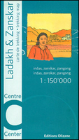
Ladakh And Zanskar Centre: Indus - Zanskar - Pangong

Central Ladakh and Zanskar: Indus - Zanskar - Pangong area in a series of excellent topographic trekking maps from the Geneva based Editions Olizane on light, waterproof and tear-resistant plastic paper. Each map is double-sided, covering a large area of 90km x 240km. The maps have exceptionally clear cartography with contours at 100m intervals, enhanced by relief shading, additional spot heights for peaks and passes, plus colouring indicating glaciers, marshes, protected zones and forested or cultivated areas. Population centres are graded into towns, villages, hamlets and settlements and names of local regions are shown.Roads, tracks and numerous trails are clearly highlighted and symbols indicate various places of interest: forts, palaces and ruins: religious sites; old trade
routes; caves and hot springs; checkpoints and military posts, etc. The maps have a UTM grid and latitude/longitude margin ticks at intervals of 9
RIP - This product is no longer available on our network. It was last seen on 25.09.2019

This page now acts as a permanent archive for this product. Add more information using the comments box below to ensure it can still be found by future generations.

Use our search facility to see if it is available from an alternative contributor.
  • Availability: Out Of Stock
  • Supplier: Stanfords
  • SKU: 9782880863685
Availability: In Stock
£19.25

Product Description

Central Ladakh & Zanskar: Indus
- Zanskar
- Pangong area in a series of excellent topographic trekking maps from the Geneva based Editions Olizane on light, waterproof & tear-resistant plastic paper. Each map is double-sided, covering a large area of 90km x 240km. The maps have exceptionally clear cartography with contours at 100m intervals, enhanced by relief shading, additional spot heights for peaks & passes, plus colouring indicating glaciers, marshes, protected zones & forested or cultivated areas. Population centres are graded into towns, villages, hamlets & settlements & names of local regions are shown. Roads, tracks & numerous trails are clearly highlighted & symbols indicate various places of interest: forts, palaces & ruins: religious sites; old trade routes; caves & hot springs; checkpoints & military posts, etc. The maps have a UTM grid & latitude/longitude margin ticks at intervals of 9

Reviews/Comments

Add New

Price History

Vouchers

No voucher codes found.
Do you know a voucher code for this product or supplier? Add it to Insights for others to use.

Facebook

Jargon Buster

Paper - A thin sheet mainly used for writing. Available in a variety of colours. Made mainly from wood pulp.
Plastic - A generic term for a synthetic product used in the manufacture of products
hot - An indication of the temperature being high and a sensation of heat to the tough
Waterproof - Resistant to water, usualy specified by depth in metres
Large - something that takes up more space than normal.
Resistant - Something that can repel against something.

Supplier Information

Stanfords
Stanfords was established in 1853 and opened their iconic Covent Garden flagship store in 1901. They have become the top retailer of maps, travel books and accessories in the UK and arguably offer the largest selection of maps and travel books worldwide. Famous names such as Captain Robert Falcon Scott, Ranulph Fiennes and Michael Palin have purchased from Stanfords. They now have a shop in Bristol and both stores together with other venues operate a calendar of events including talks, book signings and exhibitions. As a specialist map retailer, the map selection is comprehensive and includes road maps, street maps and walking maps from worldwide destinations, as well as a selection of world atlases and wall maps. Books include travel guides and travel literature. Stanfords also stock globes, from miniatures made of blue marble to magnificent floor-standing globes. The website features a selection of interesting articles on travel topics.
Page Updated: 2023-11-12 20:15:36

Community Generated Product Tags

Oh No! The productWIKI community hasn't generated any tags for this product yet!
Menu