
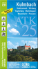
 United Kingdom
 France
 Germany
 Netherlands
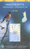
 Sweden
 USA
USA
 Italy
Italy
 Spain
Spain
More From Contributor


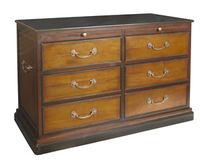
Kunstkammer Console
Our Kunstkammer Console is definitely multi-functional. Constructed of solid wood in a light and dark honey finish, this cabinet features two pullout shelves for extra work space, two small drawers, and two double-height drawers. Crown molding and brass hardware accents complete the look of this elegant piece that will not only provide abundant storage, but will enhance the beauty of any of your possessions. Elegant and practical.If we do not have this item in stock we will order it for you from our supplier. Delivery generally takes 3 weeks within the UK. For overseas delivery queries please email sales@stanfords.co.uk

Product Description
Reviews/Comments
Add New
Vouchers
No voucher codes found.
Do you know a voucher code for this product or supplier? Add it to Insights for others to use.
Do you know a voucher code for this product or supplier? Add it to Insights for others to use.
 Denmark