
 United Kingdom
 France
 Germany
 Netherlands
 Sweden
 USA
USA
 Italy
Italy
 Spain
Spain
More From Contributor


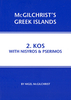


Kos Geopsis 212
Kos at 1:65, 000 on a road map from Greek publishers Geopsis, annotated with numerous places of interest and facilities. Printed on waterproof and tear-resistant plastic paper, the map includes a street plan of Kos town on the reverse. On one side is a road map of the island at 1:65, 000. The base is derived from satellite imagery, enhanced by altitude colouring and relief shading, plus graphics to indicate woodlands and protected areas. Road network included local rural roads, gives driving distances in main routes and shows locations of petrol stations. Also shown are selected hiking routes. A wide range of symbols highlights various places of interest, including picturesque landscape, nature reserves, thermal springs, caves, beaches, sport and recreational facilities,
tourist accommodation and tavernas, etc. Place names are in both Greek and Latin alphabet. The map has a UTM grid for GPS users, plus latitude and longitude margin ticks at 3’ intervals. Map legend includes English.The reverse side shows a street plan of Kos at 1:4, 000 annotated with numerous places of interest and various facilities. Names of most streets are in both alphabets, with a few smaller streets are in Greek only.Also provided is a small plan of the town’s marina, plus for the main map brief descriptions of six selected routes for walking, cycling, go-karts and cars. Text includes English.
tourist accommodation and tavernas, etc. Place names are in both Greek and Latin alphabet. The map has a UTM grid for GPS users, plus latitude and longitude margin ticks at 3’ intervals. Map legend includes English.The reverse side shows a street plan of Kos at 1:4, 000 annotated with numerous places of interest and various facilities. Names of most streets are in both alphabets, with a few smaller streets are in Greek only.Also provided is a small plan of the town’s marina, plus for the main map brief descriptions of six selected routes for walking, cycling, go-karts and cars. Text includes English.

Product Description
Reviews/Comments
Add New
Intelligent Comparison
Archived Product

Lesbos Geopsis 211 Stanfords
£6.99
Archived Product

Thasos Geopsis 214 Stanfords
£8.99
Vouchers
No voucher codes found.
Do you know a voucher code for this product or supplier? Add it to Insights for others to use.
Do you know a voucher code for this product or supplier? Add it to Insights for others to use.
 Denmark