
 United Kingdom
 France
 Germany
 Netherlands
 Sweden
 USA
USA
 Italy
Italy
 Spain
Spain
More From Contributor


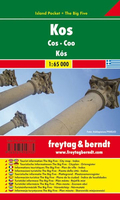
Kos F&B Pocket Map
Kos in a series of handy holiday pocket maps from Freytag & Berndt covering popular islands and other seaside destinations in Europe. Each map is laminated, so waterproof and tear-resistant, and highlights the publishers’ recommendations of five best choices in five categories: adventure, culture, food, nature and sights.On one side is a road map with icons highlighting numerous places of interest, including campsites and youth hostels, sport and recreational facilities, marinas and beaches, architectural and historical sites, etc. The maps have no geographical coordinates. Most titles also include a small street plan of the central area in the main town. The map and, if appropriate, the street plan are annotated with colour-coded markers highlighting the publishers’
recommendations of five best choices in five categories: adventure, culture, food, nature and sights, all listed on the reverse of the map with brief notes in several languages. Also provided is a Fact Box with phone numbers for tourist offices, car hire and emergency services.Map legend and notes on the recommendations include English.*In this title*: a small plan of Kos town and a map of Nisiros at 1:50, 000.
recommendations of five best choices in five categories: adventure, culture, food, nature and sights, all listed on the reverse of the map with brief notes in several languages. Also provided is a Fact Box with phone numbers for tourist offices, car hire and emergency services.Map legend and notes on the recommendations include English.*In this title*: a small plan of Kos town and a map of Nisiros at 1:50, 000.

Product Description
Reviews/Comments
Add New
Vouchers
No voucher codes found.
Do you know a voucher code for this product or supplier? Add it to Insights for others to use.
Do you know a voucher code for this product or supplier? Add it to Insights for others to use.
 Denmark