More From Contributor
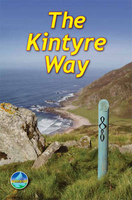
£11.19
Laminated waterproof edition of a detailed topographic map of Kintyre North from the Ordnance Survey Explorer series, covering Knapdale South & Isle of Gigha. Tarbert. Edition A2; Publication date July 2011 About this series: These highly detailed maps show all the administrative boundaries, settlements as small as isolated farms, the road network down to unfenced roads & country tracks, & field boundaries (hedges & drystone walls) which make navigation across the countryside much easier. Steep gradients on roads are indicated. Various landmarks, e.g. powerlines, archaeological sites, windmills, churches & lighthouses are shown & additional graphics indicate natural terrain features such as cliffs, scree, mud & vegetation variations. The contour interval is 5 metres in the lower parts of the country & 10 metres in the uplands, & spot heights are marked. Each map covers an area of 30 x 20km (i.e. approx. 19 x 12 miles), with some double-sided maps covering more, as indicated in the individual descriptions. The maps are fully GPS compatible, with the National Grid shown at 1km intervals & latitude & longitude indicated by margin ticks at 1'. The Explorer series has replaced the earlier, green-cover Pathfinder maps. The Explorer series is now complete & covers all of Engl&, Wales & Scotl&. Some sheets for popular areas like the National Parks are still branded as Outdoor Leisure (OL) maps, but are now included in this series as the cartography is the same as that in the Explorer Maps. The Explorer maps offer a substantial improvement on the Pathfinder series, with greater use of colour, larger area per map, & stronger emphasis on information for ramblers & tourists. This series is ideal for walking & other outdoor pursuits & each map shows a large amount of information for ramblers & tourists. Public rights of way are shown (except in Scotland), together with other routes with public access: National Trails & Recreational Paths, permitted paths & bridleways, & selected cycle routes. Open access land created under the Countryside & Rights of Way Act 2000 is marked. Tourist information

Includes::
caravan & camp sites, Park & Ride locations, recreation/leisure/sport centres, museums, historic buildings, English Heritage & National Trust sites, rural pubs, etc. The map legend is in English only, except for the tourist information content which is also in French & German.

...
Archived Product
£6.39
A detailed topographic map of Kintyre South from the Ordnance Survey Explorer series, covering Campbeltown. Edition A1 with minor changes; Publication date February 2008 About this series: These highly detailed maps show all the administrative boundaries, settlements as small as isolated farms, the road network down to unfenced roads & country tracks, & field boundaries (hedges & drystone walls) which make navigation across the countryside much easier. Steep gradients on roads are indicated. Various landmarks, e.g. powerlines, archaeological sites, windmills, churches & lighthouses are shown & additional graphics indicate natural terrain features such as cliffs, scree, mud & vegetation variations. The contour interval is 5 metres in the lower parts of the country & 10 metres in the uplands, & spot heights are marked. Each map covers an area of 30 x 20km (i.e. approx. 19 x 12 miles), with some double-sided maps covering more, as indicated in the individual descriptions. The maps are fully GPS compatible, with the National Grid shown at 1km intervals & latitude & longitude indicated by margin ticks at 1'. The Explorer series has replaced the earlier, green-cover Pathfinder maps. The Explorer series is now complete & covers all of Engl&, Wales & Scotl&. Some sheets for popular areas like the National Parks are still branded as Outdoor Leisure (OL) maps, but are now included in this series as the cartography is the same as that in the Explorer Maps. The Explorer maps offer a substantial improvement on the Pathfinder series, with greater use of colour, larger area per map, & stronger emphasis on information for ramblers & tourists. This series is ideal for walking & other outdoor pursuits & each map shows a large amount of information for ramblers & tourists. Public rights of way are shown (except in Scotland), together with other routes with public access: National Trails & Recreational Paths, permitted paths & bridleways, & selected cycle routes. Open access land created under the Countryside & Rights of Way Act 2000 is marked. Tourist information

Includes::
caravan & camp sites, Park & Ride locations, recreation/leisure/sport centres, museums, historic buildings, English Heritage & National Trust sites, rural pubs, etc. The map legend is in English only, except for the tourist information content which is also in French & German.

...
Archived Product
£14.99
South Kintyre with Campbeltown on a detailed topographic & GPS compatible map No. 356, waterproof version, from the Ordnance Survey’s 1:25, 000 Explorer series. MOBILE DOWNLOADS: this title & all the other OS Explorer maps include a code for downloading after purchase the digital version onto your smartphone or tablet for viewing on the OS smartphone app.OS EXPLORER SERIES: to see the list of all the titles in the OS Explorer series, both paper & waterproof versions, please click on the series link. The Explorer series, Ordnance Survey’s most detailed maps recommended for anyone enjoying outdoor activities, provides topographic coverage of Great Britain at 1:25, 000 on GPS compatible maps with hiking trails, cycling routes & extensive tourist information. Each printed map is available either on paper or as a waterproof & tear-resistant OS Active Map, as indicated in its title. Britain’s National Parks & other areas of particular tourist interest are presented on often double-sided OL (Outdoor Leisure) maps, whilst most standard format Explorers cover an area of 30 x 20km (approx. 19 x 12 miles). All three versions (paper, waterproof & digital) are the same & provide plenty of recreational & tourist information, indicating the traditional public right of way paths (except in Scotland where different laws apply), including bridleways & byways. National Trails & other long-distance paths are marked, as well as permissive footpaths or bridleways & on-road or traffic-free cycle routes with, where appropriate, their National/ Regional Cycle Network numbers. Boundaries of access land are clearly marked. A wide range of symbols provides additional tourist information, highlighting camping & caravanning sites, information offices & visitors’ centres, parking & picnicking places, country pubs, sport & recreational facilities including cycle hire locations & mountain biking trails, historic buildings & museums, etc. Exceptionally clear presentation of the landscape is provided by contours at 5m or in the uplands at 10m intervals, with additional spot heights plus colouring and/or graphics for different types of woodlands, orchards, heath, marshl&, scree or boulders, & other topographic features. For GPS users the maps have British National Grid lines at 1km intervals, with latitude & longitude given by margin ticks at 1`. Clearly laid out map legend

Includes::
French & German translations for the tourist information symbols.

...
Archived Product
£8.99
South Kintyre with Campbeltown on a detailed topographic & GPS compatible map No. 356, paper version, from the Ordnance Survey’s 1:25, 000 Explorer series. MOBILE DOWNLOADS: this title & all the other OS Explorer maps include a code for downloading after purchase the digital version onto your smartphone or tablet for viewing on the OS smartphone app.OS EXPLORER SERIES: to see the list of all the titles in the OS Explorer series, both paper & waterproof versions, please click on the series link. The Explorer series, Ordnance Survey’s most detailed maps recommended for anyone enjoying outdoor activities, provides topographic coverage of Great Britain at 1:25, 000 on GPS compatible maps with hiking trails, cycling routes & extensive tourist information. Each printed map is available either on paper or as a waterproof & tear-resistant OS Active Map, as indicated in its title. Britain’s National Parks & other areas of particular tourist interest are presented on often double-sided OL (Outdoor Leisure) maps, whilst most standard format Explorers cover an area of 30 x 20km (approx. 19 x 12 miles). All three versions (paper, waterproof & digital) are the same & provide plenty of recreational & tourist information, indicating the traditional public right of way paths (except in Scotland where different laws apply), including bridleways & byways. National Trails & other long-distance paths are marked, as well as permissive footpaths or bridleways & on-road or traffic-free cycle routes with, where appropriate, their National/ Regional Cycle Network numbers. Boundaries of access land are clearly marked. A wide range of symbols provides additional tourist information, highlighting camping & caravanning sites, information offices & visitors’ centres, parking & picnicking places, country pubs, sport & recreational facilities including cycle hire locations & mountain biking trails, historic buildings & museums, etc. Exceptionally clear presentation of the landscape is provided by contours at 5m or in the uplands at 10m intervals, with additional spot heights plus colouring and/or graphics for different types of woodlands, orchards, heath, marshl&, scree or boulders, & other topographic features. For GPS users the maps have British National Grid lines at 1km intervals, with latitude & longitude given by margin ticks at 1`. Clearly laid out map legend

Includes::
French & German translations for the tourist information symbols.

...
Archived Product
£11.19
Laminated waterproof edition of a detailed topographic map from the Ordnance Survey Explorer series, covering Campbeltown. Edition A1 with minor changes; Publication date February 2008 About this series: These highly detailed maps show all the administrative boundaries, settlements as small as isolated farms, the road network down to unfenced roads & country tracks, & field boundaries (hedges & drystone walls) which make navigation across the countryside much easier. Steep gradients on roads are indicated. Various landmarks, e.g. powerlines, archaeological sites, windmills, churches & lighthouses are shown & additional graphics indicate natural terrain features such as cliffs, scree, mud & vegetation variations. The contour interval is 5 metres in the lower parts of the country & 10 metres in the uplands, & spot heights are marked. Each map covers an area of 30 x 20km (i.e. approx. 19 x 12 miles), with some double-sided maps covering more, as indicated in the individual descriptions. The maps are fully GPS compatible, with the National Grid shown at 1km intervals & latitude & longitude indicated by margin ticks at 1'. The Explorer series has replaced the earlier, green-cover Pathfinder maps. The Explorer series is now complete & covers all of Engl&, Wales & Scotl&. Some sheets for popular areas like the National Parks are still branded as Outdoor Leisure (OL) maps, but are now included in this series as the cartography is the same as that in the Explorer Maps. The Explorer maps offer a substantial improvement on the Pathfinder series, with greater use of colour, larger area per map, & stronger emphasis on information for ramblers & tourists. This series is ideal for walking & other outdoor pursuits & each map shows a large amount of information for ramblers & tourists. Public rights of way are shown (except in Scotland), together with other routes with public access: National Trails & Recreational Paths, permitted paths & bridleways, & selected cycle routes. Open access land created under the Countryside & Rights of Way Act 2000 is marked. Tourist information

Includes::
caravan & camp sites, Park & Ride locations, recreation/leisure/sport centres, museums, historic buildings, English Heritage & National Trust sites, rural pubs, etc. The map legend is in English only, except for the tourist information content which is also in French & German.

...
Archived Product
£12.99
The Kintyre Way is fully waymarked & one of Scotland`s Great Trails. It runs for 100 miles southward from the beautiful natural harbour of Tarbert to Macrihanish. You will enjoy many wildlife sightings in this peaceful area, famous as Scotland only ”mainland island”. Since it opened (2006) the route has changed significantly & been extended by 13 miles. The 2018 edition of this essential guidebook contains all you need to plan & enjoy your holiday: detailed mapping showing the whole route (1:65, 000); the Way step-by-step, with summaries of distance, terrain & refreshment stops; habitats & wildlife; whisky-making in Kintyre; side-trip to the island of Gigha; & planning information for travel by car, ferry, bus & plane. The book is printed on rainproof paper throughout. It has over 80 colour photographs & 10 pages of mapping. ...
Archived Product
£8.95
Map No. 880, Kinzigtal
- Schramberg, in a series of hiking maps from Kompass providing extensive coverage of Austria & Germany
...
Archived Product
£11.99
Kinzigtal
- Schramberg
- Haslach
- Wolfach
- Schiltach
- Hornberg area of central Black Forest on a detailed, GPS


...
Archived Product
£10.99
Rudyard Kipling (1865-1936) is perhaps the most controversial major English poet of the last two centuries, not least because of his apparent enthusiasm for the empire. A child of British India, he first became famous for tales of imperial life, notably ” Kim”, ”the Jungle Book” & ” Barrack Room Ballads”. Kipling wrote verse in every classical form from the epigram to the ode, but his most distinctive gift was for the ballads & narrative poems in which he draws vivid characters in universal situations & articulates profound truths in plain language. Yet he was also a subtle & deeply affecting anatomist of the human heart, with a feeling for the natural world which rivals his younger contemporary, D H Lawrence. Shattered by World War I in which he lost his only son, his work darkens & deepens in later years, but never loses its extraordinary vitality. ...
Archived Product
£19.50
Rudyard Kipling is the doyen of travel writers. His genius for evoking the sights, sounds & atmosphere of a place was crystallised in his fiction, in which he introduced Victorian readers to the drama & exoticism of the East. The teaming, dusty Grand Trunk Road springs to life off the pages of Kim, while the misty heights of imperial Simla provide an identifiable & almost tangible physical background to Plain Tales from the Hills. Kipling`s poetry, journalism & letters also encapsulated the spirit of the places he visited, from Egypt, India & Brazil to the United States & Southern Africa. He was fascinated by the practicalities & potential of travel, the people encountered & experiences had. At a time when tourism was in its infancy, he prophetically reflected on the effects of mass transport & the `globe trotters` who thronged to India. With his darting, universal mind, he was the first person to understand the relationship between travel & globalisation. ” Kipling Abroad” gathers together some of the most descriptive & revealing of his travel writing, which has never before been published in one volume. Introduced & edited by Andrew Lycett, author of an acclaimed biography of Kipling, it captures the range, curiosity & sheer talent of one of our best loved authors, revealing as much about Kipling himself as it does about the places he visited. ...
Archived Product

Kintyre Way

The Kintyre Way, a 140km / 89 miles trail southward from the beautiful natural harbour of Tarbert to Dunaverty near the Mull of Kintyre, presented by Rucksack Readers in handy A5 size, spiral-bound, waterproof guide with mapping at 1:110, 000. The guide provides general advice on when to go, availability of accommodation, etc, and includes notes on the history of the area, whisky production, habitats and wildlife, etc. Detailed route descriptions, arranged in daily stages, are preceded by a summary of each section of the route giving distance, terrain, grade, and availability of food and drink. The guide is illustrated with numerous colour photos.The guide shows the route highlighted on fold-out flap of the cover at 1:110, 000. The map has altitude colouring to show the
topography and also indicates various facilities and places of interest. No geographical coordinates for GPS users are provided. The publishers themselves recommend that their guide is used in conjunction with more detailed, contoured and GPS compatible Explorer maps from the Ordnance Survey.To see other titles in this series please click on the series link.
RIP - This product is no longer available on our network. It was last seen on 25.09.2019

This page now acts as a permanent archive for this product. Add more information using the comments box below to ensure it can still be found by future generations.

Use our search facility to see if it is available from an alternative contributor.
  • Availability: Out Of Stock
  • Supplier: Stanfords
  • SKU: 9781898481454
Availability: In Stock
£10.99

Product Description

The Kintyre Way, a 140km / 89 miles trail southward from the beautiful natural harbour of Tarbert to Dunaverty near the Mull of Kintyre, presented by Rucksack Readers in handy A5 size, spiral-bound, waterproof guide with mapping at 1:110, 000. The guide provides general advice on when to go, availability of accommodation, etc, &

Includes::
notes on the history of the area, whisky production, habitats & wildlife, etc. Detailed route descriptions, arranged in daily stages, are preceded by a summary of each section of the route giving distance, terrain, grade, & availability of food & drink. The guide is illustrated with numerous colour photos. The guide shows the route highlighted on fold-out flap of the cover at 1:110, 000. The map has altitude colouring to show the topography & also indicates various facilities & places of interest. No geographical coordinates for GPS users are provided. The publishers themselves recommend that their guide is used in conjunction with more detailed, contoured & GPS compatible Explorer maps from the Ordnance Survey. To see other titles in this series please click on the series link.

Reviews/Comments

Add New

Intelligent Comparison

Oooops!
We couldn't find anything!
Perhaps this product's unique.... Or perhaps we are still looking for comparisons!
Click to bump this page and we'll hurry up.

Price History

Vouchers

No voucher codes found.
Do you know a voucher code for this product or supplier? Add it to Insights for others to use.

Facebook

Jargon Buster

GPS - Global Positioning System - Global position using satellites
Waterproof - Resistant to water, usualy specified by depth in metres
History - Anything that happens in the past. An acedemic subject.
Colour - The categorised spectrum of light visable to humans
Size - is the measurement of how big an object is in space.
Natural - not manmade
Rucksack - A bag which is carried on the back.
Altitude - Something that can be quite high in relation to sea or ground level.
Accommodation - A room in which someone can live in, for example in a hotel

Supplier Information

Stanfords
Stanfords was established in 1853 and opened their iconic Covent Garden flagship store in 1901. They have become the top retailer of maps, travel books and accessories in the UK and arguably offer the largest selection of maps and travel books worldwide. Famous names such as Captain Robert Falcon Scott, Ranulph Fiennes and Michael Palin have purchased from Stanfords. They now have a shop in Bristol and both stores together with other venues operate a calendar of events including talks, book signings and exhibitions. As a specialist map retailer, the map selection is comprehensive and includes road maps, street maps and walking maps from worldwide destinations, as well as a selection of world atlases and wall maps. Books include travel guides and travel literature. Stanfords also stock globes, from miniatures made of blue marble to magnificent floor-standing globes. The website features a selection of interesting articles on travel topics.
Page Updated: 2023-11-12 20:15:36

Community Generated Product Tags

Oh No! The productWIKI community hasn't generated any tags for this product yet!
Menu