More From Contributor
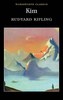
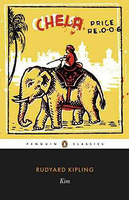
£17.99
The 1:50 000 topographic map gives a more general picture of the ground features than a basic map. It shows settlements, houses, roads, cultivated areas, waterways, cutting areas, mires, rock exposures, & relief. One map sheet covers an area of 30 x 40 km & one centimetre corresponds to 500 metres on the ground. The 1:50, 000 topographic map is also an ideal complement to nautical charts as it provides useful information about the land areas adjacent to waterways. For example, all Finnish sea areas are covered by 1:50 000 topographic map sheets. ...
Archived Product
£9.99
FROM THE VIRAL YOGA STAR43 MILLION VIEWS IN JUST FIVE DAYS` Yoga can feel elitist but the book does not alienate. Partly because of its gentle humour, & partly because the language does not assume any knowledge of terms or sequences. It`s straightforward & to the point. & the scenery beats a sterile yoga studio.`
- Evening Standard ` Apparently there is something about the recipe of beards, kilts, butts & the Scottish highlands that just works.`
- Finlay Wilson` Yoga & kilts in a Perthshire forest has proved to be just what the world was waiting for.`
- BBCGet ready to lose yourself in the wilds of Scotland & reconnect with the natural world in this gorgeous little book that will make you look at yoga in a whole new way
- kilt optional! After recovering from an accident, Finlay Wilson found yoga was the best way to rebuild his strength. Now a qualified yoga instructor himself, he`s decided to bring a modern take to this ancient practice. Feast your eyes on his yoga moves & discover why his Kilted Yoga video became an instant global sensation. This beautiful book is both dramatic & inspirational, but also tongue in cheek, quirky & funny. Finlay introduces you to the fundamentals of yoga through four progressive sequences to help you develop your practice. Combining stunning photography of the Scottish highlands with practical advice, Kilted Yoga is the inspiration you`ve been waiting for
- join the movement here. Check out the video that went viral: www.facebook.com/BBCScotland/videos/1085403278236761


...
Archived Product
£10.00
Kilvert`s classic diary, which paints a picture of mid-Victorian English country life. Closely-written in 22 notebooks, the notes of the vicar of Langley Burrell, Wiltshire, cover a span of nine years (1870-9). This is an abridged, one-volume edition &, as such, forms an admirable introduction. ...
Archived Product
£3.50
Kilwinning in 1895 in a fascinating series of reproductions of old Ordnance Survey plans in the Alan Godfrey Editions, ideal for anyone interested in the history of their neighbourhood or family. The map covers the Ayrshire town of Kilwinning, extending eastward to Corsehill & south to the Eglinton Iron Works. Features include the town centre with The Green, worsted mill, church, cemetery, Main Street, Byres, Townhead, Corsehill, Kenneth`s Castle, etc. Several railways are shown including the GSWR line with station, branches, Dubbs Junction, Blacklands Junction, Doura Branch; Lanarkshire & Ayrshire Railway with station, branches; Eglinton Iron Works, Eglinton Fire Clay Works, Eglinton Engine Works, football ground, etc. About the Alan Godfrey Editions of the 25” OS Series: Selected towns in Great Britain & Ireland are covered by maps showing the extent of urban development in the last decades of the 19th & early 20th century. The plans have been taken from the Ordnance Survey mapping & reprinted at about 15 inches to one mile (1:4, 340). On the reverse most maps have historical notes & many also include extracts from contemporary directories. Most maps cover about one mile (1.6kms) north/south, one & a half miles (2.4kms) across; adjoining sheets can be combined to provide wider coverage.FOR MORE INFORMATION & A COMPLETE LIST OF ALL AVAILABLE TITLES PLEASE CLICK ON THE SERIES LINK. ...
Archived Product
£1.99
Kim is Rudyard Kipling`s finest work. Now controversial, this novel is a memorably vivid evocation of the life & landscapes of India in the late nineteenth century. Kim himself is a resourceful lad who befriends a lama, an ageing priest; & both embark on a combined quest. Whereas Kim has an insatiable interest in the varied activities around him, the lama seeks redemption from the ` Wheel of Life`. Kim becomes involved in the ` Great Game`, undertaking espionage for the British rulers. This engrossing & moving novel, with its diversity of memorable characters, offers many insights into political, religious & social tensions. ...
Archived Product
£9.99
Kimathanka, sheet no. 2787-02, in the topographic survey of Nepal at 1:50, 000 published by the Nepali Government in the late 1990s & early 2000s & produced from remote sensing data by Finnish cartographers as part of that country’s international aid program. The maps cover 15’ x 15’ quadrangles.IMPORTANT – PLEASE NOTE BEFORE ORDERING: AVAILABILITY: although, theoretically at least, still in print, these maps are very difficult to get locally in Nepal and/or from various suppliers elsewhere specializing in obtaining such maps. DELIVERIES MAY TAKE SEVERAL WEEKS OR EVEN MONTHS.PROBLEMS WITH PLACE NAMES: reports from previous users indicate that transliteration of place names differs from that used widely not only on other maps & in guide books but also on the ground itself, in road signs & in the tourist & trekking industry in general. Whilst most names are similar enough to be easily recognizable, e.g. Namche Bajar for Namche Bazar or Lantan for Langtang, we have been told of confusion & difficulties arising from different spellings appearing on these maps.TREKKING ROUTES & TOURIST INFORMATION: whilst the maps show foot trails & mark locations of temples, etc, they carry no specific trekking information. Major trekking routes & places of interest are not highlighted. There is no marking for base camps & other tourist facilities. Map specifications: Contours are at 40m intervals, with graphics and/or coloring to show various features of the terrain (glaciers with moraines & crevasses, quarries, gravel or clay pits, etc.) & vegetation (forests, bush, grass, orchards & plantations, etc). Additional comments such as “open mixed forest mainly bajh & pine” annotate many area. The maps have numerous spot heights, but relatively few peaks are named. Areas outside the country’s borders are left blank. Settlements in remote areas are indicated by markings for individual buildings & the placing of names does not always make it clear which group of buildings they refer to. Road network distinguishes between major & minor foot trails. Symbols mark features such as temples, schools & hospitals, police stations, etc. Also shown are the country’s administrative divisions. The maps have a 1-km UTM grid, plus latitude & longitude lines at intervals of 5’. Map legend & all the text is in English. Coverage: the whole country is now covered, with the north at 1:50, 000, plus central & southern Nepal at 1:25, 000. The two series are complementary, do not overlap & use the same grid & numbering system (apart from the Lumbini Zone, where a different grid & numbering are used). For areas not shown on our grid & titles not listed here, please contact us by e-mail, but please do bear in mind the problems with availability & the likely very long delivery time. ...
Archived Product
£29.99
Map No. 2824, Kimberley, in South Africa’s official topographic survey at 1:250, 000 from the country’s national survey organization, the Chief Directorate of Surveys & Mapping. The maps have altitude colouring & contours at 50m or 100m intervals, depending on the map edition, plus spot heights. Deserts, marshes, dry pans, perennial & seasonal water features, etc, as well as protected areas are shown. The maps present the country’s road & rail networks & include the usual information expected on topographic mapping at this scale, although in more rapidly developing areas road information may not necessarily be up to date. Also indicated are magisterial district & provincial boundaries. Latitude & longitude values are shown in the margins at 5` intervals together with South African grid co-ordinates. Typically, each sheet covers an area of one degree of latitude & two degrees of longitude. The projection used is Gauss Conformal. The legend is in English & Afrikaans. ...
Archived Product
£11.50
Kimberley Bush Tucker Man Map prepared by Hema with Les Hiddins, best known for his love & knowledge of the Australian bush. Printed on light, waterproof & tear-resistant plastic paper the map is annotated with numerous tips & provides extensive tourist information. The map covers roughly the area of Western Australia from Broome to beyond the border with Northern Territory, extending southwards to include the northern part of the Great Sandy Desert & the Tanami Desert. Topographic information is provided by graphics and/ot colouring to show national parks/other parks & reserves, state forest/timber reserves, dry/salt lakes, marine swamps & coastal flats, sand & sand ridges, etc. Also marked are Noogoora Burr Quarantine Area, aboriginal lands, Native Title Determined areas, etc. Road information is divided into two groups: roads & tracks which were plotted with a GPS & computer during the fieldwork carried out by Hema, plus other tracks shown on the country ...
Archived Product
£4.50
Greek islands of Kimolos & Polyaigos in the Cyclades on a contoured & GPS compatible pocket map at 1:25, 000 from Terrain Editions. On the reverse are descriptions of two hiking trails on Kimolos & general notes on its history, sights, nature, etc, plus photos. All place names are shown in both Greek & Latin alphabet. Map legend & all the text include English. Maps of the Greek islands from Terrain Editions have topography well presented by contours at 20m intervals (unless indicated differently in the map`s individual description), enhanced by spot heights, subtle relief shading & additional altitude colouring. Road network is very clearly graded according to width & the type of surface, distinguishing between good & rough dirt roads. Distances are marked on most small local roads, as well as locations of petrol stations and/or tyre repair workshops; scenic routes are highlighted. Each map also shows which ports are served by ferry services. Hiking paths are graded as main or narrow trails. National parks & other protected areas are marked & a wide range of symbols indicate various places of interest & recreational facilities, with main sights clearly highlighted. Most titles distinguish between sandy & pebble beaches; some also indicate beaches with natural shade and/or the type of sea bed. The maps have a UTM grid, plus latitude & longitude margin ticks. The reverse side of each title is covered by general information about the isl&, illustrated with colour photos. Many titles also include brief descriptions of recommended hiking trails and/or a street plan of the island’s main town, with colouring clearly showing various tourist facilities. To see the other titles in this series please click on the series link. ...
Archived Product
£16.99
Kimono Design: An Introduction to Textiles & Patterns uses hundreds of photographs & a wealth of information on colours, fabrics & embellishments to paint a portrait of Japanese culture, art & thought. Lavish classical patterns, sweeping scenes, & the many motifs that have been woven, dyed, painted or embroidered into these textiles reveal a reflectiveness, a sense of humour, & an appreciation of exquisite beauty that is uniquely Japanese. Organised according to motifs traditionally associated with each season of the year, Kimono Design interprets the kimono`s special language as expressed in depictions of: Flowers & grasses Birds & other animals Symbols of power, luck & prestige L&-&-seascapes scenes from literature, history & daily life scenes of travel & the Japanese concept of other lands & many others Extensive notes on all the motifs demonstrate how the kimono reflects changing times & a sense of the timeless. Information on jewelry, hairpins & other accessories is scattered throughout to give a fuller sense of the Japanese art of dress. This is a volume that Japanophiles, historians, artists & designers will all cherish. ...
Archived Product

Kim

Kim, Rudyard Kipling’s epic rendition of the imperial experience in India, is arguably his greatest piece of long prose.Kim, a boy growing into early manhood and the lama, an old ascetic priest - are fired by a quest. Kim is white, a sahib, although born in India; while he wants to play the Great Game of Imperialism, he is also spiritually bound to the lama and he tries to reconcile these opposing strands. The lama, meanwhile, searches for redemption from the Wheel of Life.Viewed by some as a piece of children’s literature, Kipling’s intended audience was never verified before his death and many literary academics argue that it is a piece of adult literature- either way, what is clear is the book appeals to many ages, perhaps having a greater effect on the older reader. A
celebration of their friendship in an often hostile environment, Kim captures the opulence of India’s exotic landscape, overlaid by the uneasy presence of the British Raj- like Forster`s A Passage to India, this is a book that still has profound echoes with today`s multicultural society.
RIP - This product is no longer available on our network. It was last seen on 25.09.2019

This page now acts as a permanent archive for this product. Add more information using the comments box below to ensure it can still be found by future generations.

Use our search facility to see if it is available from an alternative contributor.
  • Availability: Out Of Stock
  • Supplier: Stanfords
  • SKU: 9780141442372
Availability: In Stock
£8.99

Product Description

Kim, Rudyard Kipling’s epic rendition of the imperial experience in India, is arguably his greatest piece of long prose. Kim, a boy growing into early manhood & the lama, an old ascetic priest
- are fired by a quest. Kim is white, a sahib, although born in India; while he wants to play the Great Game of Imperialism, he is also spiritually bound to the lama & he tries to reconcile these opposing strands. The lama, meanwhile, searches for redemption from the Wheel of Life. Viewed by some as a piece of children’s literature, Kipling’s intended audience was never verified before his death & many literary academics argue that it is a piece of adult literature- either way, what is clear is the book appeals to many ages, perhaps having a greater effect on the older reader. A celebration of their friendship in an often hostile environment, Kim captures the opulence of India’s exotic landscape, overlaid by the uneasy presence of the British Raj- like Forster`s A Passage to India, this is a book that still has profound echoes with today`s multicultural society.

Reviews/Comments

Add New

Intelligent Comparison

Oooops!
We couldn't find anything!
Perhaps this product's unique.... Or perhaps we are still looking for comparisons!
Click to bump this page and we'll hurry up.

Price History

Vouchers

No voucher codes found.
Do you know a voucher code for this product or supplier? Add it to Insights for others to use.

Facebook

Jargon Buster

India - A subcontinent in Asia
White - A colour combining all colours
Experience - To gain further knowledge by practising.
Children - A young life form within the early stages of physical development,
Environment - The conditions and surrounding area.

Supplier Information

Stanfords
Stanfords was established in 1853 and opened their iconic Covent Garden flagship store in 1901. They have become the top retailer of maps, travel books and accessories in the UK and arguably offer the largest selection of maps and travel books worldwide. Famous names such as Captain Robert Falcon Scott, Ranulph Fiennes and Michael Palin have purchased from Stanfords. They now have a shop in Bristol and both stores together with other venues operate a calendar of events including talks, book signings and exhibitions. As a specialist map retailer, the map selection is comprehensive and includes road maps, street maps and walking maps from worldwide destinations, as well as a selection of world atlases and wall maps. Books include travel guides and travel literature. Stanfords also stock globes, from miniatures made of blue marble to magnificent floor-standing globes. The website features a selection of interesting articles on travel topics.
Page Updated: 2023-11-12 20:15:36

Community Generated Product Tags

Oh No! The productWIKI community hasn't generated any tags for this product yet!
Menu