More From Contributor
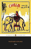
£4.50
Kilmarnock in 1855 in a fascinating series of reproductions of old Ordnance Survey plans in the Alan Godfrey Editions, ideal for anyone interested in the history of their neighbourhood or family. The map is taken from the very early h&-coloured edition & covers the town from the GSWR station & High Church southward to Glencairn Square. Features include Low Church, The Cross, Springhill House, St Andrew`s church, Glenfield Print Works, Vulcan Foundry, etc. On the reverse is an 1866 railway timetable. Please note that the map cover erroneously gives the sheet number as 18.15. About the Alan Godfrey Editions of the 25” OS Series: Selected towns in Great Britain & Ireland are covered by maps showing the extent of urban development in the last decades of the 19th & early 20th century. The plans have been taken from the Ordnance Survey mapping & reprinted at about 15 inches to one mile (1:4, 340). On the reverse most maps have historical notes & many also include extracts from contemporary directories. Most maps cover about one mile (1.6kms) north/south, one & a half miles (2.4kms) across; adjoining sheets can be combined to provide wider coverage.FOR MORE INFORMATION & A COMPLETE LIST OF ALL AVAILABLE TITLES PLEASE CLICK ON THE SERIES LINK. ...
Archived Product
£2.95
Kilnhurst in 1901 in a fascinating series of reproductions of old Ordnance Survey plans in the Alan Godfrey Editions, ideal for anyone interested in the history of their neighbourhood or family. Selected towns in Great Britain & Ireland are covered by maps showing the extent of urban development in the last decades of the 19th & early 20th century. In this title: the map covers the village of Kilnhurst, just north of Rotherham. The centre of the village is shown around Victoria Street & coverage extends north to Birdwell Flats & High Thorn, westward to Sandhill Farm, & east to Kilnhurst Bridge & Lodge Farm. The Midland Railway & GCR both run through the map, with stations at Kilnhurst, & between them is the Kilnhurst Cut canal. Other features include Albany Row, St Thomas church, part of the Swinton Iron & Steel Works, Kilnhurst Forge, Victoria Glass Works, Thrybergh Hall Colliery, Beechwood, Warren Vale Colliery Tramway, Holywell House, Piccadilly, Kilnhurst Pottery. On the reverse is a directory of Kilnhurst in 1902, notes from a Parish Magazine, & the poem ' Perils of the Mine' by John Veitch, a miner injured in Thrybergh Hall Colliery in 1937. About the Alan Godfrey Editions of the 25 ...
Archived Product
£3.50
Kilnhurst in 1901 in a fascinating series of reproductions of old Ordnance Survey plans in the Alan Godfrey Editions, ideal for anyone interested in the history of their neighbourhood or family. The map covers the village of Kilnhurst, just north of Rotherham. The centre of the village is shown around Victoria Street & coverage extends north to Birdwell Flats & High Thorn, westward to Sandhill Farm, & east to Kilnhurst Bridge & Lodge Farm. The Midland Railway & GCR both run through the map, with stations at Kilnhurst, & between them is the Kilnhurst Cut canal. Other features include Albany Row, St Thomas church, part of the Swinton Iron & Steel Works, Kilnhurst Forge, Victoria Glass Works, Thrybergh Hall Colliery, Beechwood, Warren Vale Colliery Tramway, Holywell House, Piccadilly, Kilnhurst Pottery, etc. On the reverse is a directory of Kilnhurst in 1902, notes from a Parish Magazine, & the poem ` Perils of the Mine` by John Veitch, a miner injured in Thrybergh Hall Colliery in 1937. About the Alan Godfrey Editions of the 25” OS Series: Selected towns in Great Britain & Ireland are covered by maps showing the extent of urban development in the last decades of the 19th & early 20th century. The plans have been taken from the Ordnance Survey mapping & reprinted at about 15 inches to one mile (1:4, 340). On the reverse most maps have historical notes & many also include extracts from contemporary directories. Most maps cover about one mile (1.6kms) north/south, one & a half miles (2.4kms) across; adjoining sheets can be combined to provide wider coverage.FOR MORE INFORMATION & A COMPLETE LIST OF ALL AVAILABLE TITLES PLEASE CLICK ON THE SERIES LINK. ...
Archived Product
£17.99
The 1:50 000 topographic map gives a more general picture of the ground features than a basic map. It shows settlements, houses, roads, cultivated areas, waterways, cutting areas, mires, rock exposures, & relief. One map sheet covers an area of 30 x 40 km & one centimetre corresponds to 500 metres on the ground. The 1:50, 000 topographic map is also an ideal complement to nautical charts as it provides useful information about the land areas adjacent to waterways. For example, all Finnish sea areas are covered by 1:50 000 topographic map sheets. ...
Archived Product
£9.99
FROM THE VIRAL YOGA STAR43 MILLION VIEWS IN JUST FIVE DAYS` Yoga can feel elitist but the book does not alienate. Partly because of its gentle humour, & partly because the language does not assume any knowledge of terms or sequences. It`s straightforward & to the point. & the scenery beats a sterile yoga studio.`
- Evening Standard ` Apparently there is something about the recipe of beards, kilts, butts & the Scottish highlands that just works.`
- Finlay Wilson` Yoga & kilts in a Perthshire forest has proved to be just what the world was waiting for.`
- BBCGet ready to lose yourself in the wilds of Scotland & reconnect with the natural world in this gorgeous little book that will make you look at yoga in a whole new way
- kilt optional! After recovering from an accident, Finlay Wilson found yoga was the best way to rebuild his strength. Now a qualified yoga instructor himself, he`s decided to bring a modern take to this ancient practice. Feast your eyes on his yoga moves & discover why his Kilted Yoga video became an instant global sensation. This beautiful book is both dramatic & inspirational, but also tongue in cheek, quirky & funny. Finlay introduces you to the fundamentals of yoga through four progressive sequences to help you develop your practice. Combining stunning photography of the Scottish highlands with practical advice, Kilted Yoga is the inspiration you`ve been waiting for
- join the movement here. Check out the video that went viral: www.facebook.com/BBCScotland/videos/1085403278236761


...
Archived Product
£3.50
Kilwinning in 1895 in a fascinating series of reproductions of old Ordnance Survey plans in the Alan Godfrey Editions, ideal for anyone interested in the history of their neighbourhood or family. The map covers the Ayrshire town of Kilwinning, extending eastward to Corsehill & south to the Eglinton Iron Works. Features include the town centre with The Green, worsted mill, church, cemetery, Main Street, Byres, Townhead, Corsehill, Kenneth`s Castle, etc. Several railways are shown including the GSWR line with station, branches, Dubbs Junction, Blacklands Junction, Doura Branch; Lanarkshire & Ayrshire Railway with station, branches; Eglinton Iron Works, Eglinton Fire Clay Works, Eglinton Engine Works, football ground, etc. About the Alan Godfrey Editions of the 25” OS Series: Selected towns in Great Britain & Ireland are covered by maps showing the extent of urban development in the last decades of the 19th & early 20th century. The plans have been taken from the Ordnance Survey mapping & reprinted at about 15 inches to one mile (1:4, 340). On the reverse most maps have historical notes & many also include extracts from contemporary directories. Most maps cover about one mile (1.6kms) north/south, one & a half miles (2.4kms) across; adjoining sheets can be combined to provide wider coverage.FOR MORE INFORMATION & A COMPLETE LIST OF ALL AVAILABLE TITLES PLEASE CLICK ON THE SERIES LINK. ...
Archived Product
£1.99
Kim is Rudyard Kipling`s finest work. Now controversial, this novel is a memorably vivid evocation of the life & landscapes of India in the late nineteenth century. Kim himself is a resourceful lad who befriends a lama, an ageing priest; & both embark on a combined quest. Whereas Kim has an insatiable interest in the varied activities around him, the lama seeks redemption from the ` Wheel of Life`. Kim becomes involved in the ` Great Game`, undertaking espionage for the British rulers. This engrossing & moving novel, with its diversity of memorable characters, offers many insights into political, religious & social tensions. ...
Archived Product
£8.99
Kim, Rudyard Kipling’s epic rendition of the imperial experience in India, is arguably his greatest piece of long prose. Kim, a boy growing into early manhood & the lama, an old ascetic priest
- are fired by a quest. Kim is white, a sahib, although born in India; while he wants to play the Great Game of Imperialism, he is also spiritually bound to the lama & he tries to reconcile these opposing strands. The lama, meanwhile, searches for redemption from the Wheel of Life. Viewed by some as a piece of children’s literature, Kipling’s intended audience was never verified before his death & many literary academics argue that it is a piece of adult literature- either way, what is clear is the book appeals to many ages, perhaps having a greater effect on the older reader. A celebration of their friendship in an often hostile environment, Kim captures the opulence of India’s exotic landscape, overlaid by the uneasy presence of the British Raj- like Forster`s A Passage to India, this is a book that still has profound echoes with today`s multicultural society.
...
Archived Product
£9.99
Kimathanka, sheet no. 2787-02, in the topographic survey of Nepal at 1:50, 000 published by the Nepali Government in the late 1990s & early 2000s & produced from remote sensing data by Finnish cartographers as part of that country’s international aid program. The maps cover 15’ x 15’ quadrangles.IMPORTANT – PLEASE NOTE BEFORE ORDERING: AVAILABILITY: although, theoretically at least, still in print, these maps are very difficult to get locally in Nepal and/or from various suppliers elsewhere specializing in obtaining such maps. DELIVERIES MAY TAKE SEVERAL WEEKS OR EVEN MONTHS.PROBLEMS WITH PLACE NAMES: reports from previous users indicate that transliteration of place names differs from that used widely not only on other maps & in guide books but also on the ground itself, in road signs & in the tourist & trekking industry in general. Whilst most names are similar enough to be easily recognizable, e.g. Namche Bajar for Namche Bazar or Lantan for Langtang, we have been told of confusion & difficulties arising from different spellings appearing on these maps.TREKKING ROUTES & TOURIST INFORMATION: whilst the maps show foot trails & mark locations of temples, etc, they carry no specific trekking information. Major trekking routes & places of interest are not highlighted. There is no marking for base camps & other tourist facilities. Map specifications: Contours are at 40m intervals, with graphics and/or coloring to show various features of the terrain (glaciers with moraines & crevasses, quarries, gravel or clay pits, etc.) & vegetation (forests, bush, grass, orchards & plantations, etc). Additional comments such as “open mixed forest mainly bajh & pine” annotate many area. The maps have numerous spot heights, but relatively few peaks are named. Areas outside the country’s borders are left blank. Settlements in remote areas are indicated by markings for individual buildings & the placing of names does not always make it clear which group of buildings they refer to. Road network distinguishes between major & minor foot trails. Symbols mark features such as temples, schools & hospitals, police stations, etc. Also shown are the country’s administrative divisions. The maps have a 1-km UTM grid, plus latitude & longitude lines at intervals of 5’. Map legend & all the text is in English. Coverage: the whole country is now covered, with the north at 1:50, 000, plus central & southern Nepal at 1:25, 000. The two series are complementary, do not overlap & use the same grid & numbering system (apart from the Lumbini Zone, where a different grid & numbering are used). For areas not shown on our grid & titles not listed here, please contact us by e-mail, but please do bear in mind the problems with availability & the likely very long delivery time. ...
Archived Product
£29.99
Map No. 2824, Kimberley, in South Africa’s official topographic survey at 1:250, 000 from the country’s national survey organization, the Chief Directorate of Surveys & Mapping. The maps have altitude colouring & contours at 50m or 100m intervals, depending on the map edition, plus spot heights. Deserts, marshes, dry pans, perennial & seasonal water features, etc, as well as protected areas are shown. The maps present the country’s road & rail networks & include the usual information expected on topographic mapping at this scale, although in more rapidly developing areas road information may not necessarily be up to date. Also indicated are magisterial district & provincial boundaries. Latitude & longitude values are shown in the margins at 5` intervals together with South African grid co-ordinates. Typically, each sheet covers an area of one degree of latitude & two degrees of longitude. The projection used is Gauss Conformal. The legend is in English & Afrikaans. ...
Archived Product

Kilvert`s Diary

Kilvert`s classic diary, which paints a picture of mid-Victorian English country life. Closely-written in 22 notebooks, the notes of the vicar of Langley Burrell, Wiltshire, cover a span of nine years (1870-9). This is an abridged, one-volume edition and, as such, forms an admirable introduction.
RIP - This product is no longer available on our network. It was last seen on 25.09.2019

This page now acts as a permanent archive for this product. Add more information using the comments box below to ensure it can still be found by future generations.

Use our search facility to see if it is available from an alternative contributor.
  • Availability: Out Of Stock
  • Supplier: Stanfords
  • SKU: 9780712665537
Availability: In Stock
£10.00

Product Description

Kilvert`s classic diary, which paints a picture of mid-Victorian English country life. Closely-written in 22 notebooks, the notes of the vicar of Langley Burrell, Wiltshire, cover a span of nine years (1870-9). This is an abridged, one-volume edition &, as such, forms an admirable introduction.

Reviews/Comments

Add New

Intelligent Comparison

Oooops!
We couldn't find anything!
Perhaps this product's unique.... Or perhaps we are still looking for comparisons!
Click to bump this page and we'll hurry up.

Price History

Vouchers

No voucher codes found.
Do you know a voucher code for this product or supplier? Add it to Insights for others to use.

Facebook

Jargon Buster

Diary - A day to day book record of events and experiences.
Classic - Something that is still like it was originally a high quality standard.

Supplier Information

Stanfords
Stanfords was established in 1853 and opened their iconic Covent Garden flagship store in 1901. They have become the top retailer of maps, travel books and accessories in the UK and arguably offer the largest selection of maps and travel books worldwide. Famous names such as Captain Robert Falcon Scott, Ranulph Fiennes and Michael Palin have purchased from Stanfords. They now have a shop in Bristol and both stores together with other venues operate a calendar of events including talks, book signings and exhibitions. As a specialist map retailer, the map selection is comprehensive and includes road maps, street maps and walking maps from worldwide destinations, as well as a selection of world atlases and wall maps. Books include travel guides and travel literature. Stanfords also stock globes, from miniatures made of blue marble to magnificent floor-standing globes. The website features a selection of interesting articles on travel topics.
Page Updated: 2023-11-12 20:15:36

Community Generated Product Tags

Oh No! The productWIKI community hasn't generated any tags for this product yet!
Menu