
 United Kingdom
 France
 Germany
 Netherlands
 Sweden
 USA
USA
 Italy
Italy
 Spain
Spain
More From Contributor


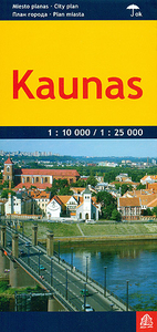
Kaunas
Kaunas at 1:25, 000 on an indexed street plan from Jana Seta, covering the city with its outer suburbs, plus an enlargement showing in greater detail its city centre. Bus and trolleybus routes are shown with line numbers. For drivers principal traffic arteries are highlighted, one way streets are marked, as are locations of petrol stations and car parks. An enlargement shows the city centre in greater detail.Symbols indicate various places of interest included selected hotel (principally in the city centre), cultural and historical sites, etc. Street index is on the reverse. Map legend includes English.
Product Description
Reviews/Comments
Add New
Intelligent Comparison
Archived Product
Kaunas Stanfords
£8.99
Archived Product

Kasnas Stanfords
£17.99
Archived Product

Klausenpass Stanfords
£19.99
Vouchers
No voucher codes found.
Do you know a voucher code for this product or supplier? Add it to Insights for others to use.
Do you know a voucher code for this product or supplier? Add it to Insights for others to use.
 Denmark