
 United Kingdom
 France
 Germany
 Netherlands
 Sweden
 USA
USA
 Italy
Italy
 Spain
Spain
More From Contributor

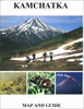

Kamchatka Peninsula
Attractive, colourful physical map relying mainly on altitude tinting to portray the relief, although spot heights and 200m-interval contours are also used. Bathymetry is also shown represented by 100m contours. Insets show the Komandorsky Islands and the Northern Kuril Islands. Road detail includes main roads and some dirt tracks, and symbols highlight towns, shelters, active volcanos, selected mountain peaks and passes and hot springs. Mountain ranges are named, wetland areas distinguished and national park boundaries highlighted. Some text and many of the symbols used are quite small and may be a little difficult to read. Latitude & longitude lines are at 1
Product Description
Reviews/Comments
Add New
Intelligent Comparison
Archived Product
Yucatan Peninsula Stanfords
£6.99
Archived Product

Balkan Peninsula Stanfords
£7.99
Vouchers
No voucher codes found.
Do you know a voucher code for this product or supplier? Add it to Insights for others to use.
Do you know a voucher code for this product or supplier? Add it to Insights for others to use.
 Denmark