
 United Kingdom
 France
 Germany
 Netherlands
 Sweden
 USA
USA
 Italy
Italy
 Spain
Spain
More From Contributor


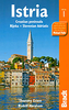
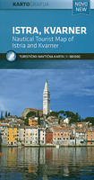
Istria - Kvarner
Istria and Kvarner, the northern part of Croatia’s Adriatic coast, at 1:100, 000 on a detailed, GPS compatible double-sided road map from Kartografija in Ljubljana highlighting picturesque locations. On one side is Istria with coverage extending north to Trieste - on the reverse the map shows the northern part of the Adriatic coast and its islands, extending south to cover all but the southernmost tip of Lošinj and approximately half of Pag.Topography is shown by relief shading with contours at 40m intervals. Road network includes small local roads and selected cart tracks. Driving distances are shown on main and most secondary routes, and locations of border crossings and petrol stations are also marked. Railway lines are included and ferry routes are marked. An overprint
highlights numerous recommended cycling routes.Pictureque locations are prominently highlighted and symbols indicate various places of interest including ordinary or nudist campsites, beaches, viewpoints, historical sites, etc. Along the coast symbols indicate marinas, harbours, anchor facilities for large craft, etc. The map also gives some bathymetric information but is not intended to be used as a sailing chart. Latitude and longitude lines are drawn at 5’ intervals. The map has no index. Map legend includes English.
highlights numerous recommended cycling routes.Pictureque locations are prominently highlighted and symbols indicate various places of interest including ordinary or nudist campsites, beaches, viewpoints, historical sites, etc. Along the coast symbols indicate marinas, harbours, anchor facilities for large craft, etc. The map also gives some bathymetric information but is not intended to be used as a sailing chart. Latitude and longitude lines are drawn at 5’ intervals. The map has no index. Map legend includes English.

Product Description
Reviews/Comments
Add New
Vouchers
No voucher codes found.
Do you know a voucher code for this product or supplier? Add it to Insights for others to use.
Do you know a voucher code for this product or supplier? Add it to Insights for others to use.
 Denmark