More From Contributor

£15.99
Ireland in the Thomas Cook Driving Guides series; comprising a range of guides dedicated to exploring a selection of the best car tours & drives in Britain, Europe, Australasia & North America. The guides are designed to provide readers with a flexible reference source to explore the region or country by car; taking in the best local attractions & things to do & see. Recommended driving tours are linked with local sights for each chapter & total driving time is indicated clearly. An introductory section gives an overview of the destination with details of the place & its people, history, art & architecture, culture, geography & food & drink. Each chapter is divided into a touring area which is rated in categories such as architecture, entertainment & children to allow readers to plan a drive accordingly. Individual chapters give an outline of the region & provide practical guidance on getting there & around. A dedicated ...
Archived Product
£7.99
Driving Map of Ireland at 1:450, 000 from OSI, the Ordnance Survey of Irel&, presenting the whole island (Eire & Northern Ireland) with enlargements showing in greater detail road access & main routes in Dublin, Cork, Limerick, Galway & Belfast. Road network is presented on a plain base with no topographic shading or colouring. Motorways indicate toll sections & clearly show junction numbers. Third class local roads are included & driving distances are marked on national & regional routes. Railway lines are shown with stations & local airports are marked. The map has no geographical coordinates. The index is next to the map. Enlargements present in greater detail road access & main routes in Dublin, Cork, Limerick, Galway & Belfast. Also provided is a distance table.PLEASE NOTE: the same presentation of the road network but in addition with scenic routes & places of interest is provided by OSI ...
Archived Product
£7.99
Ireland at 1:450, 000 from OSI, the Ordnance Survey of Irel&, presenting the whole island (Eire & Northern Ireland) in a choice of three different versions with the same base map enhanced by different additional information: The base map shows the road & rail networks, with place names in their traditional English versions, plus the Irish names where appropriate (Cork/ Corcaigh, Limerick/ Luimneach, etc). Also marked are county boundaries. The three versions then have: Driving Map: has a plain white base for clearer presentation of the road network & the driving distances shown national & regional routes. Rivers & lakes are shown but beyond it there is no topographic information on mountains, national parks, etc. The index is in a separate booklet attached to the map cover. Touring Map (this title):

Includes::
in addition names of mountain ranges & peaks or spot heights to indicate the topography. Road network shows scenic roads & a range of symbols highlight campsites, youth hostels, golf courses (indicating 9 or 18 holes), nature reserves, race courses, etc. Enlargements at 1:120, 000 show in greater detail road access to Dublin, Cork, Limerick, Galway & Belfast. The map also has a distance table. The index is in a separate booklet attached to the map cover. Leisure Map: has a similar base to the Driving Map (i.e. no topography) & no scenic routes, but provides more prominent & more extensive symbols highlighting leisure facilities: campsites, youth hostels, golf courses (indicating 9 or 18 holes), nature reserves, race courses, marinas & moorings, beaches, etc. The map also shows selected long-distance footpaths & cycle routes. No index is provided.

...
Archived Product
£7.99
Ireland East in a series of four road maps at 1:250, 000 covering both the Republic of Ireland & Northern Irel&, with detailed road classification, altitude colouring & tourist information, published by OSI, the Ordnance Survey of Irel&, with the northern sheet produced in cooperation with the Ordnance Survey of Northern Irel&. Topography of the island is shown by altitude colouring, with additional spot heights & names of mountain or hill ranges & other geographical features. Additional graphics show different types of woodlands. Road network shows six grades of roads; gradients for steep roads are indicated only in Northern Irel&. Railway lines are shown with stations.A range of symbols highlights camping & caravan sites, nature reserves, National Trust & An Taisce properties or l&, gold courses (indicating the number of holes), historical sites, etc. The maps have 10-km Irish national grid, plus latitude & longitude margin ticks at 10’ intervals. No index is provided ...
Archived Product
£5.99
Ireland in the Essential Guide Series from the AA exploring the best places to see & things to do in a range of popular destinations. Each illustrated, pocket-sized guide is divided into five sections
- the essence of the area, planning your trip, the best places to see, best things to do & an exploration of notable highlights, organised by area. An introductory chapter profiles each destination &

Includes::
notes on local cuisine & recommendations for short breaks. A planning section advises on pre-trip preparations & getting there & around as well as outlining useful language tips & what


...
Archived Product
£8.99
Explore Ireland is part of a br&-new series & is the ideal pocket companion for your trip. With its unique mix of jaw-dropping landscapes, lively cities, friendly people & buzzing nightlife, it`s hard to beat a trip to Irel&. Here is a full-colour guide containing 16 easy-to-follow routes around the country, from historic Dublin & the Celtic romance of the Rock of Cashel to the stunning landscapes of the Ring of Kerry. Insight`s trademark cultural coverage sets the routes in context, with introductions to Ireland`s exciting cuisine, fantastic shopping, entertainment & outdoor activities & key historical dates. H&-picked places to eat & drink are highlighted in each tour & in the directory section, which contains a wealth of useful practical information, including a range of carefully selected hotels to suit all budgets. All routes are plotted on the useful pull-out map, & evocative photography captures the essence of this alluring gem of a country. ...
Archived Product
£14.99
Take to the open road with Back Roads Ireland & discover 25 leisurely drives through the country`s beautiful villages & stunning ...
Archived Product
£14.99
Ireland in The ‘ Back Roads’ series from Eyewitness; comprising a range of touring guides concentrating on driving off the beaten track & away from main roads. Each title in the series

Includes::
25 driving tours, ranging from 1 to 5 days, which take drivers deep into the heart of remote countryside, taking in beautiful villages, picturesque landscapes, authentic restaurants & a range of small hotels. Each itinerary

Includes::
a guided walk through a historic town or unspoilt countryside, in addition to a range of activities & tips on buying local crafts & produce. Postcodes are also listed for use with in-car sat-nav & there is detailed advice on the rules of the road, clear driving instructions & overview maps that are designed to be useful & informative to the driver. Each drive

Includes::
a ‘plan your drive’ section providing comprehensive information on the route & day trip options. A series of listings indicates activities in the local area, places where to eat & drink & where to stay. There are also colour photographs illustrating some of the highlights of the region.


...
Archived Product
£15.99
Ireland in the Eyewitness guide series from Dorling Kindersley; lavishly illustrated & particularly concerned with providing the visitor with detailed background information to sightseeing in the chosen destination & a broad cultural introduction. Popular historical buildings & museums are often described with cutaway diagrams allowing you to view ...
Archived Product
£11.99
Ireland in the Eyewitness guide series from Dorling Kindersley; lavishly illustrated & particularly concerned with providing the visitor with detailed background information to sightseeing in the chosen destination & a broad cultural introduction. Popular historical buildings & museums are often described with cutaway diagrams allowing you to view ...
Archived Product

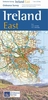
Ireland Explore Insight Guide - The Best Routes Around The Country

With its unique mix of jaw-dropping landscapes, lively cities, friendly people and buzzing nightlife, it's hard to beat a trip to Ireland. Explore Ireland is part of a brand-new series and is the ideal pocket companion for your trip: a full-colour guide containing 16 easy-to-follow routes around the country, from historic Dublin and the Celtic romance of the Rock of Cashel to the stunning landscapes of the Ring of Kerry. Insight's trademark cultural coverage sets the routes in context, with introductions to Ireland's exciting cuisine, fantastic shopping, entertainment and outdoor activities and key historical dates. Hand-picked places to eat and drink are highlighted in each tour and in the directory section, which contains a wealth of useful practical information, including a
range of carefully selected hotels to suit all budgets. All routes are plotted on the useful pull-out map, and evocative photography captures the essence of this alluring gem of a country.
RIP - This product is no longer available on our network. It was last seen on 25.09.2019

This page now acts as a permanent archive for this product. Add more information using the comments box below to ensure it can still be found by future generations.

Use our search facility to see if it is available from an alternative contributor.
  • External links may include paid for promotion
  • Availability: Out Of Stock
  • Supplier: Stanfords
  • SKU: 9781780056609
Availability: In Stock
£7.99

Product Description

With its unique mix of jaw-dropping landscapes, lively cities, friendly people & buzzing nightlife, it's hard to beat a trip to Irel&. Explore Ireland is part of a br&-new series & is the ideal pocket companion for your trip: a full-colour guide containing 16 easy-to-follow routes around the country, from historic Dublin & the Celtic romance of the Rock of Cashel to the stunning landscapes of the Ring of Kerry. Insight's trademark cultural coverage sets the routes in context, with introductions to Ireland's exciting cuisine, fantastic shopping, entertainment & outdoor activities & key historical dates. H&-picked places to eat & drink are highlighted in each tour & in the directory section, which contains a wealth of useful practical information, including a range of carefully selected hotels to suit all budgets. All routes are plotted on the useful pull-out map, & evocative photography captures the essence of this alluring gem of a country.

Reviews/Comments

Add New

Intelligent Comparison

Oooops!
We couldn't find anything!
Perhaps this product's unique.... Or perhaps we are still looking for comparisons!
Click to bump this page and we'll hurry up.

Price History

Vouchers

No voucher codes found.
Do you know a voucher code for this product or supplier? Add it to Insights for others to use.

Facebook

Jargon Buster

Hand - A part of the body at the end of the arm
Hand - A pointer which indicates time on a clock face
Key - A physical or virtual device or code used for opening something
Entertainment - Something that provides amusement
Colour - The categorised spectrum of light visable to humans
Practical - Weather a task is easy to carry out and realistically succeed.
Pocket - A bag shaped insert in clothing used to carry items
Ideal - Something that satisfies a perfect criteria.

Supplier Information

Stanfords
Stanfords was established in 1853 and opened their iconic Covent Garden flagship store in 1901. They have become the top retailer of maps, travel books and accessories in the UK and arguably offer the largest selection of maps and travel books worldwide. Famous names such as Captain Robert Falcon Scott, Ranulph Fiennes and Michael Palin have purchased from Stanfords. They now have a shop in Bristol and both stores together with other venues operate a calendar of events including talks, book signings and exhibitions. As a specialist map retailer, the map selection is comprehensive and includes road maps, street maps and walking maps from worldwide destinations, as well as a selection of world atlases and wall maps. Books include travel guides and travel literature. Stanfords also stock globes, from miniatures made of blue marble to magnificent floor-standing globes. The website features a selection of interesting articles on travel topics.
Page Updated: 2023-11-12 20:15:36

Community Generated Product Tags

Oh No! The productWIKI community hasn't generated any tags for this product yet!
Menu