
 United Kingdom
 France
 Germany
 Netherlands
 Sweden
 USA
USA
 Italy
Italy
 Spain
Spain
More From Contributor

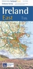
Ireland Driving Map
Driving Map of Ireland at 1:450, 000 from OSI, the Ordnance Survey of Ireland, presenting the whole island (Eire and Northern Ireland) with enlargements showing in greater detail road access and main routes in Dublin, Cork, Limerick, Galway and Belfast.Road network is presented on a plain base with no topographic shading or colouring. Motorways indicate toll sections and clearly show junction numbers. Third class local roads are included and driving distances are marked on national and regional routes. Railway lines are shown with stations and local airports are marked. The map has no geographical coordinates. The index is next to the map.Enlargements present in greater detail road access and main routes in Dublin, Cork, Limerick, Galway and Belfast. Also provided is a distance
table.PLEASE NOTE: the same presentation of the road network but additionally with scenic routes and places of interest is provided by OSI
table.PLEASE NOTE: the same presentation of the road network but additionally with scenic routes and places of interest is provided by OSI
Product Description
Reviews/Comments
Add New
Vouchers
No voucher codes found.
Do you know a voucher code for this product or supplier? Add it to Insights for others to use.
Do you know a voucher code for this product or supplier? Add it to Insights for others to use.
 Denmark