More From Contributor

£12.99
SPECTATOR BOOKS OF THE YEAR 2016, GUARDIAN BOOKS OF THE YEAR 2016 ` Authoritative, expansive & incisive...helps restore India to the global twentieth century` Sunil Khilnani Between 1939 & 1945 India changed to an extraordinary extent. Millions of Indians suddenly found themselves as soldiers, fighting in Europe & North Africa but also
- something simply never imagined
- against a Japanese army threatening to invade eastern India. Many more were pulled into the vortex of wartime mobilization. Srinath Raghavan`s compelling & original book gives both a surprising new account of the fighting & of life on the home front. For Indian nationalists the war has tended to be seen as a distraction from the quest for national independence
- but Raghavan shows that in fact the war lay at the very heart of how & why colonial rule ended in South Asia. By seeing the Second World War through Indian eyes, Raghavan transforms our understanding of the conflict
- with famous battles such as those in North Africa & Iraq reinterpreted, as well as fascinating & little known campaigns such as the destruction of Italian northeast Africa. Time & again, it was Indian troops that made Britain into a global power &, as the war came to an end, it was the Indian army that fought the final battles which marked the end both of the Japanese empire, & of the British.


...
Archived Product
£30.00
This extraordinary selection of objects showcases the beauty & knowledge embodied in works of art & everyday life from Indigenous Australia. Published to accompany the first major UK exhibition on Indigenous Australia, this ground breaking new publication explores the profound impact & legacy of colonialism, the nature of collecting & the changing meaning of objects now in the collection of the British Museum. The encounters between Indigenous peoples & colonists were complex & nuanced, & contemporary Australian society is still dealing with this legacy, trying to transform or reconcile different worldviews. ...
Archived Product
£12.99
The Indigenous People Trail map at 1:75, 000 highlighting a trekking circuit in the less visited part of Nepal directly east of Kathmandu. The map is part of the Nepa Maps series which provides extensive coverage of trekking areas of Nepal on detailed contoured maps with trekking routes & hiking trails, huts & camp sites, local places of interest & other tourist information. The map covers an area directly east of Kathmandu, with Dhulikhel & Khopasi at its western edge & Charikot in the north-eastern corner. Numerous trails are marked, with the main highlighted route crossing the area east of the Sunkashi River. Contours are at 80m intervals, with additional vegetation colouring. Margin ticks show latitude & longitude at intervals of 5`. The map is indexed &

Includes::
additional information on various stages of the main trek & other activities in this area. Titles in this series have cartography is based on the country’s topographic survey, with contours usually at 40m or 50m intervals, enhanced by relief shading, colouring & graphics to show various features of the terrain, including glaciers, forested or cultivated areas, etc. Numerous peaks, with additional spot heights, plus names of glaciers & mountain ranges are prominently shown. The network of rivers, streams & lakes is shown in great detail, with many smaller rivers & lakes named. Overprint highlights main trekking routes & numerous local trails, with symbols indicating various places of interest & tourist facilities. Most maps are indexed & include additional information such as route profiles, glossaries, etc. All the information is in English & heights are given in metres.

...
Archived Product
£8.99
Indigo is the rich, electrifying history of a precious dye: its relationship to the trans-Atlantic slave trade, its profound influence on fashion, & its spiritual significance
- all very much alive today. But it is also the story of a personal quest: Catherine Mc Kinley`s ancestors include a clan of Scots who wore indigo tartan, several generations of Jewish `rag traders` & Massachusetts textile factory owners, & African slaves who were traded along the same Saharan routes as indigo. Her journey takes her to nine West African countries & is resplendent with powerful lessons of heritage & history which shape the way she understands her world at home.
...
Archived Product
£19.99
Produced from plants by a process akin to alchemy, indigo has a unique chemistry that renders it compatible with all natural fibres. From the time of the ancient Egyptians it made an incredible impact worldwide as the world`s only source of blue of every hue, & was also indispensable for creating a glorious range of colours when combined with other natural dyes. It is hard to imagine the incredible impact indigo must have made on the many civilizations that chanced upon it. This classic study, reissued with a new final chapter, examines this extraordinary dye from all angles: the historical, agricultural & botanical origins of the different plant sources; different production & dyeing methods; commerce & economics; various patterning techniques used on a wide range of beautiful textiles; indigo`s continued presence in folklore, art & alternative medicine; & its iconic status as the dye that makes blue jeans blue. The accumulation of over twenty years research on the subject, Indigo: Egyptian Mummies to Blue Jeans is the richly told story of a commodity that has been central to international trade & textile production for centuries, across time & cultures. Richly illustrated throughout with stunning details & scenes from around the world, this is the definitive study of the fascinating dye behind blue denim. ...
Archived Product
£9.50
Indochina (Vietnam, Laos & Cambodia) at 1:1, 200, 000 on an indexed, waterproof & tear-resistant road map with topographic & tourist information, published by Reise Know-How as part of their highly acclaimed World Mapping Project. The map is double-sided to provide the best balance between a good scale & a convenient size sheet. The map divides the region north/south, with a good overlap between the sides. Light altitude colouring with contours & peak heights presents the topography. National parks & other protected areas are highlighted. Road network

Includes::
selected local roads & tracks & gives driving distances on main & many secondary routes. Border crossings are clearly indicated. Railway lines & ferry routes are included & local airports are marked. The map also shows internal administrative divisions with names of the provinces.A range of symbols highlights various places of interest including UNESCO World Heritage sites, religious temples & shrines, beaches & diving sites, etc (please note: some names of places of interest are shown in German). Latitude & longitude lines are drawn at intervals of 30

...
Archived Product
£11.50
Indochina (Vietnam, Laos & Cambodia) at 1:1, 200, 000 on an indexed, waterproof & tear-resistant road map with topographic & tourist information, published by Reise Know-How as part of their highly acclaimed World Mapping Project. The map is double-sided to provide the best balance between a good scale & a convenient size sheet. The map divides the region north/south, with a good overlap between the sides. Light altitude colouring with contours & peak heights presents the topography. National parks & other protected areas are highlighted. Road network

Includes::
selected local roads & tracks & gives driving distances on main & many secondary routes. Border crossings are clearly indicated. Railway lines & ferry routes are included & local airports are marked. The map also shows internal administrative divisions with names of the provinces.A range of symbols highlights various places of interest including UNESCO World Heritage sites, religious temples & shrines, beaches & diving sites, etc. All place names are in the Latin alphabet with, particularly in Laos, alternative transliterations provided for many locations Latitude & longitude lines are drawn at intervals of 30’. Each side of the map has a separate extensive index of localities. Map legend

Includes::
English.


...
Archived Product
£25.00
” Indochine” sees Red Lantern`s Luke Nguyen revisit his beloved Vietnam & seek out the food & cultural remnants of this former French colonial empire. On his regular visits to Vietnam today, Luke is often struck by the appearance of people wearing berets, speaking French & the aromas of coffee & butter emanating from cafes & patisseries. The recipes & accompanying stories showcase the French influence upon Vietnamese history & cuisine. Against a backdrop of grand colonial hotels, bars, restaurants & terraces, to private estates dressed in antiques & textiles of the period, Luke talks to chefs, bakers & family members to extract the very essence of French-Vietnamese cuisine. From coffee & croissants at breakfast to high tea & supper, Luke unravels the origins of Vietnamese dishes such as pho, which began life as a `pot au feu`, & experiments with new versions of traditional Vietnamese food. ” Indochine” appeals to lovers of French, Vietnamese food & travel alike. This title is from the author of best-selling cookbooks ” Secrets of the Red Lantern” & ” The Songs of Sapa”. It features vibrant food photography shot entirely in Vietnam & more than 100 regional recipes showcasing Vietnam`s French culinary roots. ...
Archived Product
£4.99
Indonesia at 1:6, 500, 000 is an indexed, double sided map with additional street plans & enlargements of popular regions on the reverse. The publisher has chosen to concentrate on creating a map which will primarily be of use for a tourist navigating between main points of interest as opposed to stressing more detailed cartography. National, main & minor roads & tracks are extremely clearly marked, as are airports. National & regional borders are demarcated. In keeping with the publisher ...
Archived Product
£15.99
Indonesia in the Countries & Regions series from Lonely Planet, market-leading comprehensive guides aimed at independent travellers & serving a large range of international destinations. Frank & informal in style, the guides explore an extensive range of sights, activities, accommodation, restaurants & nightlife & are designed for practical use while travelling on the road. Written & researched by a team of experts, each book is independent in its recommendations & suggestions, often offering individual takes on individual destinations. Widely recognised for their reliability, each Lonely Planet country & region guide has the same layout. Introductory sections profile the destination with individual chapters on particular highlights, getting started, (including when to go) itineraries, history, culture, arts, food & drink & the environment. Each guide is organised geographically by region, with individual sections detailing an extensive range of sights, places of interest, attractions, restaurants, nightlife, accommodation & any local activities. The guides have detailed explanations of historical context where relevant. There is also practical guidance on ...
Archived Product

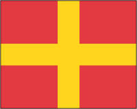
Individual Signal Flags

Individual signal flags.We are able to source a wide range flags in many sizes. They can be sewn or printed on 100% Ministry Of Defence Standard Woven and Knitted Polyester. Flags are supplied with rope and toggle. If you would like more information, have a custom size request or cannot find a desired product, please email us at maritime@stanfords.co.uk. We will be glad to help!
RIP - This product is no longer available on our network. It was last seen on 25.09.2019

This page now acts as a permanent archive for this product. Add more information using the comments box below to ensure it can still be found by future generations.

Use our search facility to see if it is available from an alternative contributor.
  • External links may include paid for promotion
  • Availability: Out Of Stock
  • Supplier: Stanfords
  • SKU: SI00003802
Availability: In Stock
£17.99

Product Description

Individual signal flags. We are able to source a wide range flags in many sizes. They can be sewn or printed on 100% Ministry Of Defence Standard Woven & Knitted Polyester. Flags are supplied with rope & toggle. If you would like more information, have a custom size request or cannot find a desired product, please email us at maritime@stanfords.co.uk. We will be glad to help!

Reviews/Comments

Add New

Intelligent Comparison

Oooops!
We couldn't find anything!
Perhaps this product's unique.... Or perhaps we are still looking for comparisons!
Click to bump this page and we'll hurry up.

Price History

Vouchers

No voucher codes found.
Do you know a voucher code for this product or supplier? Add it to Insights for others to use.

Facebook

Jargon Buster

Polyester - A synthetic fibre with improved wrinkle resistance
UK - United Kingdom - An island nation in Europe
email - An electronic communication method. Short for Electronic Mail.
Size - is the measurement of how big an object is in space.
Polyester - A man made fibre from chemicals. Often refers to polyethylene terephthalate.
Wide - Something with a large width.
Individual - A single separate item or person.

Supplier Information

Stanfords
Stanfords was established in 1853 and opened their iconic Covent Garden flagship store in 1901. They have become the top retailer of maps, travel books and accessories in the UK and arguably offer the largest selection of maps and travel books worldwide. Famous names such as Captain Robert Falcon Scott, Ranulph Fiennes and Michael Palin have purchased from Stanfords. They now have a shop in Bristol and both stores together with other venues operate a calendar of events including talks, book signings and exhibitions. As a specialist map retailer, the map selection is comprehensive and includes road maps, street maps and walking maps from worldwide destinations, as well as a selection of world atlases and wall maps. Books include travel guides and travel literature. Stanfords also stock globes, from miniatures made of blue marble to magnificent floor-standing globes. The website features a selection of interesting articles on travel topics.
Page Updated: 2023-11-12 20:15:36

Community Generated Product Tags

Oh No! The productWIKI community hasn't generated any tags for this product yet!
Menu