
 United Kingdom
 France
 Germany
 Netherlands
 Sweden
 USA
USA
 Italy
Italy
 Spain
Spain
More From Contributor


Icelandic Bird Guide
The Icelandic Bird Guide is the definitive identification guide to Icelandic avifauna. Over 500 photographs, an informative text and distribution maps make this the essential birding guide to the area. Contains information on: - Order, family, habits and identifying features of Icelandic birds.- Habitat, breeding areas, population, clutch size and incubation period.- Descriptions of birds, variations in plumage by season and age, bill feet and eyes.- Flight, wingspan, length and weight, behaviour and calls.- Duration of stay, breeding season and fledging period in diagrammatic form.- Maps of breeding distribution, winter distribution, and areas visited.- Eggs of Icelandic breeding birds shown in real size, nests and young.- Icelandic breeding birds, passage migrants,
winter visitors, summer visits and annual vagrants.
winter visitors, summer visits and annual vagrants.
Product Description
Reviews/Comments
Add New
Intelligent Comparison
Archived Product
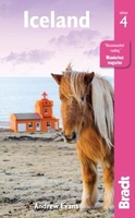
Iceland Bradt Guide Stanfords
£15.99
Archived Product
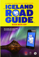
Iceland Road Guide Stanfords
£36.99
Archived Product
Ireland Spiral Guide Stanfords
£9.99
Archived Product

Iran Bradt Guide Stanfords
£17.99
Archived Product

Iran Bradt Guide Stanfords
£17.99
Archived Product

Albania Bradt Guide Stanfords
£16.99
Archived Product

Lapland Bradt Guide Stanfords
£15.99
Archived Product

Ireland Green Guide Stanfords
£16.99
Vouchers
No voucher codes found.
Do you know a voucher code for this product or supplier? Add it to Insights for others to use.
Do you know a voucher code for this product or supplier? Add it to Insights for others to use.
 Denmark