More From Contributor
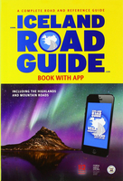
£4.99
Iceland in the Pocket Guide series from Berlitz; a collection of handy, pocket-sized guides dedicated to an extensive range of cities, regions & countries worldwide. Written in narrative form, individual guides explore the history, main sights & attractions, food & drink, accommodation & local culture of the destination in detail. Each Berlitz pocket guide has a similar format, with colour-coded sections helping readers locate information quickly in addition to distinctive chapters exploring the city or region. An introduction outlines the destination for visitors & a section dedicated to 'A Brief History' actually explores the area in relative depth. A where to go chapter is organized by region & city & is written in prose form with references to individual sites highlighted in bold for clarity. There are also further suggestions on where & when to eat. Recommendations for leisure activities in the region, including sport, nightlife & shopping, are also provided & tailored accordingly for each destination. Handy travel tips are listed alphabetically in a dedicated section, providing practical guidance & helping visitors make the most of their stay. The main hotels, particularly for cities, are also listed in an accommodation section, offering a brief overview with approximate price bandings & relevant contact details. ...
Archived Product
£5.99
DUE OUT JUNE 2014
- Iceland in the Pocket Guide series from Berlitz; a collection of handy, pocket-sized guides dedicated to an
...
Archived Product
£6.99
Iceland is a country bristling with natural beauty. Its landscape is littered with volcanoes, lagoons, glaciers, waterfalls, black-sand beaches & geysers. The lively capital city of Reykjavik also has a lot to offer visitors, from the stunning Blue Lagoon to its rich cultural heritage. Berlitz Pocket Guide Iceland is a concise, full-colour travel guide that combines lively text with vivid photography to highlight the best that the country has to offer. Inside Iceland Pocket Guide:· Where To Go details all the key sights in the country, while handy maps on the cover flaps help you find your way around, & are cross-referenced to the text.· Top 10 Attractions gives a run-down of the best sights to take in on your trip.· Perfect Tour provides an itinerary of the country.· What To Do is a snapshot of ways to spend your spare time, from catching a glimpse of the Northern Lights, to whale watching, to relaxing in the Blue Lagoon, to working your way around Reykjavik`s stylish bars.· Essential information on Icelandic culture, including a brief history of the country.· Eating Out covers the country`s best cuisine.· Curated listings of the best hotels & restaurants.· A-Z of all the practical information you`ll need. ...
Archived Product
£11.50
Iceland at 1:425, 000 on a waterproof & tear-resistant road map with topographic & tourist information, published by Reise Know-How as part of their highly acclaimed World Mapping Project. The map is double-sided to provide the best balance between a good scale & a convenient size sheet, with a generous overlap between the two sides. The map provides a large amount of topographic information through altitude colouring, with plenty of spot heights & names peaks, glaciers, mountain ranges, etc. National parks & other protected areas are prominently highlighted & also marked are geysers & hot springs. Road network indicates unsurfaced roads &

Includes::
local tracks. Driving distances are shown on most roads & river fords are marked. Also shown are ferry connections, as well as the country’s administrative boundaries with names of the provinces. Symbols indicate various places of interest, including campsites & refuges, UNESCO World Heritage sites, sport & recreational facilities, etc. The map has a latitude & longitude grid at intervals of 30’ & 1° respectively, plus an extensive index of localities which

Includes::
names of selected topographic features (e.g. glaciers). Map legend

Includes::
English.


...
Archived Product
£29.99
Road Atlas of Iceland at 1:500, 000 from Ferðakort, published in a handy 15x 25cm spiral-bound format, with an index of over 3, 000 entries, a comprehensive distance table, 46 street plans including Reykjavik & several thematic map sincluding cultural heritage & geology. The whole of Iceland is covered at 1:500, 000 with the road network distinguishing between paved & gravel roads, & showing which small local roads are maintained by the country’s government. Fords, locations of petrol stations, driving distances & car ferry routes are marked. National parks & other protected areas are highlighted & symbols mark locations of various places of interest: different types of tourist accommodations including campsites, refuges & emergency shelters, museums & cultural centres, sport & recreational facilities, local airfields, hydro-electric & thermal power stations, etc. The maps have relief shading with spot heights & plenty of names of various geographical features. Lava fields & glaciers are shown & hot springs are prominently marked. The maps have latitude & longitude lines at intervals of 20’ & 30’ respectively. Comprehensive index of over 3, 000 place names

Includes::
geographical features such as mountain ranges, volcanoes, etc. The atlas

Includes::
street plans of 46 towns, highlighting places of interest & various facilities; Reykjavik is covered on 10 pages with an additional enlargement for the town centre. Also provided are a comprehensive distance table & several thematic maps: protected natural areas, historical heritage, orientation table for viewing the surrounding landscape, administrative divisions, radio reception areas, geology, & vegetation, etc. Map legend & all the text include English.


...
Archived Product
£15.99
South-East Iceland at 1:300, 000 in a series from Mál og menning covering the country on five road maps with fine presentation of the topography, road network indicating gravel roads, plus on the reverse photos & descriptions of main sights. Maps in Mál og menning ‘s 300K series have contours at 100m intervals, enhanced by very effective relief shading & altitude colouring, plus plenty of spot heights & names of mountain ranges, peaks, glaciers, etc. Road information distinguishes between hard surface & gravel roads,

Includes::
local tracks & indicates river fords. Symbols show locations of campsites, swimming pools, thermal & hydro-electric power stations, local airfields, etc. The maps have a grid with latitude & longitude at 15` & 30` intervals respectively; the map covering the Central Highlands also has GPS waypoints for important road junctions & other sites. Map legend

Includes::
English. On the reverse of the maps there are photographs of main natural sights in the region with multilingual descriptions which include English; maps 1 to 4 also have a comprehensive distance table for the whole country; map no. 5 has instead a list of the local GPS waypoints.


...
Archived Product
£15.99
South-Eastern Iceland at 1:200, 000 on a detailed map from Mál og Menning with exceptionally vivid presentation of the country’s topography & landscape, hard surface or gravel roads & numerous country tracks, superb drawings of local birds & flowers, etc. Coverage extends southwards from the central part of the Vatnajökull Glacier with Grimsfjall & westwards to the Þórisvatn Lake. Maps in this series, first published in summer 2013, are based on the publishers’ topographic mapping of Iceland at 1:100, 000 & provides an outstanding presentation of Iceland’s unique topography & landscape. Contours at 100m intervals are supplemented by very vivid relief shading & altitude colouring, with many more names of topographic features than on the publishers’ 1:300, 000 series. The maps also have additional colouring and/or graphics to indicate different types of land cover. Road network is also finely presented, divided into main & secondary roads with hard or gravel surface. Significantly more cross-country tracks are marked than on other road maps. Symbols indicate location of fords, emergency shelters, campsites, tourist huts or shelters, swimming pools & golf courses, thermal & hydro-electric power stations, local airfields, etc. The maps have a grid with latitude & longitude at 4’ & 10` intervals respectively. On the reverse the maps have photographs of main natural sights in the region with multilingual descriptions which include English. Each map also has lovely drawings of local birds & flowers (names include English & Latin). ...
Archived Product
£15.99
South-West Iceland at 1:300, 000 in a series from Mál og menning covering the country on five road maps with fine presentation of the topography, road network indicating gravel roads, plus on the reverse photos & descriptions of main sights. Maps in Mál og menning ‘s 300K series have contours at 100m intervals, enhanced by very effective relief shading & altitude colouring, plus plenty of spot heights & names of mountain ranges, peaks, glaciers, etc. Road information distinguishes between hard surface & gravel roads,

Includes::
local tracks & indicates river fords. Symbols show locations of campsites, swimming pools, thermal & hydro-electric power stations, local airfields, etc. The maps have a grid with latitude & longitude at 15` & 30` intervals respectively; the map covering the Central Highlands also has GPS waypoints for important road junctions & other sites. Map legend

Includes::
English. On the reverse of the maps there are photographs of main natural sights in the region with multilingual descriptions which include English; maps 1 to 4 also have a comprehensive distance table for the whole country; map no. 5 has instead a list of the local GPS waypoints.


...
Archived Product
£21.99
South-East Iceland at 1:250, 000 in a series of detailed, contoured road maps of Iceland with cartography based on the country’s topographic survey, supplemented by additional tourist information. Contours are at 50m intervals, enhanced by relief shading with additional graphics & colouring showing different types of terrain & vegetation: glaciers, lava fields, s&, forest & shrubbery, cultivated l&, etc. Boundaries of the national park & other protected areas are marked. Road detail

Includes::
gravel/earth roads, fords over rivers, petrol stations, & intermediate driving distances. A wide range of symbols highlight various types of accommodation including tourist huts & campsites, sport & leisure facilities, places of interest, etc. Latitude & longitude lines are drawn at 15` & 20` intervals respectively. The maps have no index. Map legend

Includes::
English. To see the other titles in this series please click on the series link.


...
Archived Product
£21.99
South-West Iceland in a series of detailed, contoured road maps of Iceland with cartography based on the country’s topographic survey, supplemented by additional tourist information. Contours are at 50m intervals, enhanced by relief shading with additional graphics & colouring showing different types of terrain & vegetation: glaciers, lava fields, s&, forest & shrubbery, cultivated l&, etc. Boundaries of the national park & other protected areas are marked. Road detail

Includes::
gravel/earth roads, fords over rivers, petrol stations, & intermediate driving distances. A wide range of symbols highlight various types of accommodation including tourist huts & campsites, sport & leisure facilities, places of interest, etc. Latitude & longitude lines are drawn at 15` & 20` intervals respectively. The maps have no index. Map legend

Includes::
English. To see the other titles in this series please click on the series link.


...
Archived Product

Iceland Road Guide

Iceland Road Guide from Vegahandbókin, an exceptionally comprehensive, 605-page guide with region-by-region descriptions of sites accompanied by road maps and street plans, plus a separate road atlas section covering the whole country at 1:500, 000 and information on a wide variety of tourism relating topics to help the user get the best of their visit to the country.The main, over 500-page long guide section divides Iceland into nine regions and, since most visitors explore the country by car, presents the descriptions arranged by road numbers, e.g. for travellers along road number 261 leading from Highway 1 into the interior the book lists or describes all locations along the route, from one or two words for individual farms to more detailed comments about interesting
topographic features, historical sites, etc. The round-Iceland circuit along the Highway 1 gets a chapter to itself. The descriptions are placed next to road maps, mostly at around 1:100, 000; where useful street plans are also provided. Both the road maps and the plans are annotated with a wide range of symbols highlighting accommodation options, restaurants, information centres, petrol stations and car repairs, hiking and other recreational locations, etc. Whilst at first glance this not often used format of presentation may appear a bit confusing to follow, it is quickly apparent that it is very well suited to exploring Iceland by car. The atlas section presents the country at 1:500, 000 on mapping with bold altitude colouring to indicate the topography, using the same icon
range to highlight places of tourist interest. The guide includes several additional maps of the whole country providing at-a-glance information useful for route planning: roadside rest areas, accommodation options, information centres, historic buildings, etc. Also included are notes on numerous other topics such as driving regulations, geothermal pools, medical help and the risk of avalanches, photos of animals, etc, plus adverts for various national and local services. The guide, with all the text in English only, is currently in its 14th, 2015 edition.
RIP - This product is no longer available on our network. It was last seen on 25.09.2019

This page now acts as a permanent archive for this product. Add more information using the comments box below to ensure it can still be found by future generations.

Use our search facility to see if it is available from an alternative contributor.
  • External links may include paid for promotion
  • Availability: Out Of Stock
  • Supplier: Stanfords
  • SKU: 9789935925473
Availability: In Stock
£36.99

Product Description

Iceland Road Guide from Vegahandbókin, an exceptionally comprehensive, 605-page guide with region-by-region descriptions of sites accompanied by road maps & street plans, plus a separate road atlas section covering the whole country at 1:500, 000 & information on a wide variety of tourism relating topics to help the user get the best of their visit to the country. The main, over 500-page long guide section divides Iceland into nine regions &, since most visitors explore the country by car, presents the descriptions arranged by road numbers, e.g. for travellers along road number 261 leading from Highway 1 into the interior the book lists or describes all locations along the route, from one or two words for individual farms to more detailed comments about interesting topographic features, historical sites, etc. The round-Iceland circuit along the Highway 1 gets a chapter to itself. The descriptions are placed next to road maps, mostly at around 1:100, 000; where useful street plans are also provided. Both the road maps & the plans are annotated with a wide range of symbols highlighting accommodation options, restaurants, information centres, petrol stations & car repairs, hiking & other recreational locations, etc. Whilst at first glance this not often used format of presentation may appear a bit confusing to follow, it is quickly apparent that it is very well suited to exploring Iceland by car. The atlas section presents the country at 1:500, 000 on mapping with bold altitude colouring to indicate the topography, using the same icon range to highlight places of tourist interest. The guide

Includes::
several additional maps of the whole country providing at-a-glance information useful for route planning: roadside rest areas, accommodation options, information centres, historic buildings, etc. Also included are notes on numerous other topics such as driving regulations, geothermal pools, medical help & the risk of avalanches, photos of animals, etc, plus adverts for various national & local services. The guide, with all the text in English only, is currently in its 14th, 2015 edition.

Reviews/Comments

Add New

Intelligent Comparison

Oooops!
We couldn't find anything!
Perhaps this product's unique.... Or perhaps we are still looking for comparisons!
Click to bump this page and we'll hurry up.

Price History

Vouchers

No voucher codes found.
Do you know a voucher code for this product or supplier? Add it to Insights for others to use.

Facebook

Jargon Buster

Hiking - An outdoor activity envolving walking in nature
Car - A machine used for transport which runs on roads
Road - a manmade lane or a path that is used to speed up travel.
Altitude - Something that can be quite high in relation to sea or ground level.
Wide - Something with a large width.
Accommodation - A room in which someone can live in, for example in a hotel
Interior - The inside of something, usually what is not visible.
Individual - A single separate item or person.

Supplier Information

Stanfords
Stanfords was established in 1853 and opened their iconic Covent Garden flagship store in 1901. They have become the top retailer of maps, travel books and accessories in the UK and arguably offer the largest selection of maps and travel books worldwide. Famous names such as Captain Robert Falcon Scott, Ranulph Fiennes and Michael Palin have purchased from Stanfords. They now have a shop in Bristol and both stores together with other venues operate a calendar of events including talks, book signings and exhibitions. As a specialist map retailer, the map selection is comprehensive and includes road maps, street maps and walking maps from worldwide destinations, as well as a selection of world atlases and wall maps. Books include travel guides and travel literature. Stanfords also stock globes, from miniatures made of blue marble to magnificent floor-standing globes. The website features a selection of interesting articles on travel topics.
Page Updated: 2023-11-12 20:15:36

Community Generated Product Tags

Oh No! The productWIKI community hasn't generated any tags for this product yet!
Menu