
 United Kingdom
 France
 Germany
 Netherlands
 Sweden
 USA
USA
 Italy
Italy
 Spain
Spain
More From Contributor


Iceland Reise Know-How
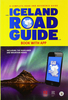
Iceland at 1:425, 000 on a waterproof and tear-resistant road map with topographic and tourist information, published by Reise Know-How as part of their highly acclaimed World Mapping Project. The map is double-sided to provide the best balance between a good scale and a convenient size sheet, with a generous overlap between the two sides. The map provides a large amount of topographic information through altitude colouring, with plenty of spot heights and names peaks, glaciers, mountain ranges, etc. National parks and other protected areas are prominently highlighted and also marked are geysers and hot springs. Road network indicates unsurfaced roads and includes local tracks. Driving distances are shown on most roads and river fords are marked. Also shown are ferry connections, as
well as the country’s administrative boundaries with names of the provinces. Symbols indicate various places of interest, including campsites and refuges, UNESCO World Heritage sites, sport and recreational facilities, etc. The map has a latitude and longitude grid at intervals of 30’ and 1° respectively, plus an extensive index of localities which includes names of selected topographic features (e.g. glaciers). Map legend includes English.
well as the country’s administrative boundaries with names of the provinces. Symbols indicate various places of interest, including campsites and refuges, UNESCO World Heritage sites, sport and recreational facilities, etc. The map has a latitude and longitude grid at intervals of 30’ and 1° respectively, plus an extensive index of localities which includes names of selected topographic features (e.g. glaciers). Map legend includes English.

Product Description
Reviews/Comments
Add New
Vouchers
No voucher codes found.
Do you know a voucher code for this product or supplier? Add it to Insights for others to use.
Do you know a voucher code for this product or supplier? Add it to Insights for others to use.
 Denmark