
 United Kingdom
 France
 Germany
 Netherlands
 Sweden
 USA
USA
 Italy
Italy
 Spain
Spain
More From Contributor


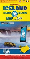
Iceland Touring Map
Touring map of Iceland at 1:500, 000 from Vegahandbokin, with an index which includes topographic features presented in a separate booklet, plus on the reverse of the map photos and brief descriptions of various places of interest, etc.The map presents Iceland’s topography by bold if undifferentiated altitude colouring contracting the interior against the coastal areas. Main glaciers areas are clearly indicated. Road network distinguishes between different types of gravel roads, but overall fewer small local roads are shown than on other locally produced road maps of Iceland. Driving distances are marked on main routes. The map is extensively annotated with small icons indicating various tourist facilities and places of interest including emergency shelters, different types of
accommodation, hot springs, recreational facilities, etc. The map has latitude and longitude lines at 20’ and 30’ respectively. The index is in a separate booklet and includes names of volcanoes and selected other topographic features.On the reverse numerous places of interest are illustrated by colour photos and presented with their GPS waypoints, a brief description and a QR code for further information. Also provided is a distance table, a glossary of Icelandic place names, facts and figures about the country. Map legend and all the text include English.
accommodation, hot springs, recreational facilities, etc. The map has latitude and longitude lines at 20’ and 30’ respectively. The index is in a separate booklet and includes names of volcanoes and selected other topographic features.On the reverse numerous places of interest are illustrated by colour photos and presented with their GPS waypoints, a brief description and a QR code for further information. Also provided is a distance table, a glossary of Icelandic place names, facts and figures about the country. Map legend and all the text include English.

Product Description
Reviews/Comments
Add New
Vouchers
No voucher codes found.
Do you know a voucher code for this product or supplier? Add it to Insights for others to use.
Do you know a voucher code for this product or supplier? Add it to Insights for others to use.
 Denmark