More From Contributor
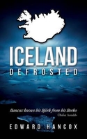
£15.99
Touring map of Iceland at 1:500, 000 from Vegahandbokin, with an index which

Includes::
topographic features

...
Archived Product
£9.99
The handy pocket-size guide is packed with useful information, tips & recommendations, accompanied by color photographs, charts & maps for the first-time traveler who wants to experience the major highlights that Iceland has to offer. The fold-out map of Iceland is ideal for tourists & visitors. ...
Archived Product
£15.99
Iceland Wall Map at 1:600, 000 from Mál og menning, size 100 x 70cm (39” x 27.5” approx), with excellent, vivid presentation of the country’s topography through relief shading combined with graphics & colouring to show eight different types of the terrain and/or vegetation, including heath, grassl&, wetl&, birch woodl&, s&, lava, glaciers, etc. Hard surface roads, gravel roads & tracks are marked, with locations of fords & distances on most routes. Ferry connections & local airfields are also shown. Symbols indicate locations of tourist huts & shelters, campsites, museums, swimming pools, lighthouses, thermal or hydroelectric power stations, etc. Margin ticks give latitude & longitude at intervals of 30’ & 1º respectively. Map legend

Includes::
English. Please note: this map is also available in a folded format with on the reverse photographs of some of Iceland`s most popular destinations, each accompanied by a brief description (all the text

Includes::
English), plus a comprehensive table showing distances from the country’s 11 main towns to over 70 destinations.


...
Archived Product
£15.99
Western Iceland at 1:200, 000 on a detailed map from Mál og Menning with exceptionally vivid presentation of the country’s topography & landscape, hard surface or gravel roads & numerous country tracks, superb drawings of local birds & flowers, etc. Coverage extends northwards from Akranes to Skarðsströnd & the Gilsfjördur bay & eastwards to the Ok & Eiríksjökull glaciers. Maps in this series, first published in summer 2013, are based on the publishers’ topographic mapping of Iceland at 1:100, 000 & provides an outstanding presentation of Iceland’s unique topography & landscape. Contours at 100m intervals are supplemented by very vivid relief shading & altitude colouring, with many more names of topographic features than on the publishers’ 1:300, 000 series. The maps also have additional colouring and/or graphics to indicate different types of land cover. Road network is also finely presented, divided into main & secondary roads with hard or gravel surface. Significantly more cross-country tracks are marked than on other road maps. Symbols indicate location of fords, emergency shelters, campsites, tourist huts or shelters, swimming pools & golf courses, thermal & hydro-electric power stations, local airfields, etc. The maps have a grid with latitude & longitude at 4’ & 10` intervals respectively. On the reverse the maps have photographs of main natural sights in the region with multilingual descriptions which include English. Each map also has lovely drawings of local birds & flowers (names include English & Latin). ...
Archived Product
£15.99
The Western Fjords of Iceland at 1:200, 000 on a detailed map from Mál og Menning with exceptionally vivid presentation of the country’s topography & landscape, hard surface or gravel roads & numerous country tracks, superb drawings of local birds & flowers, etc. Maps in this series, first published in summer 2013, are based on the publishers’ topographic mapping of Iceland at 1:100, 000 & provides an outstanding presentation of Iceland’s unique topography & landscape. Contours at 100m intervals are supplemented by very vivid relief shading & altitude colouring, with many more names of topographic features than on the publishers’ 1:300, 000 series. The maps also have additional colouring and/or graphics to indicate different types of land cover. Road network is also finely presented, divided into main & secondary roads with hard or gravel surface. Significantly more cross-country tracks are marked than on other road maps. Symbols indicate location of fords, emergency shelters, campsites, tourist huts or shelters, swimming pools & golf courses, thermal & hydro-electric power stations, local airfields, etc. The maps have a grid with latitude & longitude at 4’ & 10` intervals respectively. On the reverse the maps have photographs of main natural sights in the region with multilingual descriptions which include English. Each map also has lovely drawings of local birds & flowers (names include English & Latin). ...
Archived Product
£17.95
Walking & Trekking in Iceland from Cicerone Press with 49 day walks & 10 multi-stage treks in various types of terrain including the country’s geothermal areas, presenting both popular classics like the Laugavegur trail & lesser known routes. The walks are grouped geographically to provide a variety of choices in a given area, which is presented on an overview road map indicating locations of the individual walks &, where appropriate, the multi-stage trail. Detailed descriptions of the walks are accompanied by map extracts at approx. 1:100, 000 with contours at 100m intervals, plus information panels with references to hiking maps published by various organizations, mostly the Mal og menning or Ferðakort/ Landmaelingar Íslands hiking series also available from Stanfords’ website. The guides

Includes::
an introductory section to Icel&, including advice on accommodation, travel across the country, wildlife & protected area, etc, plus sections at the end of the book show route summary tables, a glossary, & a list of useful contact details.

...
Archived Product
£29.99
Topographic survey of Iceland at 1:100, 000 covering the whole of country in a series last revised in the early eighties. Contour interval is 20 meters. In addition to the usual features shown on survey mapping, the maps also include a large amount of information indicating the type of the terrain & land use (block or smooth surfaced lava, clay, boulders, sand & dunes, cultivated area, meadows, pastures, bogs, wetlands, etc.) & details not often found on maps: physicians` residences, parsonages, etc. Each map covers an area of 44 x 40 km / 27 x 25 miles. Margin ticks give latitude & longitude in steps of 6`. Map legend

Includes::
English.* For titles not listed on our website, please contact us by e-mail.** Please note:* some titles in this series are no longer available pending a decision whether to continue with printed maps or change to print-on-demand only.

...
Archived Product
£21.99
Iceland at 1:250, 000 on four detailed, contoured road maps, plus a special title providing coverage of the Highlands
- the
...
Archived Product
£15.99
Iceland on eight detailed maps at 1:200, 000 from Mál og Menning with exceptionally vivid presentation of the country’s topography & landscape, hard surface or gravel roads & numerous country tracks, superb drawings of local birds & flowers, etc. This new series, first published in summer 2013, is based on the publishers’ topographic mapping of Iceland at 1:100, 000 & provides an outstanding presentation of Iceland’s unique topography & landscape. Contours at 100m intervals are supplemented by very vivid relief shading & altitude colouring, with many more names of topographic features than on the publishers’ 1:300, 000 series. The maps also have additional colouring and/or graphics to indicate different types of land cover. Road network is also finely presented, divided into main & secondary roads with hard or gravel surface. Significantly more cross-country tracks are marked than on other road maps. Symbols indicate location of fords, emergency shelters, campsites, tourist huts or shelters, swimming pools & golf courses, thermal & hydro-electric power stations, local airfields, etc. The maps have a grid with latitude & longitude at 4’ & 10` intervals respectively. On the reverse the maps have photographs of main natural sights in the region with multilingual descriptions which include English. Each map also has lovely drawings of local birds & flowers (names include English & Latin). ...
Archived Product
£15.99
Iceland at 1:300, 000 on five maps from Mál og menning showing the road network on a base with contours, coloring & graphics to provide a very clear picture of the country’s topography, plus on the reverse photos & descriptions of main sights. The maps have contours at 100m intervals, enhanced by very effective relief shading & altitude colouring, plus plenty of spot heights & names of mountain ranges, peaks, glaciers, etc. Road information distinguishes between hard surface & gravel roads,

Includes::
local tracks & indicates river fords. Symbols show locations of campsites, swimming pools, thermal & hydro-electric power stations, local airfields, etc. The maps have a grid with latitude & longitude at 15` & 30` intervals respectively; the map covering the Central Highlands also has GPS waypoints for important road junctions & other sites. Map legend

Includes::
English. On the reverse of the maps there are photographs of main natural sights in the region with multilingual descriptions which include English; maps 1 to 4 also have a comprehensive distance table for the whole country; map no. 5 has instead a list of the local GPS waypoints.


...
Archived Product

Iceland, Defrosted

This is the story of one Englishman`s obsession with a half-frozen, roughly duck-shaped island in the cold North Atlantic. `Iceland, Defrosted` is less about wars over cod, flight-halting volcanoes and globe-shattering financiers, and more about relaxing in natural hot pots, sharing barbeques in howling winter storms and eating waffles and rhubarb jam while watching playful Arctic foxes. Oh, and desperately, desperately searching for the elusive Northern Lights (which might not exist anyway). Loosely based on a circuitous route around Iceland, it concentrates on places, people and experiences, soundtracked by the coolest Icelandic musicians, all wrapped up in the warmest lopapeysa and jump-started with the strongest coffee. It is a story that`s almost a love letter, born from a
constant yearning for this special place and fuelled by a growing understanding and a desire to uncover the real Iceland.
RIP - This product is no longer available on our network. It was last seen on 25.09.2019

This page now acts as a permanent archive for this product. Add more information using the comments box below to ensure it can still be found by future generations.

Use our search facility to see if it is available from an alternative contributor.
  • External links may include paid for promotion
  • Availability: Out Of Stock
  • Supplier: Stanfords
  • SKU: 9781781321089
Availability: In Stock
£8.99

Product Description

This is the story of one Englishman`s obsession with a half-frozen, roughly duck-shaped island in the cold North Atlantic. ` Icel&, Defrosted` is less about wars over cod, flight-halting volcanoes & globe-shattering financiers, & more about relaxing in natural hot pots, sharing barbeques in howling winter storms & eating waffles & rhubarb jam while watching playful Arctic foxes. Oh, & desperately, desperately searching for the elusive Northern Lights (which might not exist anyway). Loosely based on a circuitous route around Icel&, it concentrates on places, people & experiences, soundtracked by the coolest Icelandic musicians, all wrapped up in the warmest lopapeysa & jump-started with the strongest coffee. It is a story that`s almost a love letter, born from a constant yearning for this special place & fuelled by a growing understanding & a desire to uncover the real Icel&.

Reviews/Comments

Add New

Intelligent Comparison

Oooops!
We couldn't find anything!
Perhaps this product's unique.... Or perhaps we are still looking for comparisons!
Click to bump this page and we'll hurry up.

Price History

Vouchers

No voucher codes found.
Do you know a voucher code for this product or supplier? Add it to Insights for others to use.

Facebook

Jargon Buster

Flight - The process of of an object moving through the air
hot - An indication of the temperature being high and a sensation of heat to the tough
Coffee - A popular brewed drink using roasted coffee beans
Love - Someone who shows deep affection for someone else.
Natural - not manmade
Winter - The fourth season of a year that comes between Spring and Autumn

Supplier Information

Stanfords
Stanfords was established in 1853 and opened their iconic Covent Garden flagship store in 1901. They have become the top retailer of maps, travel books and accessories in the UK and arguably offer the largest selection of maps and travel books worldwide. Famous names such as Captain Robert Falcon Scott, Ranulph Fiennes and Michael Palin have purchased from Stanfords. They now have a shop in Bristol and both stores together with other venues operate a calendar of events including talks, book signings and exhibitions. As a specialist map retailer, the map selection is comprehensive and includes road maps, street maps and walking maps from worldwide destinations, as well as a selection of world atlases and wall maps. Books include travel guides and travel literature. Stanfords also stock globes, from miniatures made of blue marble to magnificent floor-standing globes. The website features a selection of interesting articles on travel topics.
Page Updated: 2023-11-12 20:15:36

Community Generated Product Tags

Oh No! The productWIKI community hasn't generated any tags for this product yet!
Menu