-
Home
-
Contributors
-
International
-
Account
-
Information
More From Contributor
£20.00
`I love this healthy eating book!!` Victoria Beckham Honestly Healthy is the original alkaline diet cookbook, packed with recipes, tips & tricks to help you look & feel great. Whatever your needs
- be it a short cleanse or total eating habit overhaul
- Honestly Healthy has the right plan for you. With over 100 mouthwatering recipes from gourmet vegetarian chef Natasha Corrett, all designed with nutritionist Vicki Edgson to help your energy levels soar, split into breakfasts & smoothies, starters & soups, mains, snacks & treats, & desserts, you will find everything you need. Follow a 5-Day Cleanse with full meal plans to help your body eliminate toxins & leave you feeling great. The Cleanse Section will show you the foods to avoid & why, & the foods to enjoy & how they help, leaving you with the knowledge & inspiration to try your own ideas. The Honestly Healthy Lifestyle Section goes a step further & shows you how to make simple long-term changes to your eating habits in order to maintain a delicious, nutritious & alkaline lifestyle. More recipes & meal plans will help you on your way to looking & feeling great. Cooking delicious, healthy food has never been so simple. ` Forget Dukan & Atkins
- these days, the A-list way to a flat tummy is eating alkaline.` Daily Mail ...
Archived Product
£26.00
Best Newcomer in the Observer Food Monthly Awards 2013. This is our food, this is our restaurant
- fresh fruit & vegetables, ...
- fresh fruit & vegetables, ...
Archived Product
£9.99
From Fizzing Whizbees to Cockroach Clusters, Bertie Bott`s Every Flavour Beans to Chocolate Frogs, the Harry Potter films abound with sweets to enchant & astonish! Now for the first time, fans can scratch & savour the scents of delectable confections straight from the shelves of Honeydukes! Look back on the most mouthwatering Harry Potter movie moments in this beautiful, scented hardback, perfect for fans of all ages. ...
Archived Product
£16.99
The honeymoon
- no other holiday inspires so much anticipation, or has such potential for blissful happiness, or for disappointment. ...
- no other holiday inspires so much anticipation, or has such potential for blissful happiness, or for disappointment. ...
Archived Product
£8.95
This clear map shows both the road network & public transport system for the city centre over Kowloon Peninsula & Hong Kong Isl&. Coverage extends from Sham Shui Po district in the north to the Victoria Peak & Happy Valley in the south. & from Shek Tong Tsui district in the west (including the University of Hong Kong) to Kwun Tong district & Quarry Bay in the east. Ferry services within the city & railway, subway & bus stations are indicated, as well as district names. A series of symbols marks police stations, hospitals, leisure & public facilities, points of interest & notable buildings. An inset map shows the main road & suburban rail networks into the area surrounding the city, & the ferry services between the various islands.
Includes: a map of the railway & underground system & an index. ...
Includes: a map of the railway & underground system & an index. ...
Archived Product
£8.50
Large scale street plan of Hong Kong. All roads are shown, with clear distinctions between dual carriageways, through roads, & secondary roads. Railway lines & stations are marked, as are public buildings, pedestrian zones, forests/parks, & industrial zones. Points of interest such as sporting facilities, historical sites, zoos, commercial centres are displayed, as well as post offices, hospitals, police stations & cemeteries. The map is grid-referenced & fully indexed. ...
Archived Product
£4.99
Hong Kong at 1:16, 500 approx on a laminated, waterproof & tear-resistant street plan from the AA with on the reverse a mini guide to the city highlighting its top 25 sights, recommendations for eating out, shopping & entertainment, plus general tourist information. The main plan covers central Hong Kong & Kowloon. An inset presents the whole of the Hong Kong Administrative Area. Recommended sights are highlighted & other places of interest are prominently marked. The map also shows selected car parks. Street index is next to the plan. A separate inset shows a diagram of Hong Kong ...
Archived Product
£7.95
A brand new edition Nelles Map of Hong Kong with a special map of the Special Administrative Region of Hong Kong & a City Centre Map. The scale of cartography is 1:22, 500 & the legend is in four languages, this map is fully indexed. Rich in detail, it features transport systems including major & minor roads, ferry routes & airports. Physical relief shading
Includes:: spot heights. Major tourist sites are highlighted & distance indicators are also included. The high quality paper ensures long-lasting durability & easy folding. ...
Includes:: spot heights. Major tourist sites are highlighted & distance indicators are also included. The high quality paper ensures long-lasting durability & easy folding. ...
Archived Product
£17.50
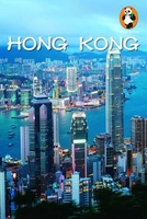
With details concerning major attractions, off-the-beaten-track spots, drinking & nightlife venues, & restaurants & hotels/hostels from all over the city, Panda Guides Hong Kong is the most complete guide of its kind. Written by a team of expats who live in & know China`s roaring capital, our Hong Kong title is the first HK city guidebook to offer an opportunity to win a free trip through China by purchasing the book. Apart from all the money readers can save by following the Panda, this edition of Hong Kong also comes with a pullout map of the city, while individual maps can be found inside for key tourist attractions, & mini-maps are provided for every local business (hotels, hostels, bars, & restaurants) that show all major cross streets & the nearest subway station (s). What`s more, we`ve made the travel experience even easier by placing each attraction`s vital info (i.e. transportation details, opening hours, admission, phone number, website, etc.) in clearly marked orange boxes at the beginning of every listing. This volume is also packed with sample itineraries, a Cantonese phrasebook, a user-friendly index, sections on culture, history, art, music, & movies, full-color pictures (to give you an engrossing feel of a destination before the reader even goes) & much more! Plus, the Hot Topics section will reveal what life on the ground is like with coverage of fascinating themes such as Air Pollution, Food & Water Safety, Traveling with Kids, Scams, Travel, Culture Shock, Taboo & Etiquette & others. For all this & more, Panda Guides Hong Kong isn`t just a guide, it`s an experience. For more on our books & maps, & to get updated information concerning travel news & special events throughout China, check out www. Panda Guides.com. ...
Archived Product
£4.99
Hong Kong & Macau in the Luxe city guides series, which are slim & small enough to fit easily in a pocket or handbag. Information is distilled from elite suggestions by city residents, specially selected for their style, knowledge & expertise. Luxe guides aim at the upper end of the market & subjectively edit to choose the very best recommendations for shopping, restaurants, leisure options & nightlife. Half day shopping & activity itineraries are suggested for you to mix & match your visit to suit your timetable. When folded close the cardboard guide slots into its own protective plastic frame. Vanity Fair magazine calls them ...
Archived Product

Hong Kong
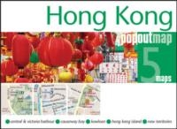
Hong Kong at 1:17, 500 is an indexed tourist map with additional street plans of Hong Kong city centre and Macau, and regional maps of the Hong Kong area, Lantau Island, Cheung Chau Island and Lamma Island. Motorways, national, main, minor roads and tracks are shown, as are ferry routes, rail, tram and metro lines, bus termini and the international airport. Where applicable maps show hotels, green spaces, shopping centres and other places of interest to the visitor such as museums and popular beaches. Parking facilities, municipal buildings, hospitals, temples and places of worship are additionally highlighted.The publisher
RIP - This product is no longer available on our network. It was last seen on 25.09.2019
This page now acts as a permanent archive for this product. Add more information using the comments box below to ensure it can still be found by future generations.
Use our search facility to see if it is available from an alternative contributor.
This page now acts as a permanent archive for this product. Add more information using the comments box below to ensure it can still be found by future generations.
Use our search facility to see if it is available from an alternative contributor.
- External links may include paid for promotion
- Availability: Out Of Stock
- Supplier: Stanfords
- SKU: 9781847736116
Availability: In Stock
£4.99
Product Description
Hong Kong at 1:17, 500 is an indexed tourist map with additional street plans of Hong Kong city centre & Macau, & regional maps of the Hong Kong area, Lantau Isl&, Cheung Chau Island & Lamma Isl&. Motorways, national, main, minor roads & tracks are shown, as are ferry routes, rail, tram & metro lines, bus termini & the international airport. Where applicable maps show hotels, green spaces, shopping centres & other places of interest to the visitor such as museums & popular beaches. Parking facilities, municipal buildings, hospitals, temples & places of worship are in addition highlighted. The publisher
Reviews/Comments
Add New
Intelligent Comparison
Price History
Vouchers
No voucher codes found.
Do you know a voucher code for this product or supplier? Add it to Insights for others to use.
Facebook
Do you know a voucher code for this product or supplier? Add it to Insights for others to use.
Jargon Buster
Tram - A large vehicle common in cities for public transport, also known as a cable car.
Popular - Something that is admired and liked by many people.
Regional - An adjective to describe a set geographic area.
Supplier Information
Stanfords
Stanfords was established in 1853 and opened their iconic Covent Garden flagship store in 1901. They have become the top retailer of maps, travel books and accessories in the UK and arguably offer the largest selection of maps and travel books worldwide. Famous names such as Captain Robert Falcon Scott, Ranulph Fiennes and Michael Palin have purchased from Stanfords. They now have a shop in Bristol and both stores together with other venues operate a calendar of events including talks, book signings and exhibitions. As a specialist map retailer, the map selection is comprehensive and includes road maps, street maps and walking maps from worldwide destinations, as well as a selection of world atlases and wall maps. Books include travel guides and travel literature. Stanfords also stock globes, from miniatures made of blue marble to magnificent floor-standing globes. The website features a selection of interesting articles on travel topics.
Page Updated: 2023-11-12 20:15:36
Community Generated Product Tags
Oh No! The productWIKI community hasn't generated any tags for this product yet!


 United Kingdom
 France
 Germany
 Netherlands
 Sweden
 USA
USA
 Italy
Italy
 Spain
Spain


 Denmark