
 United Kingdom
 France
 Germany
 Netherlands
 Sweden
 USA
USA
 Italy
Italy
 Spain
Spain
More From Contributor


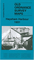
Heysham Harbour 1931
Heysham Harbour in 1931 in a fascinating series of reproductions of old Ordnance Survey plans in the Alan Godfrey Editions, ideal for anyone interested in the history of their neighbourhood or family. Selected towns in Great Britain and Ireland are covered by maps showing the extent of urban development in the last decades of the 19th and early 20th century.In this title: the map covers Heysham Harbour and Higher Heysham, extending from the shore eastward to Middleton Lane, and northward to Crime Well Lane. Features include the Harbour itself, shown in detail with station, sidings, sheds, even mooring posts; Trumacar Park, Heysham Head, Heysham House, Heysham Hall, Heysham Tower, Old Hall, Money Close Lane. A directory of Heysham in 1918 is included on the reverse. About the
Alan Godfrey Editions of the 25
Alan Godfrey Editions of the 25
Product Description
Reviews/Comments
Add New
Intelligent Comparison
Archived Product
Heysham Harbour 1931 Stanfords
£3.50
Archived Product

Seaham Harbour 1895 Stanfords
£3.50
Vouchers
No voucher codes found.
Do you know a voucher code for this product or supplier? Add it to Insights for others to use.
Do you know a voucher code for this product or supplier? Add it to Insights for others to use.
 Denmark