
 United Kingdom
 France
 Germany
 Netherlands
 Sweden
 USA
USA
 Italy
Italy
 Spain
Spain
More From Contributor


Seaham Harbour 1895
Seaham Harbour in 1895 in a fascinating series of reproductions of old Ordnance Survey plans in the Alan Godfrey Editions, ideal for anyone interested in the history of their neighbourhood or family. The map is double-sided. The main map includes St John`s church, part of town centre, Londonderry Railway with Seaham Colliery and Seaham stations, Londonderry Engine Works, Wagon Works, Dene House, part of South Hetton Railway, Rainton & Seaham Railway including Seaham Bank incline, Dawdon Hall, Dawdon Dene, most of New Seaham, Seaham Colliery, Miners Hall, Colliery Inn, Brick Works, etc. Sheet 21.04 on the reverse shows the harbour including North Dock, South Dock and Dry Harbour; Blastfurnace Branch railway, Ballast Branch, Seaham Bottle Works, Chemical Works (disused),
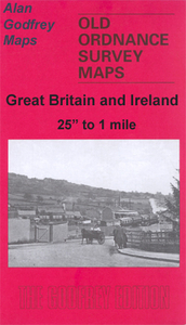
Terrace Green, Bath Terrace (near top of map), Swine Lodge Bank and railways around docks, Bottle Makers Arms, etc.About the Alan Godfrey Editions of the 25” OS Series:Selected towns in Great Britain and Ireland are covered by maps showing the extent of urban development in the last decades of the 19th and early 20th century. The plans have been taken from the Ordnance Survey mapping and reprinted at about 15 inches to one mile (1:4, 340). On the reverse most maps have historical notes and many also include extracts from contemporary directories. Most maps cover about one mile (1.6kms) north/south, one and a half miles (2.4kms) across; adjoining sheets can be combined to provide wider coverage.FOR MORE INFORMATION AND A COMPLETE LIST OF ALL AVAILABLE TITLES PLEASE CLICK ON THE
SERIES LINK.

Product Description
Reviews/Comments
Add New
Intelligent Comparison
Archived Product
Heysham Harbour 1931 Stanfords
£2.95
Archived Product
Heysham Harbour 1931 Stanfords
£3.50
Archived Product
Leith Harbour 1896 Stanfords
£3.50
Vouchers
No voucher codes found.
Do you know a voucher code for this product or supplier? Add it to Insights for others to use.
Do you know a voucher code for this product or supplier? Add it to Insights for others to use.
 Denmark