
 United Kingdom
 France
 Germany
 Netherlands
 Sweden
 USA
USA
 Italy
Italy
 Spain
Spain
More From Contributor


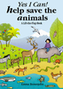

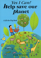
Help Save Our Planet
Yes I Can! Help Save Our Planet by Emma Brownjohn is a book for small children that offers suggestions for making our planet a healthier and better place to live, presented in a fun lift-the-flap format. The book includes information on recycling, solar heating, organic gardening and lots more. The Green Game at the end of the book helps to reinforce this message.

Product Description
Reviews/Comments
Add New
Vouchers
No voucher codes found.
Do you know a voucher code for this product or supplier? Add it to Insights for others to use.
Do you know a voucher code for this product or supplier? Add it to Insights for others to use.
 Denmark