
 United Kingdom
 France
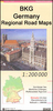
 Germany
 Netherlands
 Sweden
 USA
USA
 Italy
Italy
 Spain
Spain
More From Contributor


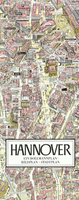
Hanover In 3-D Street Plan
Unusual, very attractive street plan of Hannover from Bollmann, offering a bird’s-eye view of the city with every building drawn to scale with full architectural detail, from street arcades to rooftops and inner courtyards. The plan, drawn in 2010, covers central Hannover from the AWD Arena and Waterlooplatz in the west to the Stadthalle in the east and is annotated with small icons of various businesses which sponsored its production. On the reverse is a conventional street plan of the city with its outer suburbs. Street index, in a separate booklet, covers both plans and includes brief descriptions of the main monuments and places of interest, plus lists of local facilities and various shops and other businesses. All the text is in German only.

Product Description
Reviews/Comments
Add New
Vouchers
No voucher codes found.
Do you know a voucher code for this product or supplier? Add it to Insights for others to use.
Do you know a voucher code for this product or supplier? Add it to Insights for others to use.
 Denmark