More From Contributor
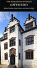
£9.99
Guyana with on the reverse Surinam & French Guiana, all shown at 1:850, 000 & indexed, with street plans of central Georgetown, Paramaribo, Cayenne & Kputpu. Altitude colouring with spot heights in feet indicates the region’s topography, with graphics showing swamps/mangrove areas & rapids on rivers. National parks & other protected areas, as well as Amerindian Reserves & disputed border areas are highlighted. Road network indicates, mainly in Guyana, road names &

Includes::
selected local tracks. Local airfields are marked. The map also shows internal administrative boundaries with names of the provinces/districts. Symbols indicate various places of interest, including locations with tourist accommodation, etc. Latitude & longitude lines are drawn at 1° & each side has a separate index. Street plans show tourist accommodation & places of interest. Another inset shows the Illes du Salut (Salvation Islands) at 1:35, 000, including the infamous Devil’s Isl&.

...
Archived Product
£12.95
Banish the baked beans, bin the bangers
- & fill up on delicious, freshly made meals on your camping trip. Guyrope Gourmet:
...
Archived Product
£9.99
Slick, upbeat & funny, these stories inspired the popular musical & film Guys & Dolls. ` Of all the high players this country ever sees, there is no doubt but that the guy they call the Sky is the highest. He will bet all he has, & nobody can bet any more than this`. ...
Archived Product
£30.00
This unique cushion from the National Railway Museum features a reproduction of the travel artwork produced for Great Western Railway to promote rail travel to Cornwall. This cushion is made with a super soft faux & machine washable suede & comes complete with the cushion pad. The print had been created using archival inks to get the brightest, saturated finish possible, which will bring life & style to any room setting. Fully machine washable at 30c ...
Archived Product
£30.00
This unique cushion from the National Railway Museum features a reproduction of the travel artwork produced for Great Western Railway to promote rail travel to Wales. The poster shows a view of Cader Idris & Afon Mawddach. This cushion is made with a super soft faux & machine washable suede & comes complete with the cushion pad. The print had been created using archival inks to get the brightest, saturated finish possible, which will bring life & style to any room setting. Fully machine washable at 30c ...
Archived Product
£35.00
Gwynedd Pevsner Architectural Guide, in a series of publications begun with the express aim of providing up-to-date guides to the most significant buildings in every part of the country, suitable for both general reader & specialist. Each volume provides an introductory overview of the architecture of the area, followed by a descriptive gazetteer arranged alphabetically by place. Whilst cathedrals & their furnishings, great country houses & their parks form the grand set pieces, the books demonstrate the enjoyable diversity of architecture in the British Isles in accounts of rural churches & farmsteads, Victorian public buildings & industrial monuments. A continuing programme of publication keeps the series up-to-date with new information on older buildings & recent architecture while maintaining the tradition of Pevsner`s own succinct accounts. Each book has over 100 photographs, mostly specially commissioned, numerous maps & plans, a glossary & indexes. ...
Archived Product
£11.50
Topographic survey of France at 1:25, 000 in IGN`s excellent TOP25 / Série Bleue series. All the maps are GPS compatible, with a 1km UTM grid plus latitude & longitude lines at 5’ intervals. Contours are at 5m intervals except for mountainous areas where the maps have contours at 10m intervals, vividly enhanced by hill shading & graphics for rocky terrain. Colouring with graphics indicates different types of vegetation or land use (deciduous or coniferous forests, moors, orchards, vineyards, etc). PLEASE NOTE: coverage of France at this scale is currently being revised – the format & the presentation of each title are indicated by the letters at the end of its Sheet Reference number (e.g. 0416ET, 3531ETR, 1923SB, etc.)MAPS WITH FULL TOURIST OVERPRINT & AN ENGLISH MAP LEGEND: all TOP25 maps & the SB editions of Série Bleue have an overprint highlighting waymarked walking trails including long-distance GR routes &, where appropriate, ski routes. Symbols indicate campsites, gîtes d’etape, refuges, equestrian centres & other recreational facilities or sites, tourist information centres, cultural heritage, etc. Towns & locations of particular interest are highlighted.- ET or OT = single-sided TOP25 map covering approx. 29x 21 km / 18x 13 miles.- ETR or OTR = waterproof & tear resistant TOP25 map covering the same area as the corresponding ET or OT number, but double-sided, printed on a smaller size sheet with a good overlap between the sides.- SB = Série Bleue map with full tourist overprint; these maps, first introduced in summer 2014, each cover approx. 29x 24km / 18x 15 miles.SÉRIE BLEUE maps with numbers ending in E (Est) or O (Ouest): most editions now indicate the GR routes, but do not show any other tourist information. Map legend is in French only. Each map covers approx. 14x 20km / 9x 12 miles. ...
Archived Product
£4.99
Gyor in a series of street plans of Hungary’s main towns from Cartographia in Budapest. The plans cover the whole town with its outer suburbs &, where appropriate, have an enlargement for the central area. All the plans have a street index. Map legend varies; in plans of larger towns or popular tourist destinations it usually

Includes::
English. Many plans also include additional

Features:
insets with plans of larger satellite developments or villages, lists of sights and/or various municipal offices & facilities, etc. Some titles include on the reverse a road map of the town’s environs or the administrative province.* In this title:* English map legend for the plan, an enlargement for the city centre at 1:8, 500, a list of over 200 places of interest, services & facilities, plus a road map of the Gyor -Moson
- Sopron province at 1:250, 000 including the adjoining areas of Slovakia & Austria with the whole of the Neusiedler See (map legend in Hungarian only).


...
Archived Product
£6.99
Gypsies have been a part of the British & European social fabric for centuries
- & have faced prejudice & oppression for nearly
...
Archived Product
£6.99
Mikey was born into a Romany Gypsy family. They live in a closeted community, & little is known about their way of life. After centuries of persecution Gypsies are wary of outsiders & if you choose to leave you can never come back. This is something Mikey knows only too well. Growing up, he rarely went to school, & seldom mixed with non-Gypsies. The caravan & camp were his world. But although Mikey inherited a vibrant & loyal culture his family`s legacy was bittersweet with a hidden history of grief & abuse. Eventually Mikey was forced to make an agonising decision
- to stay & keep secrets, or escape & find somewhere he could truly belong. Read the second part of Mikey`s amazing story in Gypsy Boy on the Run
...
Archived Product

Gwynedd

Part of the Ancient and Historic Wales series, this guidebook takes the reader on a tour of the history of Gwynedd. The 150 sites covered range from the monumental tombs of the first farmers to the circles and cairns of the Bronze Age, from the forts of the Roman army to the strongholds of the English King Edward 1, and from early Christian graves to Cistercian monasteries. It provides knowledge of the moors and mountains, the ruins of the tombs and castles of the great, and the evocative remains of more mundane homes and workplaces. One of the best methods of conservation is to awaken in people an awareness of the value of the ancient sites which enrich our landscape. This series of four regional guides to Wales aims to do so, by providing the reader with a tangible link with the
past.
RIP - This product is no longer available on our network. It was last seen on 25.09.2019

This page now acts as a permanent archive for this product. Add more information using the comments box below to ensure it can still be found by future generations.

Use our search facility to see if it is available from an alternative contributor.
  • External links may include paid for promotion
  • Availability: Out Of Stock
  • Supplier: Stanfords
  • SKU: 9780117015746
Availability: In Stock
£11.95

Product Description

Part of the Ancient & Historic Wales series, this guidebook takes the reader on a tour of the history of Gwynedd. The 150 sites covered range from the monumental tombs of the first farmers to the circles & cairns of the Bronze Age, from the forts of the Roman army to the strongholds of the English King Edward 1, & from early Christian graves to Cistercian monasteries. It provides knowledge of the moors & mountains, the ruins of the tombs & castles of the great, & the evocative remains of more mundane homes & workplaces. One of the best methods of conservation is to awaken in people an awareness of the value of the ancient sites which enrich our landscape. This series of four regional guides to Wales aims to do so, by providing the reader with a tangible link with the past.

Reviews/Comments

Add New

Intelligent Comparison

Oooops!
We couldn't find anything!
Perhaps this product's unique.... Or perhaps we are still looking for comparisons!
Click to bump this page and we'll hurry up.

Price History

Vouchers

No voucher codes found.
Do you know a voucher code for this product or supplier? Add it to Insights for others to use.

Facebook

Jargon Buster

History - Anything that happens in the past. An acedemic subject.
King - The figure head of a monarch
Regional - An adjective to describe a set geographic area.

Supplier Information

Stanfords
Stanfords was established in 1853 and opened their iconic Covent Garden flagship store in 1901. They have become the top retailer of maps, travel books and accessories in the UK and arguably offer the largest selection of maps and travel books worldwide. Famous names such as Captain Robert Falcon Scott, Ranulph Fiennes and Michael Palin have purchased from Stanfords. They now have a shop in Bristol and both stores together with other venues operate a calendar of events including talks, book signings and exhibitions. As a specialist map retailer, the map selection is comprehensive and includes road maps, street maps and walking maps from worldwide destinations, as well as a selection of world atlases and wall maps. Books include travel guides and travel literature. Stanfords also stock globes, from miniatures made of blue marble to magnificent floor-standing globes. The website features a selection of interesting articles on travel topics.
Page Updated: 2023-11-12 20:15:36

Community Generated Product Tags

Oh No! The productWIKI community hasn't generated any tags for this product yet!
Menu