
 United Kingdom
 France
 Germany
 Netherlands
 Sweden
 USA
USA
 Italy
Italy
 Spain
Spain
More From Contributor


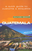


Guatemala
History, culture, natural beauty, majestic ruins and gorgeous colonial streetscapes: Guatemala has everything a traveler could hope for. Lucas Vidgen, Lonely Planet Writer
Getting you to the heart of a place
Getting you to the heart of a place
- Amazing experiences Inspirational

Product Description
- Amazing experiences Inspirational images, 3D illustrations, city walks & the best of local knowledge. Plan the perfect trip Planning features & top itineraries give you the freedom to create your ideal trip. Get off the beaten track Our authors uncover local secrets that will make your trip unique. Special Features Advice for first-time travelers Maya ruins planning guide Tikal in full, illustrated detail Antigua city walk We tell it like it is
Our job is to make amazing travel experiences happen. We visit the places we write about each & every edition. We never take freebies for positive coverage, so you can always rely on us to tell it like it is.
Reviews/Comments
Add New
Vouchers
No voucher codes found.
Do you know a voucher code for this product or supplier? Add it to Insights for others to use.
Do you know a voucher code for this product or supplier? Add it to Insights for others to use.
 Denmark