
 United Kingdom
 France
 Germany
 Netherlands
 Sweden
 USA
USA
 Italy
Italy
 Spain
Spain
More From Contributor


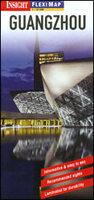
Guangzhou Flexi Map
Guangzhou on a laminated, tear-resistant Insight Flexi Map with an indexed street plan, road maps of the Guangzhou area, Pearl River Delta and southern China, a diagram of the city’s metro network, plus extensive tourist information. The plan covers the city’s central districts, extending from the southern banks of the Pearl River to the main railway station. Metro lines with stations are clearly marked. Main public buildings, places of interest and selected hotels are prominently highlighted and named. The plan is indexed for streets, districts, parks, hotels, shopping centres, public buildings and points of interest. Also provided is a diagram of the city’s metro network.On the reverse are indexed road maps of the Guangzhou area (1:100, 000), the Pearl River Delta
(1:600, 000) showing road and rail access to Hong Kong and Macau, plus southern China (1:8, 000, 000). On the street plan names of streets, districts, places of interest, etc. are given both in Latin alphabet and in Chinese characters; on road maps all names are shown only transliterated.A special feature of the Insight Flexi series are panels with additional tourist information:- 17 main sights, neatly grouped into sections covering Major Urban Sights, Temples and Pagodas, Shopping and Markets, plus Further Afield, are given brief descriptions and are prominently highlighted on the relevant maps.- Further panels provide information on Getting Around and Facts for Visitors, including tourist information offices, public holidays, opening times, money, tipping,
telecommunications and monthly climate charts.To see the list of other titles in this series please click on the series link.

Product Description
Reviews/Comments
Add New
Vouchers
No voucher codes found.
Do you know a voucher code for this product or supplier? Add it to Insights for others to use.
Do you know a voucher code for this product or supplier? Add it to Insights for others to use.
 Denmark