More From Contributor
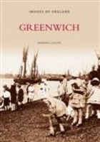
£11.19
Laminated waterproof edition of a detailed topographic map of Greenock, Largs & Millport from the Ordnance Survey Explorer series, covering Clyde Muirshiel Regional Park. Edition A1; Publication date November 2006 About this series: These highly detailed maps show all the administrative boundaries, settlements as small as isolated farms, the road network down to unfenced roads & country tracks, & field boundaries (hedges & drystone walls) which make navigation across the countryside much easier. Steep gradients on roads are indicated. Various landmarks, e.g. powerlines, archaeological sites, windmills, churches & lighthouses are shown & additional graphics indicate natural terrain features such as cliffs, scree, mud & vegetation variations. The contour interval is 5 metres in the lower parts of the country & 10 metres in the uplands, & spot heights are marked. Each map covers an area of 30 x 20km (i.e. approx. 19 x 12 miles), with some double-sided maps covering more, as indicated in the individual descriptions. The maps are fully GPS compatible, with the National Grid shown at 1km intervals & latitude & longitude indicated by margin ticks at 1'. The Explorer series has replaced the earlier, green-cover Pathfinder maps. The Explorer series is now complete & covers all of Engl&, Wales & Scotl&. Some sheets for popular areas like the National Parks are still branded as Outdoor Leisure (OL) maps, but are now included in this series as the cartography is the same as that in the Explorer Maps. The Explorer maps offer a substantial improvement on the Pathfinder series, with greater use of colour, larger area per map, & stronger emphasis on information for ramblers & tourists. This series is ideal for walking & other outdoor pursuits & each map shows a large amount of information for ramblers & tourists. Public rights of way are shown (except in Scotland), together with other routes with public access: National Trails & Recreational Paths, permitted paths & bridleways, & selected cycle routes. Open access land created under the Countryside & Rights of Way Act 2000 is marked. Tourist information

Includes::
caravan & camp sites, Park & Ride locations, recreation/leisure/sport centres, museums, historic buildings, English Heritage & National Trust sites, rural pubs, etc. The map legend is in English only, except for the tourist information content which is also in French & German.

...
Archived Product
£9.99
In over 40 years as a senior captain for Greenpeace International, Peter Willcox has been in the vanguard of the international environmentalist movement. He has led crews into battle for the good of the planet against whale killers, nuclear testing sites & deep sea drillers. The recipient of a Lifetime Achievement Award from The Guardian, Peter has confronted naval warships, including diving in front of a moving destroyer; faced a bombing attack of the iconic ` Rainbow Warrior`, resulting in the murder of a shipmate; & endured imprisonment for peacefully protesting Russian oil drilling in Antarctica along with his crew. This is his story. ...
Archived Product
£12.99
” The Greens Cookbook” is a rarity; it is a book that created a revolution in cooking when it first appeared in 1987. It has now become a classic & has been unavailable in the UK for many years. Here are the recipes that helped to create the boldly original & highly successful Greens Restaurant on San Francisco Bay. Not only for vegetarians; it caters to everyone who seeks delight in cooking & eating. Using an extraordinary range of fresh ingredients in imaginative & delicious ways, ” The Greens Cookbook” contains more than 260 recipes for all seasons, all occasions, & all tastes. From bright, simple salads to deliciously succulent frittatas, here is a provocative, sophisticated & varied fare, dedicated to elegance & balance, taste & texture, color & freshness with recipes such as Mexican Vegetable Soup with Lime & Avocado, Artichoke & Fennel Stew, Wild Mushroom Ragout, Charcoal-Grilled Leeks, Red & Yellow Pepper Tart, Goat-Cheese Pizza with Red Onions & Green Olives, Blueberry Cream-Cheese Tart & Brazilian Chocolate Cake.” The Greens Cookbook” presents inspiring menus for spring, summer, autumn, winter; Everything from easy-to-prepare dishes for two to meals for large scale entertaining. It has the first ever guide to selecting wines with vegetable dishes, glossaries of unfamiliar ingredients & useful kitchen equipment. ...
Archived Product
£7.99
The Triad: Greensboro
- Winston-Salem
- High Point area of North Carolina on an indexed street plan from Rand Mc Nally in their

...
Archived Product
£6.99
Greenvoe, the tight-knit community on the Orcadian island of Hellya, has existed unchanged for generations. However, a sinister military/industrial project, Operation Black Star, requires the island for unspecified purposes & threatens the islanders` way of life. In this, his first novel (1972), George Mac Kay Brown recreates a week in the life of the island community as they come to terms with the destructiveness of Operation Black Star. A whole host of characters
- The Skarf, failed fishermen & Marxist historian; Ivan Westray, boatman & dallier; pious creeler Samuel Whaness; drunken fishermen Bert Kerston; earth-mother Alice Voar, & meths-drinker Timmy Folster
- are vividly brought to life in this sparkling mixture of prose & poetry. In the end Operation Black Star fails, but not before it has ruined the isl&. But the book ends on a note of hope as the islanders return to celebrate the ritual rebirth of Hellya.

...
Archived Product
£6.39
A detailed topographic map of Greenwich & Gravesend from the Ordnance Survey Explorer series, covering East End, Docklands, Bromley, Sidcup & Thurrock (showing part of the Thames Path). Edition A3; Publication date January 2009 About this series: These highly detailed maps show all the administrative boundaries, settlements as small as isolated farms, the road network down to unfenced roads & country tracks, & field boundaries (hedges & drystone walls) which make navigation across the countryside much easier. Steep gradients on roads are indicated. Various landmarks, e.g. powerlines, archaeological sites, windmills, churches & lighthouses are shown & additional graphics indicate natural terrain features such as cliffs, scree, mud & vegetation variations. The contour interval is 5 metres in the lower parts of the country & 10 metres in the uplands, & spot heights are marked. Each map covers an area of 30 x 20km (i.e. approx. 19 x 12 miles), with some double-sided maps covering more, as indicated in the individual descriptions. The maps are fully GPS compatible, with the National Grid shown at 1km intervals & latitude & longitude indicated by margin ticks at 1'. The Explorer series has replaced the earlier, green-cover Pathfinder maps. The Explorer series is now complete & covers all of Engl&, Wales & Scotl&. Some sheets for popular areas like the National Parks are still branded as Outdoor Leisure (OL) maps, but are now included in this series as the cartography is the same as that in the Explorer Maps. The Explorer maps offer a substantial improvement on the Pathfinder series, with greater use of colour, larger area per map, & stronger emphasis on information for ramblers & tourists. This series is ideal for walking & other outdoor pursuits & each map shows a large amount of information for ramblers & tourists. Public rights of way are shown (except in Scotland), together with other routes with public access: National Trails & Recreational Paths, permitted paths & bridleways, & selected cycle routes. Open access land created under the Countryside & Rights of Way Act 2000 is marked. Tourist information

Includes::
caravan & camp sites, Park & Ride locations, recreation/leisure/sport centres, museums, historic buildings, English Heritage & National Trust sites, rural pubs, etc. The map legend is in English only, except for the tourist information content which is also in French & German.

...
Archived Product
£7.99
A detailed topographic map of Greenwich & Gravesend from the Ordnance Survey Explorer series, covering East End, Docklands, Bromley, Sidcup & Thurrock (showing part of the Thames Path). Edition A4; Publication date June 2012 About this series: These highly detailed maps show all the administrative boundaries, settlements as small as isolated farms, the road network down to unfenced roads & country tracks, & field boundaries (hedges & drystone walls) which make navigation across the countryside much easier. Steep gradients on roads are indicated. Various landmarks, e.g. powerlines, archaeological sites, windmills, churches & lighthouses are shown & additional graphics indicate natural terrain features such as cliffs, scree, mud & vegetation variations. The contour interval is 5 metres in the lower parts of the country & 10 metres in the uplands, & spot heights are marked. Each map covers an area of 30 x 20km (i.e. approx. 19 x 12 miles), with some double-sided maps covering more, as indicated in the individual descriptions. The maps are fully GPS compatible, with the National Grid shown at 1km intervals & latitude & longitude indicated by margin ticks at 1'. The Explorer series has replaced the earlier, green-cover Pathfinder maps. The Explorer series is now complete & covers all of Engl&, Wales & Scotl&. Some sheets for popular areas like the National Parks are still branded as Outdoor Leisure (OL) maps, but are now included in this series as the cartography is the same as that in the Explorer Maps. The Explorer maps offer a substantial improvement on the Pathfinder series, with greater use of colour, larger area per map, & stronger emphasis on information for ramblers & tourists. This series is ideal for walking & other outdoor pursuits & each map shows a large amount of information for ramblers & tourists. Public rights of way are shown (except in Scotland), together with other routes with public access: National Trails & Recreational Paths, permitted paths & bridleways, & selected cycle routes. Open access land created under the Countryside & Rights of Way Act 2000 is marked. Tourist information

Includes::
caravan & camp sites, Park & Ride locations, recreation/leisure/sport centres, museums, historic buildings, English Heritage & National Trust sites, rural pubs, etc. The map legend is in English only, except for the tourist information content which is also in French & German.

...
Archived Product
£11.19
Laminated waterproof edition of a detailed topographic map of Greenwich & Gravesend from the Ordnance Survey Explorer series, covering East End, Docklands, Bromley, Sidcup & Thurrock (showing part of the Thames Path). Edition A3; Publication date January 2009 About this series: These highly detailed maps show all the administrative boundaries, settlements as small as isolated farms, the road network down to unfenced roads & country tracks, & field boundaries (hedges & drystone walls) which make navigation across the countryside much easier. Steep gradients on roads are indicated. Various landmarks, e.g. powerlines, archaeological sites, windmills, churches & lighthouses are shown & additional graphics indicate natural terrain features such as cliffs, scree, mud & vegetation variations. The contour interval is 5 metres in the lower parts of the country & 10 metres in the uplands, & spot heights are marked. Each map covers an area of 30 x 20km (i.e. approx. 19 x 12 miles), with some double-sided maps covering more, as indicated in the individual descriptions. The maps are fully GPS compatible, with the National Grid shown at 1km intervals & latitude & longitude indicated by margin ticks at 1'. The Explorer series has replaced the earlier, green-cover Pathfinder maps. The Explorer series is now complete & covers all of Engl&, Wales & Scotl&. Some sheets for popular areas like the National Parks are still branded as Outdoor Leisure (OL) maps, but are now included in this series as the cartography is the same as that in the Explorer Maps. The Explorer maps offer a substantial improvement on the Pathfinder series, with greater use of colour, larger area per map, & stronger emphasis on information for ramblers & tourists. This series is ideal for walking & other outdoor pursuits & each map shows a large amount of information for ramblers & tourists. Public rights of way are shown (except in Scotland), together with other routes with public access: National Trails & Recreational Paths, permitted paths & bridleways, & selected cycle routes. Open access land created under the Countryside & Rights of Way Act 2000 is marked. Tourist information

Includes::
caravan & camp sites, Park & Ride locations, recreation/leisure/sport centres, museums, historic buildings, English Heritage & National Trust sites, rural pubs, etc. The map legend is in English only, except for the tourist information content which is also in French & German.

...
Archived Product
£13.99
Laminated waterproof edition of a detailed topographic map of Greenwich & Gravesend from the Ordnance Survey Explorer series, covering East End, Docklands, Bromley, Sidcup & Thurrock (showing part of the Thames Path). Edition A4; Publication date June 2012 About this series: These highly detailed maps show all the administrative boundaries, settlements as small as isolated farms, the road network down to unfenced roads & country tracks, & field boundaries (hedges & drystone walls) which make navigation across the countryside much easier. Steep gradients on roads are indicated. Various landmarks, e.g. powerlines, archaeological sites, windmills, churches & lighthouses are shown & additional graphics indicate natural terrain features such as cliffs, scree, mud & vegetation variations. The contour interval is 5 metres in the lower parts of the country & 10 metres in the uplands, & spot heights are marked. Each map covers an area of 30 x 20km (i.e. approx. 19 x 12 miles), with some double-sided maps covering more, as indicated in the individual descriptions. The maps are fully GPS compatible, with the National Grid shown at 1km intervals & latitude & longitude indicated by margin ticks at 1'. The Explorer series has replaced the earlier, green-cover Pathfinder maps. The Explorer series is now complete & covers all of Engl&, Wales & Scotl&. Some sheets for popular areas like the National Parks are still branded as Outdoor Leisure (OL) maps, but are now included in this series as the cartography is the same as that in the Explorer Maps. The Explorer maps offer a substantial improvement on the Pathfinder series, with greater use of colour, larger area per map, & stronger emphasis on information for ramblers & tourists. This series is ideal for walking & other outdoor pursuits & each map shows a large amount of information for ramblers & tourists. Public rights of way are shown (except in Scotland), together with other routes with public access: National Trails & Recreational Paths, permitted paths & bridleways, & selected cycle routes. Open access land created under the Countryside & Rights of Way Act 2000 is marked. Tourist information

Includes::
caravan & camp sites, Park & Ride locations, recreation/leisure/sport centres, museums, historic buildings, English Heritage & National Trust sites, rural pubs, etc. The map legend is in English only, except for the tourist information content which is also in French & German.

...
Archived Product
£12.99
Greenwich has always been well known for its position on the Meridian Line. As David Ramzan illustrates in this new book, the area also has a rich history with its commercial & industrial businesses in the town or on the river, & its naval & military connections. Illustrated with over 200 images, the book brings to life bygone days when Greenwich was a major tourist attraction where visitors could take a steamer trip along the river, spend a day in the park to watch the deer or visit the theatre or a famous riverside tavern. At the turn of the twentieth century, it was also a fashionable area in which to live with many Regency style & Edwardian buildings. Although today much of Greenwich`s heritage has been lost, this book will show what a wonderful place Greenwich was & still is today. ...
Archived Product

Greenwich

Greenwich and Woolwich have long been associated with the great national monuments. Since the seventeenth century Greenwich has been associated with `time`. The time-ball at the Old Royal Observatory still falls daily at one o`clock, just as it has done since 1833. But `time` also means change. This fascinating collection of over 250 photographs shows that many changes which the area underwent between 1858 and the 1970s. It is not a definitive history of the London Borough of Greenwich, its monuments and its institiutions, but a vividy authentic `taste` of the life and times of the people of a region which was, until 1889, still part of Kent. Farms, rural villiages, market gardens, open countryside, brickfields, heavy industry, bustiling High Streets, the sounds of ships`
sirens, from the River Thames and of guns being tested at Woolwich Arsenal were all part of everyday social and industrial life for the ordinary people that the images in this selection represent.Throughout periods of immense change - the amalgamation of separate communities into the metropolis, the 1920s and `30s, the heavy bombing of the Second World War, re-development - and the rigours of modern city life, the people of the Borough are shown at work and at play. This extraordinary portrayal of a time gone by recreaes, revelas and perhaps reminds a few of a time that has now disappeared forever.
RIP - This product is no longer available on our network. It was last seen on 25.09.2019

This page now acts as a permanent archive for this product. Add more information using the comments box below to ensure it can still be found by future generations.

Use our search facility to see if it is available from an alternative contributor.
  • External links may include paid for promotion
  • Availability: Out Of Stock
  • Supplier: Stanfords
  • SKU: 9780752400457
Availability: In Stock
£12.99

Product Description

Greenwich & Woolwich have long been associated with the great national monuments. Since the seventeenth century Greenwich has been associated with `time`. The time-ball at the Old Royal Observatory still falls daily at one o`clock, just as it has done since 1833. But `time` also means change. This fascinating collection of over 250 photographs shows that many changes which the area underwent between 1858 & the 1970s. It is not a definitive history of the London Borough of Greenwich, its monuments & its institiutions, but a vividy authentic `taste` of the life & times of the people of a region which was, until 1889, still part of Kent. Farms, rural villiages, market gardens, open countryside, brickfields, heavy industry, bustiling High Streets, the sounds of ships` sirens, from the River Thames & of guns being tested at Woolwich Arsenal were all part of everyday social & industrial life for the ordinary people that the images in this selection represent. Throughout periods of immense change
- the amalgamation of separate communities into the metropolis, the 1920s & `30s, the heavy bombing of the Second World War, re-development
- & the rigours of modern city life, the people of the Borough are shown at work & at play. This extraordinary portrayal of a time gone by recreaes, revelas & perhaps reminds a few of a time that has now disappeared forever.

Reviews/Comments

Add New

Intelligent Comparison

Oooops!
We couldn't find anything!
Perhaps this product's unique.... Or perhaps we are still looking for comparisons!
Click to bump this page and we'll hurry up.

Price History

Vouchers

No voucher codes found.
Do you know a voucher code for this product or supplier? Add it to Insights for others to use.

Facebook

Jargon Buster

Clock - A device used for telling the time
Arsenal - A football team from London
Sounds - Audible notes that can be heard using ears
History - Anything that happens in the past. An acedemic subject.
World - A physical grouping, commonly used to describe earth and everything associated with ti
heavy - A concept of weight indicating an item may require some effort to lift or move
Greenwich - A southern borough in London.

Supplier Information

Stanfords
Stanfords was established in 1853 and opened their iconic Covent Garden flagship store in 1901. They have become the top retailer of maps, travel books and accessories in the UK and arguably offer the largest selection of maps and travel books worldwide. Famous names such as Captain Robert Falcon Scott, Ranulph Fiennes and Michael Palin have purchased from Stanfords. They now have a shop in Bristol and both stores together with other venues operate a calendar of events including talks, book signings and exhibitions. As a specialist map retailer, the map selection is comprehensive and includes road maps, street maps and walking maps from worldwide destinations, as well as a selection of world atlases and wall maps. Books include travel guides and travel literature. Stanfords also stock globes, from miniatures made of blue marble to magnificent floor-standing globes. The website features a selection of interesting articles on travel topics.
Page Updated: 2023-11-12 20:15:36

Community Generated Product Tags

Oh No! The productWIKI community hasn't generated any tags for this product yet!
Menu