
 United Kingdom
 France
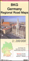
 Germany
 Netherlands
 Sweden
 USA
USA
 Italy
Italy
 Spain
Spain
More From Contributor


Greece Regional Map Set
Greece on a set of four double-sided regional maps at 1:425, 000 from the Athens based Road Editions, presented in a plastic folder with a separate index booklet. Also included are street plans of Athens and Thessaloniki. All place names are given in both Greek and Latin script.Cartography is similar to the publisher
Product Description
Reviews/Comments
Add New
Intelligent Comparison
Archived Product
Bremen Regional Map Stanfords
£10.99
Archived Product
Dresden Regional Map Stanfords
£10.99
Vouchers
No voucher codes found.
Do you know a voucher code for this product or supplier? Add it to Insights for others to use.
Do you know a voucher code for this product or supplier? Add it to Insights for others to use.
 Denmark