More From Contributor

£17.99
Great Britain in the Eyewitness guide series from Dorling Kindersley; lavishly illustrated & particularly concerned with providing the visitor with detailed background information to sightseeing in the chosen destination & a broad cultural introduction. Popular historical buildings & museums are often described with cutaway diagrams allowing you to view ...
Archived Product
£17.99
DUE OUT MARCH 2014
- Great Britain in the Eyewitness guide series from Dorling Kindersley; lavishly illustrated & particularly
...
Archived Product
£12.99
Great Britain in the Berlitz Handbook series; comprising a range of guides providing comprehensive information on a range of international countries. Each guide is arranged by region, with individual sections on notable cities & towns in the area, in addition to ...
Archived Product
£32.50
A new updated edition of this long running publication written, known as the  waterways bible`. Details every navigable waterway in Britain, each entry

Includes::
a brief description, a simple maps, distance tables & information on the maximum vessel

Dimensions.

Includes::
a separate fold-out map of showing the whole network.


...
Archived Product
£7.99
Inland Waterways map of Great Britain from Collins, published under their prestigious Nicholson imprint with over 40-years long tradition of waterway maps & guides. Numerous panels provide details of contact addresses of various organizations. The main map is at 1:550, 000 & extends north to Middlesbrough. Two insets at the same scale show the waterways of Scotland: the central lowlands including River Tay & the Crinan Canal, plus the route from Fort William to Inverness via Loch Lochy, the Caledonian Canal & Loch Ness. Three more insets provide more detailed enlargements of London, the Birmingham conurbation & the Norfolk Broads. Presentation of the waterways has been colour-coded to complement Nicholson ...
Archived Product
£9.99
Great Britain on an indexed, double-sided map from ITMB printed on light, waterproof & tear-resistant synthetic paper. The map divides the country north/south across the southern part of the Lake District, with a small overlap between the sides. Coverage inludes most of Northern Irel&. Topography is shown by altitude colouring with names of main mountain ranges & highlighting for national parks & selected other protected areas. Road network presents the motorways with junction numbers & services, & shows the numbers of most A roads. Many B roads are included but not numbered. Railway lines & ferry connections are included & administrative boundaries are marked. Symbols indicate various places of interest. Latitude & longitude lines are drawn at 1° intervals. Each side has a separate index. ...
Archived Product
£14.99
Great Britain in the Green Guide series from Michelin; detailed guides exploring the major sights & attractions of a range of cities, regions & countries. Drawing on a long publishing history, Michelin guides are renowned for their individual ‘star rating’, ranking restaurants, sights & attractions. Listings in each guide are organised alphabetically, allowing readers to access information quickly as well as being designed for practical use on the road. With an emphasis on cultural activities & history, each sight is graded & has extensive background information. Practical visitor information is clearly highlighted with symbols. Predominantly recognised for their extensive coverage of French regions (shown on our website in a separate series), the Green Guides also cover international destinations. An extensive introductory section on planning your trip provides information on when & where to go, useful pre-trip information, getting there, where to stay & eat & what to do & see. There are also individual sections on Nature, History & Art ad Culture & a selection of driving tours of the area. Fold-out maps at the front & back of the book give an overview of the area covered by the guide. The structure of each guide varies depending on the type of destination. National & regional guides cover regions alphabetically, each with their own accommodation, sights & food & drink listings, while City guides cover sights alphabetically with one city-wide section for listings. Accommodation & food & drink listings are both concise & comprehensive, aiming to cater for all budgets & tastes. Both sights & listings often include information specific to travelling with kids. Each of the places covered in the guide is listed alphabetically & three Michelin star ratings
- highly recommended, recommended & interesting, which have been used for more than 100 years
- help readers identify places of interest, restaurants & notable local attractions. Individual listings include principal sights for each city or town, local walking & driving tours in addition to tips on local excursions. There is also an ‘address book’ information box in each section including recommendations for the best restaurants & accommodation in the area, as well as any relevant leisure activities. A series of overview regional & city plans also helps navigation & orientation for each region.

...
Archived Product
£15.99
Newly updated Green Guide Great Britain invites exploration of an island composed of three distinct national cultures & diverse landscapes. A country long rooted in tradition & history, yet with an evolving 21st century identity. Tour an English garden, take a ramble through the Lake District, or enjoy a delicious pub lunch. Rely on Michelin`s driving & walking tours, renowned star-rating system for attractions & activities, respected maps, & recommendations for hotels & restaurants to create a memorable visit. ...
Archived Product
£5.50
Great Britain Motorways' Route Planner Map is a fold out map of Great Britain with national grid referencing, showing the motorway network across Engl&, Scotland & Wales at a scale of 1:730, 000, with an enlarged scale map of the M25-London region at a scale of 1:79, 200 on the reverse. The map is indexed in an attached booklet & features inset maps which show the motorway networks & urban area road maps surrounding Leeds, Birmingham, Manchester/ Liverpool & Glasgow is greater detail. Motorway junctions are very clearly marked, including unnumbered junctions & junctions with limited interchange access. Motorway service areas are shown on the map & illustrated with single or both carriage access symbols, & a quick reference list of motorway services & junction locations is provided. Motorway tolls points are shown. Primary route roads & route destinations are boldly marked, with adjoining A roads & sections of dual carriageway detailed, as well as B roads, selected minor roads. Railway lines, airports with scheduled services & vehicle ferry routes are illustrated, as are national, county & unitary authority boundaries. Detailed urban area inset maps also indicate places of interest such as parks/woodlands, houses/buildings to visit, picnic areas & wildlife centres. The M25-London region map is separately indexed & very clearly presented, containing all information to be found on the country wide map, plus localised detailed additions such marking out road networks under the jurisdiction of Transport for London, shading out the congestion charge zone area, & marking out rail, underground, DLR & tramline links into the city. Golf courses have been especially illustrated in the area. The M25-London map extends as far as Gravesend in the east, Reigate in the south, the Herefordshire border in the North & Windsor in the west. ...
Archived Product
£25.00
Great Britain Mountain Biking is a comprehensive area-by-area guide to the best places to ride mountain bikes in Engl&, Scotland & Wales. Authors Tom Fenton & Andy Mc Candlish have compiled everything you need to know about Britain`s top riding spots in this ideal companion for planning weekends away mountain biking in Great Britain. Ride hidden singletrack, cross remote passes, reach mountain summits & plan trips to those parts of the country where you`ve always wanted to ride. The book is split into four sections
- Southern Engl&, Northern Engl&, Wales & Scotl&. Within each area is a detailed introduction, advice on what kind of riding to expect & when to go. Each area

Includes::
at least one featured route
- 56 in total
- complete with introduction, information box, route directions & Ordnance Survey map, together with suggestions for further rides, with abbreviated directions to allow you to plan your adventures. There`s also a detailed information panel with accommodation details, bike shops, trail centres & more. The book is illustrated with stunning photography throughout.


...
Archived Product

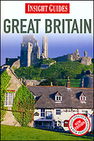
Great Britain Insight Guide

Great Britain Insight Guide is dedicated to exploring the destination in detail with a selection of glossy illustrations. Extensive introductory sections explore the region’s history and culture and there are also short articles written by locals about distinctive local issues, whilst selective photo-features illustrate the variety of the place. The ‘Places’ section is grouped geographically and provides details of the area including places to visit, suggestions for tours and other activities. Each section has its own listings of the best restaurants, bars and cafes. Essential practical information is provided in the Travel Tips chapter on accommodation, shopping and local activities. A useful location finder and travel tip index with relevant page numbers are given on the inside
covers. Overview street plans are also provided for the main cities in the region or country.
RIP - This product is no longer available on our network. It was last seen on 25.09.2019

This page now acts as a permanent archive for this product. Add more information using the comments box below to ensure it can still be found by future generations.

Use our search facility to see if it is available from an alternative contributor.
  • Availability: Out Of Stock
  • Supplier: Stanfords
  • SKU: 9781780050508
Availability: In Stock
£15.99

Product Description

Great Britain Insight Guide is dedicated to exploring the destination in detail with a selection of glossy illustrations. Extensive introductory sections explore the region’s history & culture & there are also short articles written by locals about distinctive local issues, whilst selective photo-features illustrate the variety of the place. The ‘ Places’ section is grouped geographically & provides details of the area including places to visit, suggestions for tours & other activities. Each section has its own listings of the best restaurants, bars & cafes. Essential practical information is provided in the Travel Tips chapter on accommodation, shopping & local activities. A useful location finder & travel tip index with relevant page numbers are given on the inside covers. Overview street plans are also provided for the main cities in the region or country.

Reviews/Comments

Add New

Intelligent Comparison

Oooops!
We couldn't find anything!
Perhaps this product's unique.... Or perhaps we are still looking for comparisons!
Click to bump this page and we'll hurry up.

Price History

Vouchers

No voucher codes found.
Do you know a voucher code for this product or supplier? Add it to Insights for others to use.

Facebook

Jargon Buster

History - Anything that happens in the past. An acedemic subject.
Accommodation - A room in which someone can live in, for example in a hotel
Practical - Weather a task is easy to carry out and realistically succeed.
illustrations - Pictures typically in books and newspapers.
Glossy - Something that is smooth and shiny in appearance.

Supplier Information

Stanfords
Stanfords was established in 1853 and opened their iconic Covent Garden flagship store in 1901. They have become the top retailer of maps, travel books and accessories in the UK and arguably offer the largest selection of maps and travel books worldwide. Famous names such as Captain Robert Falcon Scott, Ranulph Fiennes and Michael Palin have purchased from Stanfords. They now have a shop in Bristol and both stores together with other venues operate a calendar of events including talks, book signings and exhibitions. As a specialist map retailer, the map selection is comprehensive and includes road maps, street maps and walking maps from worldwide destinations, as well as a selection of world atlases and wall maps. Books include travel guides and travel literature. Stanfords also stock globes, from miniatures made of blue marble to magnificent floor-standing globes. The website features a selection of interesting articles on travel topics.
Page Updated: 2023-11-12 20:15:36

Community Generated Product Tags

Oh No! The productWIKI community hasn't generated any tags for this product yet!
Menu