
 United Kingdom
 France
 Germany
 Netherlands
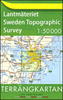
 Sweden
 USA
USA
 Italy
Italy
 Spain
Spain
More From Contributor


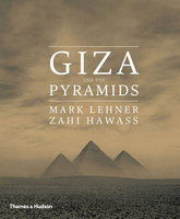
Giza And The Pyramids
For more than 4, 000 years the pyramids of Giza have stood like giant question marks that have intrigued and endlessly fascinated people. Who exactly built them? When? Why? And how did they create these colossal structures? But the pyramids are not a complete mystery - the stones, the hieroglyphs, the landscape and even the layers of sand and debris hold stories for us to read. Mark Lehner and Zahi Hawass, with over four decades of involvement with Giza, provide their unique and personal insight into the site, bringing together all the information and evidence to create a record unparalleled in its detail and scope. The celebrated Great Pyramid of Khufu, or Cheops, is the only one of the seven wonders of the ancient world still standing, but there is much more to Giza. We may think
of the pyramids as rising from the desert, isolated and enigmatic, yet they were surrounded by temples, tombs, vast cemeteries and even teeming towns of the living.All are described in detail here and brought back to life, with hundreds of illustrations including detailed photographs of the monuments, excavations and objects, as well as plans, reconstructions and the latest images from remote-controlled cameras and laser scans. Through the ages, Giza and the pyramids have inspired the most extraordinary speculations and wild theories, but here, finally, in this prestigious publication, is the full story as told by the evidence on the ground, by the leading authorities on the site.
of the pyramids as rising from the desert, isolated and enigmatic, yet they were surrounded by temples, tombs, vast cemeteries and even teeming towns of the living.All are described in detail here and brought back to life, with hundreds of illustrations including detailed photographs of the monuments, excavations and objects, as well as plans, reconstructions and the latest images from remote-controlled cameras and laser scans. Through the ages, Giza and the pyramids have inspired the most extraordinary speculations and wild theories, but here, finally, in this prestigious publication, is the full story as told by the evidence on the ground, by the leading authorities on the site.

Product Description
Reviews/Comments
Add New
Vouchers
No voucher codes found.
Do you know a voucher code for this product or supplier? Add it to Insights for others to use.
Do you know a voucher code for this product or supplier? Add it to Insights for others to use.
 Denmark