
 United Kingdom
 France
 Germany
 Netherlands
 Sweden
 USA
USA
 Italy
Italy
 Spain
Spain
More From Contributor


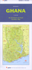

Ghana
Ghana at 1:750, 000 on a map from Peter Meyer Verlag, publishers of a very successful guide to the country, available only in German. The map shows road and rail networks, ferry routes on Lake Volta and local airports or airfields. Roads are shown with locations of petrol station and indicate border crossings to the neighbouring countries.Topography is presented by altitude colouring with spot heights. National parks and protected areas are prominently marked. Also shown are internal administrative boundaries with names of the regions. Symbols mark various places of interest, beaches, waterfalls, caves, mines and industrial sites, etc.Compared with currently available alternatives, the map shows fewer small villages and fewer local tracks but, judging by the praise received by
the guide, one would assume that the information presented on the map is well researched and accurate, and that the selection is based on tourism within the country.The map has latitude and longitude lines at intervals of 1
the guide, one would assume that the information presented on the map is well researched and accurate, and that the selection is based on tourism within the country.The map has latitude and longitude lines at intervals of 1
Product Description
Reviews/Comments
Add New
Intelligent Comparison
Archived Product

Ghana Stanfords
£19.95
Archived Product
Ghana Stanfords
£16.99
Archived Product

Guyana Stanfords
£15.99
Archived Product

Guyana Stanfords
£25.00
Archived Product
Dhaina Stanfords
£9.99
Vouchers
No voucher codes found.
Do you know a voucher code for this product or supplier? Add it to Insights for others to use.
Do you know a voucher code for this product or supplier? Add it to Insights for others to use.
 Denmark