More From Contributor
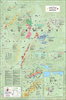
£12.99
Southern Germany at 1:500, 000 on a double-sided map from Kümmerly + Frey printed on waterproof & tear resistant plastic, prominently highlighting locations worth visiting & providing driving distances on most local roads. The map is double-sided, with an overlap between the sides, & extends northwards beyond Düsseldorf, Kassel & Leipzig. Road network stresses the motorways, clearly showing interchange numbers & different types of services. Scenic routes are highlighted & the map also indicates roads with seasonal closures or closed to motorized traffic. Driving distances are marked on most local roads. Railway lines & ferry connections are included & local airports are marked. Symbols indicate various places of interest, with towns & villages worth visiting prominently highlighted. Landscape is presented by unobtrusive relief shading, plus spot heights & names of mountain ranges, etc. Colouring indicates Germany’s numerous natural parks. Latitude & longitude lines are drawn at 30’ intervals & the map has an extensive index. Map legend

Includes::
English. Also provided is basic information on driving regulations. The same mapping is also available as at a reduced scale of 1:750, 000 to cover the whole of Germany on one sheet.

...
Archived Product
£11.99
Southern Germany at 1:500, 000 on a large road map from Mair Dumont with prominent highlighting of interesting locations, 10 more detailed enlargements for environs of main towns, plus an index booklet with 17 city maps & brief descriptions of 15 selected top sights, etc. Coverage starts from Düsseldorf, Kassel & Leipzig southwards to Zurich & Innsbruck, & eastward to Prague. Road network

Includes::
selected minor roads, highlights scenic roads & special tourist routes, shows intermediate driving distances on main roads, & indicates motorway services, toll stations, caravan & vehicle restrictions, etc. Railway lines, ferry routes & local airports are included, as well as administrative divisions with names of the states. Locations of interest are prominently highlighted, with separate colouring for towns or villages & for natural sites. Symbols show locations of campsites, youth hostels, etc. National parks & other protected areas are marked & topography is presented by relief shading with plenty of names of mountain ranges, valleys, etc. Latitude & longitude lines are drawn at 30` intervals. Multilingual map legend

Includes::
English. On the reverse are 10 large panels with enlargements showing in greater detail the environs of Cologne
- Bonn, Dresden, Frankfurt, Karlsruhe, Mannheim – Ludwigshafen, Mainz – Wiesbaden, Munich, Nuremberg, Saarbrücken & Stuttgart. A separate 95-page booklet attached to the map cover

Includes::
an index which also lists national parks, UNESCO World Heritage sites, airports & amusement parks. The booklet also contains brief descriptions of 15 most interesting locations prominently highlighted on the map, plus street plans of central Augsburg, Cologne, Dresden, Erfurt, Frankfurt, Freiburg, Karlsruhe, Ludwigshafen – Mannheim, Mainz, Munich, Nuremberg, Regensburg, Saarbrücken, Stuttgart, Ulm, Wiesbaden & Würzburg.A fold-out flap in the cover shows for route planning an overview of the whole area covered by the map plus the adjacent regions, prominently highlighting main places of interest, with the grid reference system in the margins making it easier to find locations on the main map. Also included are a distance/driving times table & basic driving regulations.


...
Archived Product
£5.99
One of the titles in a series of indexed regional maps with enlargements showing access to main cities. Bold relief shading combined with colouring for forested areas & a large number of place names make the base map rather dark & some of the small print occasionally difficult to read. Major roads do stand out well, but in more densely populated areas road information does become difficult to follow given the amount of detail, such as numbers & names of motorway junctions. Railways &, where appropriate, ferry routes are shown. National parked are marked & tourist information

Includes::
places of interest, sport & leisure facilities, etc. Latitude & longitude lines are drawn at intervals of 10

...
Archived Product
£5.99
South-eastern Germany at 1:375, 000 in a series of six indexed regional road maps from Michelin. The map covers the state of Bavaria, extending south to include the Austrian Tyrol. Enlargements with a short index listing main streets show road access to central Munich & Nuremburg. The map also

Includes::
a distance/driving times table & indicates which locations have street plans in the Michelin’s Red Guide to hotels & restaurants in Germany. Maps in the Michelin’s coverage of Germany show the motorways with full or limited interchanges & service areas, indicate interregional & less congested roads, & include information such as step gradients, seasonal closures & restrictions for caravans, dangerous or difficult road sections, etc. Scenic roads & special tourist routes are highlighted. Railway lines are included & ferry connections indicate whether for cars or passengers/cyclists only. Topography is shown by relief shading with plenty of names of mountain ranges & peaks, plus colouring for woodlands. Small symbols mark various places of interest. The maps also indicate which locations have a street plan in the Michelin’s Red Guide to hotels & restaurants in Germany. Latitude & longitude lines are drawn at intervals of 20’. The index is on the reverse. Map legend

Includes::
English.


...
Archived Product
£5.99
South-western Germany at 1:300, 000 in a series of six indexed regional road maps from Michelin. The map covers the state of Baden-Württemberg &

Includes::
insets with street plans of central Freiburg, Mannheim & Karlsruhe, plus an enlargement showing road access to Stuttgart; all indicate important places of interest & have a short index listing main streets. The map also

Includes::
a distance/driving times table & indicates which locations have street plans in the Michelin’s Red Guide to hotels & restaurants in Germany. Maps in the Michelin’s coverage of Germany show the motorways with full or limited interchanges & service areas, indicate interregional & less congested roads, & include information such as step gradients, seasonal closures & restrictions for caravans, dangerous or difficult road sections, etc. Scenic roads & special tourist routes are highlighted. Railway lines are included & ferry connections indicate whether for cars or passengers/cyclists only. Topography is shown by relief shading with plenty of names of mountain ranges & peaks, plus colouring for woodlands. Small symbols mark various places of interest. The maps also indicate which locations have a street plan in the Michelin’s Red Guide to hotels & restaurants in Germany. Latitude & longitude lines are drawn at intervals of 20’. The index is on the reverse. Map legend

Includes::
English.


...
Archived Product
£16.99
Road Atlas of Germany from Freytag & Berndt in an A4 spiral-bound format, with extra large print for all place names. 16 main cities have street plans plus detailed maps showing road access across the outer suburbs to the city centre. The main section of the atlas has road mapping with reduced relief shading & colouring to make the place names, all in extra large print size, easy to read. Cartography is a simplified version of the publisher’s regional series at 1:200, 000, with main roads in bold colours & smaller local roads clearly drawn. Road network shows motorway junction numbers & various services, toll routes, intermediate distances on most roads, gradients, seasonal closures, caravan restrictions, etc. Scenic routes & places of particular interest are highlighted & other tourist information

Includes::
national & regional parks, campsites, spas, viewpoints, etc. The maps have latitude/longitude grid at intervals of 30’. Map legend

Includes::
English. Extensive index lists all localities with their postcodes. The atlas also

Includes::
maps of Germany’s 16 main cities, each with a map of the city with its outer suburbs showing through roads & access to the centre, plus a street plan of the central area.


...
Archived Product
£18.99
Germany in the National Geographic Traveler guide series, produced by America’s leading travel publishers, exploring a range of cities, regions & countries worldwide & using the expertise & tradition of National Geographic to provide a comprehensive survey of each destination. Each of the guides in the series draws upon National Geographic’s rich history of travel experience & is researched by authors familiar with the area. Whilst the content is influenced by an American editorial style, individual titles are still accessible to a non-American audience, with a combination of practical guidance & detailed information included in each guide. The series also relies upon the extensive image libraries of National Geographic to present a rich visual image of each destination. Individual National Geographic Traveler titles are organised uniformly, allowing readers to access information quickly & easily. Introductory sections provide information on Charting your Trip, with details of getting there & around & a History & Culture chapter profiling history, food & drink, land & landscape, flora & fauna & arts & literature. Chapter are arranged geographically by region, with notable cities & areas principally describing the main sites & attractions, with further information on directions, history & practicalities. There are also a number of individual features & insider tips throughout each guide covering subjects such as walking tours, local culture, driving tours, recommended local experiences & in-depth thematic short histories of the culture & histories of individual regions. A Travelwise section at the back of each guide provides essential practical information on when to go, what to take, further reading, getting there & around, local etiquette, media, holidays, money matters, religion, smoking, time differences, opening times, travellers with disabilities & accommodation. Restaurants & hotels are listed with brief descriptions & information on prices, location, contact details & facilities for the relevant regional chapters in the guide. ...
Archived Product
£10.99
North-western part of Germany on road map at 1:500, 000 from Freytag & Berndt, with an index booklet attached to the map cover also providing city centre street plans of Aachen, Bremen, Cologne, Dortmund, Frankfurt, Karlsruhe & Stuttgart. Coverage extends east to Hamburg, Hanover & Würzburg, north to the Elbe estuary, & south beyond Stuttgart. The map also provides coverage of almost all of the Netherlands, Belgium east of Ghent, & north-eastern France between Rheims & Strasbourg. Road network

Includes::
many small local roads, most shown with driving distances. Scenic routes are highlighted. Railway lines are included. Topography is indicated by light relief shading with plenty of names of mountain ranges, regional parks, etc. Latitude & longitude lines are drawn at 30’ intervals. Map legend

Includes::
English. The index is in a separate booklet attached to the map covers, which also

Includes::
street plans of central Aachen, Bremen, Cologne, Dortmund, Frankfurt, Karlsruhe & Stuttgart.


...
Archived Product
£19.99
Wine wall map of Germany from De Long Company, size 61 x 92 cm / 24” x 36”, presents in an attractive pastel colouring the country’s officially designated wine growing regions. Rather than covering the whole country, the map shows its south-western part between Lake Constance & Bonn, with two insets presenting wine regions of eastern Germany: Saale
- Unstrut south-west of Leipzig, plus Saxony near Dresden & Meissen. The main map covers both sides of the Rhine from Lake Constance & Basel northwards to Bonn, extending eastwards to include the vineyards of Franconia around Würzburg. Coverage also extends across the Rhine & the Moselle to show the wine growing areas of Alsace & Luxembourg. Insets present in greater detail the Rheingau region on the right bank of the Rhine east of Wiesbaden, plus the central part of the Moselle Valley. The base map has colouring according the mean annual temperature, with graphics to indicate mountainous and/or forested areas, main rivers & roads, plus selected towns & locations within the wine regions. An information panel provides brief descriptions of Germany’s four main classifications: Deutscher Wein, Landwein, Prädikatswien & VDP, plus their subdivisions. Each main region also has a panel showing the area under cultivation & main grape varieties grown there. Map legend & all the text are in English. An interesting feature is the inclusion of latitude lines to provide comparisons with other wine growing areas, e.g. at 49°04 the wine growing region north of Stuttgart is at the latitude of Champagne.
...
Archived Product
£14.99
Anyone looking for delicious food & wine, stunning landscapes & a warm welcome will find Germany wine country truly delightful. ...
Archived Product

Germany SUPERCEDED

Offers comprehensive coverage of Berlin nightclubs, Munich beer halls and peaceful Alps trails. This book provides insider tips from locals on their favourite German places, people and things, and a background on contemporary Germany cuisine as well as the traditional pleasures of sausages, beer and wine.
RIP - This product is no longer available on our network. It was last seen on 25.09.2019

This page now acts as a permanent archive for this product. Add more information using the comments box below to ensure it can still be found by future generations.

Use our search facility to see if it is available from an alternative contributor.
  • External links may include paid for promotion
  • Availability: Out Of Stock
  • Supplier: Stanfords
  • SKU: 9781740599887
Availability: In Stock
£16.99

Product Description

Offers comprehensive coverage of Berlin nightclubs, Munich beer halls & peaceful Alps trails. This book provides insider tips from locals on their favourite German places, people & things, & a background on contemporary Germany cuisine as well as the traditional pleasures of sausages, beer & wine.

Reviews/Comments

Add New

Intelligent Comparison

Oooops!
We couldn't find anything!
Perhaps this product's unique.... Or perhaps we are still looking for comparisons!
Click to bump this page and we'll hurry up.

Price History

Vouchers

No voucher codes found.
Do you know a voucher code for this product or supplier? Add it to Insights for others to use.

Facebook

Jargon Buster

Contemporary - Modern era design
Wine - An alcoholic drink made from fermented grapes.
Contemporary - A design reference to indicate post war modern design
Germany - A country in Central Europe.
Traditional - Something that has become the same through a period of time and thus repeated.
Contemporary - An object that is living in the same time.
Traditional - Something that has been around for a while and is repeated regularly.

Supplier Information

Stanfords
Stanfords was established in 1853 and opened their iconic Covent Garden flagship store in 1901. They have become the top retailer of maps, travel books and accessories in the UK and arguably offer the largest selection of maps and travel books worldwide. Famous names such as Captain Robert Falcon Scott, Ranulph Fiennes and Michael Palin have purchased from Stanfords. They now have a shop in Bristol and both stores together with other venues operate a calendar of events including talks, book signings and exhibitions. As a specialist map retailer, the map selection is comprehensive and includes road maps, street maps and walking maps from worldwide destinations, as well as a selection of world atlases and wall maps. Books include travel guides and travel literature. Stanfords also stock globes, from miniatures made of blue marble to magnificent floor-standing globes. The website features a selection of interesting articles on travel topics.
Page Updated: 2023-11-12 20:15:36

Community Generated Product Tags

Oh No! The productWIKI community hasn't generated any tags for this product yet!
Menu