More From Contributor

£12.99
The first water-resistant roadmap with direct access to useful additional information from the Internet Germany in a scale of 1:700, 000 shown on a practical map; inclusive of the High 5 Edition app technology for calling up additional travel information & many other benefits:- practical format (11.4 x 23.5 cm)- it is water-resistant (laminated/cellophane coating)- the UNESCO World Heritage Sites are listed on the map- contains a selection of the local index including postal codes; the entire index can be viewed using the QR-code It doesn’t matter what weather it is used in or how often it is folded, the condition of the “ROADMAP Germany” will not deteriorate. Roads, ascents, woodland & mountain areas are easily recognisable thanks to the clear layout of the map. There is also a brief informative section about Germany (speed limits, area codes, emergency numbers, etc.) The “ Interactive Mobile ROADMAP Germany” – a “paper backup” just in case...... & when used in conjunction with a smartphone, it is a great tool for planning trips. What’s not on the map is in the app By scanning the section of the map you want with the High 5 Edition app, you can get a lot of useful additional information about major attractions & cities in Germany. The app is based on Augmented Reality technology & is available free of charge from the Apple App store & Google Play store. ...
Archived Product
£16.99
Insight Guides: Inspiring your next adventure Europe`s economic powerhouse is home to stunning landscapes & exquisite castles ...
Archived Product
£6.99
This Germany Travel Map is drawn to a scale of 1:500000 & shows the entire country complete with a comprehensive index. This is an ideal on-the-move companion when you`re exploring Germany It

Includes::
detailed street plans of major cities Outlines Top Attractions & places of interest Pictorial symbols for instant recognition Shows countries roads, rail networks & ferry routes
Includes: distance indicators Detailed topography Legend shown in eight languages


...
Archived Product
£14.50
Motorways are clearly depicted on this map, but the other main roads are not differentiated much from each other, & town names & road numbers jostle together, making the map rather cluttered. International borders are also difficult to pick out. However national parks are shown, as are railways, places of interest, campsites & winter sports resorts. Double-sided map. ...
Archived Product
£15.50
Rail Map of Germany at 1:800, 000 from Kümmerly + Frey, with a 68-page index booklet providing detailed plans of platforms & facilities at 20 railway stations, including the three main ones in Berlin & the Frankfurt Airport. The rail network is shown with lines clearly indicating their gauge, whether electrified & the types of trains used on them, including tourist steam train routes. Each line is annotated with the number used in the Deutsche Bahn timetable for online enquiries. Scenic routes & picturesque towns are highlighted & the map also shows stations providing facilities for car transportation. Local airports are prominently marked & ferry routes are included. There insets show main international connections from Germany: sleeper routes to France, Belgium, Netherlands, Denmark, Czech Republic, Austria, Switzerland & Italy, plus summer (Apr
- Oct) & winter (Nov – Mar) services for car transportation. Also provided is a list of web addresses of steam train tourist routes, plus other useful information for online enquiries. The main map legend uses only large, easy-to-understand icons rather then text. The 68-page booklet provides a comprehensive index of stations &

Includes::
detailed, 2-page plans of platform layouts & facilities for passengers (lifts & escalators, ticket offices, shopping, toilets, urban transport connections, taxi ranks, etc) at 20 of the country’s main railway stations: Berlin (Hbf, South & East), Bremen, Cologne, Dortmund, Dresden, Düsseldorf, Essen, Frankfurt Hbf plus the airport, Hamburg, Hannover, Karlsruhe, Leipzig, Mainz, Mannheim, Munich, Nuremberg & Stuttgart. Map legend here is in German only.


...
Archived Product
£14.99
Germany in the Key Guide series from AA Publishing; exploring a range of international destinations & recently been re-launched with full colour pages. Thorough & detailed in style, the guides are targeted at an older audience, exploring the principal sights, walks, activities, restaurants & accommodation of the destination. A detailed introductory section provides comprehensive information about the destination, including the economy, politics, heritage & language. There are also specific sections unique to each destination, covering society, the urban & rural, sports & leisure, art media & culture, history & science & technology. Each title is organised in the same way with destinations grouped by region or district & colour-coded to help readers navigate around the guide. An On the Move section provides details on transport, with important information on arriving, getting around (including distinctive local transport features such as metro & underground networks) & for visitors with a disability. Individual regional sections cover Sights, driving & walking opportunities, what to do, eating & accommodation. Local listings are accompanied by addresses, opening times, prices, directions & local transport options, though options for younger travellers & those with children are more limited. Extensive colour photography accompanies the text, with a range of pictures illustrations the main sites of the city, region or country. An extensive Practicalities chapter at the back of each guide carries essential information on weather, documents & customs, money, health, communication, tourist information, useful websites, finding help, opening times & entrance fees, media & books, films & maps. There is also basic information on entertainment & nightlife, sports & activities, film & music & festivals & events. ...
Archived Product
£11.99
Names & boundaries of 750 officially designated landscape areas, as well as historical natural or industrial regions, presented by the Bundesamt für Kartographie und Geodäsie (Germany’s national survey organization) on a base map at 1:1, 000, 000 showing the country’s road & rail networks. The map shows boundaries &, where appropriate, subdivisions of officially designated natural regions, e.g. Harz: Oberharz / Unterharz, Lüneburger Heide: Hohe Heide / Uelzener Becken / Harburger Berge / Lüss, etc. Also marked are boundaries of historical landscape areas (Historische Landschaft) such as Rheinhessen or Oberschwaben, or industrial areas (Wittscheftlandschaft) Ruhrgebiet, Fränkisches Seel&, etc. All the areas marked on the map are listed in an index which gives for each entry its latitude & longitude. Map legend for the base map

Includes::
English; all other explanatory notes are in German only.

...
Archived Product
£5.99
How were you to know that you had to weigh your own fruit in the supermarket, or that the unidentified machine on the platform was where you should have punched your ticket before getting on the train, or that the barman is trying to tell you to pay for your drink at the cash till before you can order at the bar, or that the titbits he places by your side are for everyone, not just for you to scoff? This new generation phrase book combines illustrated practical information (specially commissioned photographs) together with useful phrases. A dictionary contains practical vocabulary & an illustrated menu reader to helps you identify the food. ...
Archived Product
£11.99
“ Long-distance Cycle Routes in Germany” guide from Verlag Esterbauer, in German, provides an overview of the country’s 126 most beautiful cycle trails, ranging from the best known: along the Danube, the Rhine, the Elbe or the Weser, to shorter but no less interesting ones such as the Tauber Valley. For each trail a general map shows the route & the sights along it. Accompanying route profiles & descriptions provide more information. ALL THE TEXT IS IN GERMAN ONLY.PLEASE NOTE: Verlag Esterbauer produce an extensive range of individual guides to long-distance cycling trails not just in Germany but also in other European countries, listed on our website in a separate series. ...
Archived Product
£6.99
Germany at 1:800, 000 on a large road map from Marco Polo Travel Publishing with prominent highlighting of interesting locations, 10 more detailed enlargements, plus an index booklet with 20 city maps & brief descriptions of 15 selected top sights, etc. Cartography is from the renowned German publishers Mair Dumont. Road network

Includes::
selected minor roads, highlights scenic roads & special tourist routes, shows intermediate driving distances on main roads, & indicates motorway services, toll stations, caravan & vehicle restrictions, etc. Railway lines, ferry routes & local airports are included, as well as administrative divisions with names of the states. Locations of interest are prominently highlighted, with separate colouring for towns or villages & for natural sites. Symbols show locations of campsites, youth hostels, etc. National parks & other protected areas are marked & topography is presented by relief shading with plenty of names of mountain ranges, valleys, etc. Latitude & longitude lines are drawn at 30` intervals. Multilingual map legend

Includes::
English. The whole of Germany is presented on one side; the reverse side contains 10 large panels with enlargements showing in greater detail the environs of Berlin, Bremen, Cologne, Frankfurt, Hamburg, Leipzig, Nuremberg, Munich & Stuttgart, plus the Ruhr including Dortmund, Düsseldorf & Leverkusen. A separate 95-page booklet attached to the map cover

Includes::
an index which also lists national parks, UNESCO World Heritage sites, airports & amusement parks. The booklet also contains brief descriptions of 15 most interesting locations prominently highlighted on the map, plus street plans of central Berlin, Bremen, Cologne, Dresden, Düsseldorf, Frankfurt, Hamburg, Hannover, Kiel, Leipzig, Magdeburg, Mainz, Nuremberg, Munich, Potsdam, Saarbrücken, Schwerin, Stuttgart & Wiesbaden, A fold-out flap in the cover shows for route planning an overview of the whole area covered by the map plus the adjacent regions, prominently highlighting main places of interest, with the grid reference system in the margins making it easier to find locations on the main map. Also included are a distance/driving times table & basic driving regulations.


...
Archived Product

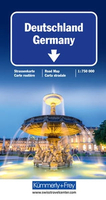
Germany K+F Road Map

Germany at 1:750, 000 on a double-sided map from Kümmerly + Frey printed on waterproof and tear resistant plastic, prominently highlighting locations worth visiting and providing driving distances on most local roads.The map divides the country north/south with an overlap between the sides. Road network stresses the motorways, clearly showing interchange numbers and different types of services. Scenic routes are highlighted and the map also indicates roads with seasonal closures or closed to motorized traffic. Driving distances are marked on most local roads. Railway lines and ferry connections are included and local airports are marked.Symbols indicate various places of interest, with towns and villages worth visiting prominently highlighted. Landscape is presented by unobtrusive
relief shading, plus spot heights and names of mountain ranges, etc. Colouring indicates Germany’s numerous natural parks. Latitude and longitude lines are drawn at 30’ intervals and the map has an extensive index. Map legend includes English. Also provided is basic information on driving regulations.The same mapping is also available as North or South Germany, enlarged for greater clarity of detail to 1:500, 000.
RIP - This product is no longer available on our network. It was last seen on 25.09.2019

This page now acts as a permanent archive for this product. Add more information using the comments box below to ensure it can still be found by future generations.

Use our search facility to see if it is available from an alternative contributor.
  • External links may include paid for promotion
  • Availability: Out Of Stock
  • Supplier: Stanfords
  • SKU: 9783259018033
Availability: In Stock
£12.99

Product Description

Germany at 1:750, 000 on a double-sided map from Kümmerly + Frey printed on waterproof & tear resistant plastic, prominently highlighting locations worth visiting & providing driving distances on most local roads. The map divides the country north/south with an overlap between the sides. Road network stresses the motorways, clearly showing interchange numbers & different types of services. Scenic routes are highlighted & the map also indicates roads with seasonal closures or closed to motorized traffic. Driving distances are marked on most local roads. Railway lines & ferry connections are included & local airports are marked. Symbols indicate various places of interest, with towns & villages worth visiting prominently highlighted. Landscape is presented by unobtrusive relief shading, plus spot heights & names of mountain ranges, etc. Colouring indicates Germany’s numerous natural parks. Latitude & longitude lines are drawn at 30’ intervals & the map has an extensive index. Map legend

Includes::
English. Also provided is basic information on driving regulations. The same mapping is also available as North or South Germany, enlarged for greater clarity of detail to 1:500, 000.

Reviews/Comments

Add New

Intelligent Comparison

Oooops!
We couldn't find anything!
Perhaps this product's unique.... Or perhaps we are still looking for comparisons!
Click to bump this page and we'll hurry up.

Price History

Vouchers

No voucher codes found.
Do you know a voucher code for this product or supplier? Add it to Insights for others to use.

Facebook

Jargon Buster

Plastic - A generic term for a synthetic product used in the manufacture of products
Germany - A country in Central Europe.
Waterproof - Resistant to water, usualy specified by depth in metres
Natural - not manmade
Network - A link and communication between things. Often computers or people.
Road - a manmade lane or a path that is used to speed up travel.
Resistant - Something that can repel against something.

Supplier Information

Stanfords
Stanfords was established in 1853 and opened their iconic Covent Garden flagship store in 1901. They have become the top retailer of maps, travel books and accessories in the UK and arguably offer the largest selection of maps and travel books worldwide. Famous names such as Captain Robert Falcon Scott, Ranulph Fiennes and Michael Palin have purchased from Stanfords. They now have a shop in Bristol and both stores together with other venues operate a calendar of events including talks, book signings and exhibitions. As a specialist map retailer, the map selection is comprehensive and includes road maps, street maps and walking maps from worldwide destinations, as well as a selection of world atlases and wall maps. Books include travel guides and travel literature. Stanfords also stock globes, from miniatures made of blue marble to magnificent floor-standing globes. The website features a selection of interesting articles on travel topics.
Page Updated: 2023-11-12 20:15:36

Community Generated Product Tags

Oh No! The productWIKI community hasn't generated any tags for this product yet!
Menu