More From Contributor

£25.00
We are able to source a wide range of courtesy flags. Flags are available in many sizes & can be sewn or printed on 100% Ministry Of Defence Standard Woven & Knitted Polyester. Flags are supplied with rope & toggle. If you would like more information, have a custom size request or cannot find a desired product, please email us at maritime@stanfords.co.uk. We will be glad to help! ...
Archived Product
£19.99
We are able to source a wide range of courtesy flags. Flags are available in many sizes & can be sewn or printed on 100% Ministry Of Defence Standard Woven & Knitted Polyester. Flags are supplied with rope & toggle. If you would like more information, have a custom size request or cannot find a desired product, please email us at maritime@stanfords.co.uk. We will be glad to help! ...
Archived Product
£6.99
Germany at a scale of 1:1, 000, 000 on a laminated, tear-resistant, indexed Insight Flexi Map which favours cultural touring in the country, has over 80 significant points of visitor interest enumerated on the legend, & comes with enlarged city street plans of Berlin, Frankfurt, Hamburg & Munich. Road network shown covers motorways, dual carriageways, trunk roads, main & secondary roads. Motorway junctions are marked, along with petrol stations & road side service stations. Airports, rail lines & ferry lines are marked. The map is indexed by both important place name & the country ...
Archived Product
£7.99
Quick to read, light to carry with expert advice in all price ranges, Frommer`s Easy Guide to Germany is the complete up-to-date reference for travelers who want to maximize their stay in the smartest, most efficient way. With Frommer`s trademark candid & accessible expertise, this invaluable guide offers reviews in a wide array of choices available including lodging, sightseeing, shopping, dining & entertainment. It

Includes::
insider tips on how to tackle vacationing, based on time constraints & interests, complete with practical advice & suggested itineraries. With user-friendly features it offers tips on excellent values, special moments, traveling with kids & overrated experiences &

Includes::
thematic tours for every interest, schedule & taste.


...
Archived Product
£12.99
Germany at 1:700, 000 with E-Distoguide® via QR-Code. Combining print & the web for even greater flexibility. With QR-Code, more than 2000 distances are accessible directly from your mobile! Road Map with transit maps, town index, touring information & tourist attractions. Hallwag road maps are renowned for their up-to-date information, clear layout & convenience. See for yourself the benefits of the Hallwag international map collection, with new ideas to make travel even easier. ...
Archived Product
£16.99
Insight Guides: Inspiring your next adventure Europe`s economic powerhouse is home to stunning landscapes & exquisite castles ...
Archived Product
£6.99
This Germany Travel Map is drawn to a scale of 1:500000 & shows the entire country complete with a comprehensive index. This is an ideal on-the-move companion when you`re exploring Germany It

Includes::
detailed street plans of major cities Outlines Top Attractions & places of interest Pictorial symbols for instant recognition Shows countries roads, rail networks & ferry routes
Includes: distance indicators Detailed topography Legend shown in eight languages


...
Archived Product
£14.50
Motorways are clearly depicted on this map, but the other main roads are not differentiated much from each other, & town names & road numbers jostle together, making the map rather cluttered. International borders are also difficult to pick out. However national parks are shown, as are railways, places of interest, campsites & winter sports resorts. Double-sided map. ...
Archived Product
£15.50
Rail Map of Germany at 1:800, 000 from Kümmerly + Frey, with a 68-page index booklet providing detailed plans of platforms & facilities at 20 railway stations, including the three main ones in Berlin & the Frankfurt Airport. The rail network is shown with lines clearly indicating their gauge, whether electrified & the types of trains used on them, including tourist steam train routes. Each line is annotated with the number used in the Deutsche Bahn timetable for online enquiries. Scenic routes & picturesque towns are highlighted & the map also shows stations providing facilities for car transportation. Local airports are prominently marked & ferry routes are included. There insets show main international connections from Germany: sleeper routes to France, Belgium, Netherlands, Denmark, Czech Republic, Austria, Switzerland & Italy, plus summer (Apr
- Oct) & winter (Nov – Mar) services for car transportation. Also provided is a list of web addresses of steam train tourist routes, plus other useful information for online enquiries. The main map legend uses only large, easy-to-understand icons rather then text. The 68-page booklet provides a comprehensive index of stations &

Includes::
detailed, 2-page plans of platform layouts & facilities for passengers (lifts & escalators, ticket offices, shopping, toilets, urban transport connections, taxi ranks, etc) at 20 of the country’s main railway stations: Berlin (Hbf, South & East), Bremen, Cologne, Dortmund, Dresden, Düsseldorf, Essen, Frankfurt Hbf plus the airport, Hamburg, Hannover, Karlsruhe, Leipzig, Mainz, Mannheim, Munich, Nuremberg & Stuttgart. Map legend here is in German only.


...
Archived Product
£12.99
Germany at 1:750, 000 on a double-sided map from Kümmerly + Frey printed on waterproof & tear resistant plastic, prominently highlighting locations worth visiting & providing driving distances on most local roads. The map divides the country north/south with an overlap between the sides. Road network stresses the motorways, clearly showing interchange numbers & different types of services. Scenic routes are highlighted & the map also indicates roads with seasonal closures or closed to motorized traffic. Driving distances are marked on most local roads. Railway lines & ferry connections are included & local airports are marked. Symbols indicate various places of interest, with towns & villages worth visiting prominently highlighted. Landscape is presented by unobtrusive relief shading, plus spot heights & names of mountain ranges, etc. Colouring indicates Germany’s numerous natural parks. Latitude & longitude lines are drawn at 30’ intervals & the map has an extensive index. Map legend

Includes::
English. Also provided is basic information on driving regulations. The same mapping is also available as North or South Germany, enlarged for greater clarity of detail to 1:500, 000.

...
Archived Product

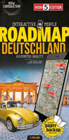
Germany High 5 Edition Road Map

The first water-resistant roadmap with direct access to useful additional information from the InternetGermany in a scale of 1:700, 000 shown on a practical map; inclusive of the High 5 Edition app technology for calling up additional travel information and many other benefits:- practical format (11.4 x 23.5 cm)- it is water-resistant (laminated/cellophane coating)- the UNESCO World Heritage Sites are listed on the map- contains a selection of the local index including postal codes; the entire index can be viewed using the QR-codeIt doesn’t matter what weather it is used in or how often it is folded, the condition of the “ROADMAP Germany” will not deteriorate. Roads, ascents, woodland and mountain areas are easily recognisable thanks to the clear layout of the map. There is also a
brief informative section about Germany (speed limits, area codes, emergency numbers, etc.)The “Interactive Mobile ROADMAP Germany” – a “paper backup” just in case...... and when used in conjunction with a smartphone, it is a great tool for planning trips.What’s not on the map is in the appBy scanning the section of the map you want with the High 5 Edition app, you can get a lot of useful additional information about major attractions and cities in Germany. The app is based on Augmented Reality technology and is available free of charge from the Apple App store and Google Play store.
RIP - This product is no longer available on our network. It was last seen on 25.09.2019

This page now acts as a permanent archive for this product. Add more information using the comments box below to ensure it can still be found by future generations.

Use our search facility to see if it is available from an alternative contributor.
  • External links may include paid for promotion
  • Availability: Out Of Stock
  • Supplier: Stanfords
  • SKU: 9783906908069
Availability: In Stock
£12.99

Product Description

The first water-resistant roadmap with direct access to useful additional information from the Internet Germany in a scale of 1:700, 000 shown on a practical map; inclusive of the High 5 Edition app technology for calling up additional travel information & many other benefits:- practical format (11.4 x 23.5 cm)- it is water-resistant (laminated/cellophane coating)- the UNESCO World Heritage Sites are listed on the map- contains a selection of the local index including postal codes; the entire index can be viewed using the QR-code It doesn’t matter what weather it is used in or how often it is folded, the condition of the “ROADMAP Germany” will not deteriorate. Roads, ascents, woodland & mountain areas are easily recognisable thanks to the clear layout of the map. There is also a brief informative section about Germany (speed limits, area codes, emergency numbers, etc.) The “ Interactive Mobile ROADMAP Germany” – a “paper backup” just in case...... & when used in conjunction with a smartphone, it is a great tool for planning trips. What’s not on the map is in the app By scanning the section of the map you want with the High 5 Edition app, you can get a lot of useful additional information about major attractions & cities in Germany. The app is based on Augmented Reality technology & is available free of charge from the Apple App store & Google Play store.

Reviews/Comments

Add New

Intelligent Comparison

Oooops!
We couldn't find anything!
Perhaps this product's unique.... Or perhaps we are still looking for comparisons!
Click to bump this page and we'll hurry up.

Price History

Vouchers

No voucher codes found.
Do you know a voucher code for this product or supplier? Add it to Insights for others to use.

Facebook

Jargon Buster

Paper - A thin sheet mainly used for writing. Available in a variety of colours. Made mainly from wood pulp.
Cm - Centimetres, one centimetre is equal to 10 milimetres
water - A chemical substance. Chemical formula H2O.
Germany - A country in Central Europe.
Interactive - Interaction can take place between a person and a device
World - A physical grouping, commonly used to describe earth and everything associated with ti
speed - A measurement of how fast an object travels between two points
Weather - is the change of an atmospheres conditions.
Road - a manmade lane or a path that is used to speed up travel.
Condition - The quality of a product or service.
Resistant - Something that can repel against something.
Practical - Weather a task is easy to carry out and realistically succeed.
Laminated - A thin layer of plastic that gives a coating and shine to a material.

Supplier Information

Stanfords
Stanfords was established in 1853 and opened their iconic Covent Garden flagship store in 1901. They have become the top retailer of maps, travel books and accessories in the UK and arguably offer the largest selection of maps and travel books worldwide. Famous names such as Captain Robert Falcon Scott, Ranulph Fiennes and Michael Palin have purchased from Stanfords. They now have a shop in Bristol and both stores together with other venues operate a calendar of events including talks, book signings and exhibitions. As a specialist map retailer, the map selection is comprehensive and includes road maps, street maps and walking maps from worldwide destinations, as well as a selection of world atlases and wall maps. Books include travel guides and travel literature. Stanfords also stock globes, from miniatures made of blue marble to magnificent floor-standing globes. The website features a selection of interesting articles on travel topics.
Page Updated: 2023-11-12 20:15:36

Community Generated Product Tags

Oh No! The productWIKI community hasn't generated any tags for this product yet!
Menu