
 United Kingdom
 France
 Germany
 Netherlands
 Sweden
 USA
USA
 Italy
Italy
 Spain
Spain
More From Contributor

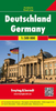


Germany F&B Supertouring Atlas
Supertouring Atlas of Germany from Freytag & Berndt in a handy A5, spiral-bound format, with an extensive index plus 51 indexed street plans covering central districts of the country’s main cities.Cartography is a simplified version of the publisher’s regional series at 1:200, 000, with main roads in bold colours and smaller local roads clearly drawn. Road network shows motorway junction numbers and various services, toll routes, intermediate distances on most roads, gradients, seasonal closures, caravan restrictions, etc. Scenic routes and places of particular interest are highlighted and other tourist information includes national land regional parks, campsites, spas, viewpoints, etc. The maps have no geographical coordinates. Map legend includes English. Extensive index
lists all localities with their postcodes. The atlas also includes indexed street plans of central districts in Germany’s 51 main cities.
lists all localities with their postcodes. The atlas also includes indexed street plans of central districts in Germany’s 51 main cities.
Product Description
Reviews/Comments
Add New
Vouchers
No voucher codes found.
Do you know a voucher code for this product or supplier? Add it to Insights for others to use.
Do you know a voucher code for this product or supplier? Add it to Insights for others to use.
 Denmark