More From Contributor
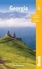
£17.99
This new sixth edition of Bradt`s Georgia, the only dedicated guide to the country, has been thoroughly updated throughout to include all the most recent developments, ranging from greatly expanded coverage of Batumi, Adjara & Svaneti to the addition of new maps for Tbilisi Old Town, Mestia & Telavi. Tourism is booming in Georgia: the number of guesthouses has mushroomed, Tbilisi airport has just opened a second terminal & a new terminal & rail link are under construction at Kutaisi airport. New low-cost flights are now available & visa-free travel is the norm for most. With Bradt`s Georgia discover both the old & the new. The capital, Tbilisi, has seen huge changes in the past decade with some conspicuous new projects such as the Peace Bridge, the Opera House & the Presidential Palace, as well as excellent new restaurants & bars. Much of the country can be reached in day-trips from the luxury hotels of Tbilisi & Batumi, & the remotest areas such as Svaneti & the Pankisi Valley can also now be visited. In addition, Mestia, the capital of Svaneti, now has an airport & two ski resorts. Also new for this edition is expanded information on Tusheti & the Trans Caucasian Trail, a volunteer-led project to create two long-distance hiking routes, east-west & north-south, linking the Black Sea with the Caspian, the Greater Caucasus with the Lower Caucasus & Georgia with Armenia & Azerbaijan. The Georgian wine industry is covered, with particular emphasis on natural qvevri wines, & so too are skiing, rugby, the World Heritage sites of Mtskheta & Gelati, Georgian food, fifth-century churches, cave cities, & Georgian polyphonic singing. Bradt`s unique guide to Georgia is the ideal companion for all travellers, from serious hikers to wine buffs, high-end culture lovers to backpackers of all ages. ...
Archived Product
£5.99
Georgia at 1:600, 000 on an indexed road map from the Kiev-based Kartografia, with place names shown in the Cyrillic alphabet (selected locations also in the Georgian script) & a map legend in Ukrainian. The map provides good presentation of the country’s topography through relief shading & plenty of spot heights, plus names of peaks & mountain ranges, & boundaries of national parks. Road network is graded into six types, including country tracks, shows locations of petrol stations & border crossings & gives distances on main routes. Railway lines & coastal ferry connections are included & local airports are marked. The map also indicates locations with tourist accommodation. All place names are in the Cyrillic alphabet with names of selected towns & geographic features also shown in the Georgian script. The map indicates the borders of Abkhazia & South Ossetia & within those two regions gives alternative local names for selected towns. The road network does not indicate if transit across those borders is possible. The map is indexed & has latitude & longitude lines at 1° intervals. Map legend is in Ukrainian only. Also provided is a distance table.IMPORTANT
- PLEASE NOTE BEFORE ORDERING: supplies of all titles published in the Ukraine are irregular & we cannot guarantee a firm delivery time. When a title is out of stock, it may be advisable to choose an alternative publication.
...
Archived Product
£9.99
Armenia & Georgia at 1:430, 000 on an indexed map from ITMB. Each side of the map covers the whole of one of these two countries, presented with a street plan of its capital. Diverse ethnography of the region is indicated on an inset. Topography is shown by altitude colouring in feet, with heights of peaks given in metres (and not in feet as indicated in the map legend). Mountain passes are annotated with months when passable. Swamp areas are marked & national parks or protected areas highlighted. The map shows the region’s road & rail networks, including selected seasonal tracks, & indicates local airports. Symbols highlight various places of interest: historical sites, beaches, winter sport areas, etc. All place names are in the Latin alphabet only. Latitude & longitude lines are drawn at 1° intervals. Each country has a separate index. Street plans of central Yerevan & Tbilisi name main streets & highlight various places of interest including selected foreign embassies. Also provided is an inset showing the distribution of various ethnographic groups. ...
Archived Product
£7.99
Georgia in the Culture Smart range of pocket-sized guide books; providing detailed information on local customs, culture, etiquette & manners & ensuring that visitors are prepared for a diverse range of social environments. The series covers an extensive number of countries worldwide & are designed both for those working & living abroad, as well as for visitors who do not want to offend, either intentionally or inadvertently. Their aim is to prevent readers from making embarrassing mistakes & feel confident in unfamiliar situations, while preparing them before arrival on what to expect & how to behave. Each guide is arranged thematically, with dedicated individual chapters on land & people, values & attitudes, customs & traditions, making friends, people at home, ‘time-out’, travelling & communicating. There is also a separate chapter for business travelers, with important information on subjects such as business culture, meetings & making appointments. A Further Reading section also offers a list of recommended other history, travel literature & language titles available on the country. ...
Archived Product
£29.99
This is the first comprehensive cultural & historical introduction to modern Georgia. It covers the country region by region, taking the form of a literary journey through the transition from Soviet Georgia to the modern independent nation state. Georgia's recorded history goes back nearly 3, 000 years. The Georgians converted to Christianity in 330 & their Bagratuni monarchy endured for over 1, 000 years. The Soviets ruled the region from 1921 but their vigorous repression did little to eradicate the strong Georgian sense of nationhood & under Gorbachev, Georgian independence became inevitable. Nasmyth's lively & topical survey charts the nation's remarkable cultural & historical journey to statehood. Having travelled extensively in the country over a period of five years, Peter Nasmyth is exceptionally qualified to write on Georgia. His authoritative, dynamic & perceptive book is based on hundreds of interviews with modern Georgians, from country priests to black marketeers. Georgia: In the Mountains of Poetry will be essential reading for anyone interested in this fascinating region as well as for students & researchers requiring an insight into life after the collapse of the old Soviet order in the richest & most dramatic of the former republics. ...
Archived Product
£8.95
Eastern Georgia at 1:250, 000 in a series of on four double-sided road maps from the locally based Geoplan, with topographic & tourist information, detailed grading of towns & villages according to the number of inhabitants, etc. The map covers the provinces of Kakheti, Signagi, Tusheti, Khevsureti & Tbilisi. Relief shading with numerous peak heights, plus colouring or graphics for marshl&, glaciers, forests, gardens & vineyards, etc. shows the topography. Internal administrative boundaries are marked, & presentation of towns & villages is finely graded to indicate both their administrative status & the number of inhabitants. Road network distinguished between local paved or unpaved roads & dirt tracks. Railway lines are also included. A range of symbols highlight various places of interest including nine different types of religious establishments, cave towns, historical towers & bridges, archaeological sites, temporary shelters & ruined villages, etc. Each map has a latitude & longitude grid at intervals of 20 ...
Archived Product
£9.99
Georgia on a laminated & waterproof Easy-to-Fold map from Rand Mc Nally, the country’s leading publisher of road maps & street plans. For clarity of road information Rand Mc Nally state maps present the road network on a plain background, with no or little topographic detail. Driving distances are indicated on all principal highways & on many local routes. National or state parks & other protected areas, Indian Reservations & restricted entry military zones are highlighted & symbols indicate campsites, rest areas, various places of interest, etc. Each map shows local administrative boundaries with names of the counties, is indexed & gives geographical coordinates as margin ticks usually at 1° intervals. Rand Mc Nally state maps are available in two formats: double-sided Easy-to-Read maps with numerous enlargements for cities and/or most visited areas, & laminated Easy-to-Fold maps in a more handy format but with smaller print. TO SEE THE LIST OF RAND Mc NALLY STATE MAPS PLEASE CLICK ON THE SERIES LINK. ...
Archived Product
£6.99
Georgia Easy-to-Read map from Rand Mc Nally, US leading publisher of road maps & street plans, in their extensive series of state maps. Additional panels provide enlargements for Albany, Athens, Atlanta & Vicinity with a street plan of downtown Atlanta, Augusta, Brunswick, Columbus, Macon, & Savannah. For clarity of road information Rand Mc Nally state maps present the road network on a plain background, with no or little topographic detail. Driving distances are indicated on all principal highways & on many local routes. National or state parks & other protected areas, Indian Reservations & restricted entry military zones are highlighted & symbols indicate campsites, rest areas, various places of interest, etc. Each map shows local administrative boundaries with names of the counties, is indexed & gives geographical coordinates as margin ticks usually at 1° intervals. Rand Mc Nally state maps are available in two formats: double-sided Easy-to-Read maps with numerous enlargements for cities and/or most visited areas, & laminated Easy-to-Fold maps in a more handy format but with smaller print. TO SEE THE LIST OF RAND Mc NALLY STATE MAPS PLEASE CLICK ON THE SERIES LINK. ...
Archived Product
£9.99
Georgia at 1:500, 000 on a double-sided road map
- paper version
- from the Tbilisi-based Geol&, showing a large number of

...
Archived Product
£15.99
Georgia at 1:500, 000 on a double-sided road map
- waterproof & tear-resistant version
- from the Tbilisi-based Geol&, showing

...
Archived Product

Georgia Central

Central Georgia at 1:250, 000 in a series of on four double-sided road maps from the locally based Geoplan, with topographic and tourist information, detailed grading of towns and villages according to the number of inhabitants, etc. The map covers South Ossetia and the provinces of Kartli, Meskheti, Javakheti, Racha, Kazbegi and Tbilisi.Relief shading with numerous peak heights, plus colouring or graphics for marshland, glaciers, forests, gardens and vineyards, etc. shows the topography. Internal administrative boundaries are marked, and presentation of towns and villages is finely graded to indicate both their administrative status and the number of inhabitants. Road network distinguished between local paved or unpaved roads and dirt tracks. Railway lines are also included.
A range of symbols highlight various places of interest including nine different types of religious establishments, cave towns, historical towers and bridges, archaeological sites, temporary shelters and ruined villages, etc. Each map has a latitude and longitude grid at intervals of 20
RIP - This product is no longer available on our network. It was last seen on 25.09.2019

This page now acts as a permanent archive for this product. Add more information using the comments box below to ensure it can still be found by future generations.

Use our search facility to see if it is available from an alternative contributor.
  • External links may include paid for promotion
  • Availability: Out Of Stock
  • Supplier: Stanfords
  • SKU: X184607
Availability: In Stock
£8.95

Product Description

Central Georgia at 1:250, 000 in a series of on four double-sided road maps from the locally based Geoplan, with topographic & tourist information, detailed grading of towns & villages according to the number of inhabitants, etc. The map covers South Ossetia & the provinces of Kartli, Meskheti, Javakheti, Racha, Kazbegi & Tbilisi. Relief shading with numerous peak heights, plus colouring or graphics for marshl&, glaciers, forests, gardens & vineyards, etc. shows the topography. Internal administrative boundaries are marked, & presentation of towns & villages is finely graded to indicate both their administrative status & the number of inhabitants. Road network distinguished between local paved or unpaved roads & dirt tracks. Railway lines are also included. A range of symbols highlight various places of interest including nine different types of religious establishments, cave towns, historical towers & bridges, archaeological sites, temporary shelters & ruined villages, etc. Each map has a latitude & longitude grid at intervals of 20

Reviews/Comments

Add New

Intelligent Comparison

Oooops!
We couldn't find anything!
Perhaps this product's unique.... Or perhaps we are still looking for comparisons!
Click to bump this page and we'll hurry up.

Price History

Vouchers

No voucher codes found.
Do you know a voucher code for this product or supplier? Add it to Insights for others to use.

Facebook

Jargon Buster

Graphics - A general term for visual aspects of an item/display
Network - A link and communication between things. Often computers or people.
Road - a manmade lane or a path that is used to speed up travel.

Supplier Information

Stanfords
Stanfords was established in 1853 and opened their iconic Covent Garden flagship store in 1901. They have become the top retailer of maps, travel books and accessories in the UK and arguably offer the largest selection of maps and travel books worldwide. Famous names such as Captain Robert Falcon Scott, Ranulph Fiennes and Michael Palin have purchased from Stanfords. They now have a shop in Bristol and both stores together with other venues operate a calendar of events including talks, book signings and exhibitions. As a specialist map retailer, the map selection is comprehensive and includes road maps, street maps and walking maps from worldwide destinations, as well as a selection of world atlases and wall maps. Books include travel guides and travel literature. Stanfords also stock globes, from miniatures made of blue marble to magnificent floor-standing globes. The website features a selection of interesting articles on travel topics.
Page Updated: 2023-11-12 20:15:36

Community Generated Product Tags

Oh No! The productWIKI community hasn't generated any tags for this product yet!
Menu