More From Contributor
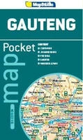
£9.99
Gaurishankar Himal, sheet no. 2786-02, in the topographic survey of Nepal at 1:50, 000 published by the Nepali Government in the late 1990s & early 2000s & produced from remote sensing data by Finnish cartographers as part of that country’s international aid program. The maps cover 15’ x 15’ quadrangles.IMPORTANT – PLEASE NOTE BEFORE ORDERING: AVAILABILITY: although, theoretically at least, still in print, these maps are very difficult to get locally in Nepal and/or from various suppliers elsewhere specializing in obtaining such maps. DELIVERIES MAY TAKE SEVERAL WEEKS OR EVEN MONTHS.PROBLEMS WITH PLACE NAMES: reports from previous users indicate that transliteration of place names differs from that used widely not only on other maps & in guide books but also on the ground itself, in road signs & in the tourist & trekking industry in general. Whilst most names are similar enough to be easily recognizable, e.g. Namche Bajar for Namche Bazar or Lantan for Langtang, we have been told of confusion & difficulties arising from different spellings appearing on these maps.TREKKING ROUTES & TOURIST INFORMATION: whilst the maps show foot trails & mark locations of temples, etc, they carry no specific trekking information. Major trekking routes & places of interest are not highlighted. There is no marking for base camps & other tourist facilities. Map specifications: Contours are at 40m intervals, with graphics and/or coloring to show various features of the terrain (glaciers with moraines & crevasses, quarries, gravel or clay pits, etc.) & vegetation (forests, bush, grass, orchards & plantations, etc). Additional comments such as “open mixed forest mainly bajh & pine” annotate many area. The maps have numerous spot heights, but relatively few peaks are named. Areas outside the country’s borders are left blank. Settlements in remote areas are indicated by markings for individual buildings & the placing of names does not always make it clear which group of buildings they refer to. Road network distinguishes between major & minor foot trails. Symbols mark features such as temples, schools & hospitals, police stations, etc. Also shown are the country’s administrative divisions. The maps have a 1-km UTM grid, plus latitude & longitude lines at intervals of 5’. Map legend & all the text is in English. Coverage: the whole country is now covered, with the north at 1:50, 000, plus central & southern Nepal at 1:25, 000. The two series are complementary, do not overlap & use the same grid & numbering system (apart from the Lumbini Zone, where a different grid & numbering are used). For areas not shown on our grid & titles not listed here, please contact us by e-mail, but please do bear in mind the problems with availability & the likely very long delivery time. ...
Archived Product
£23.99
Gaustatoppen area in Norway in a series of GPS compatible recreational maps at 1:25, 000 with cartography based on the country’s topographic survey & additional tourist information. The base map is an enlargement of the standard 1:50, 000 topographic survey series. Contours lines are drawn at 20m intervals. The overprint varies from title to title, but

Includes::
local footpaths, in some cases distinguishing between easy & more difficult trails, as well as mountain huts & campsites. Many titles also indicate cycle, ski or canoeing routes, other accommodation possibilities, sport & recreational facilities, including alpine skiing slopes, places of interest, etc. The maps have a UTM grid & margin ticks giving latitude & longitude. Map legend

Includes::
English. Several titles have on the reverse additional tourist information, although in most cases in Norwegian only. To see the list of Turkart maps at 1:25, 000 & links to Turkart series at 50K, 100K & Hiking Sets please click on the series link above.


...
Archived Product
£29.95
The built-up areas of the Gauteng Province in an A4 size, paperback street atlas, including Johannesburg, Pretoria, Soweto, etc. Detail

Includes::
one-way streets, traffic lights, toll plazas, service stations, railways, public buildings, community services, parks, landmarks, cultural sites, recreation sites, industrial areas, suburb & municipal boundaries, etc. Additional maps include central Johannesburg at 1:12, 500, plan of the Jo

...
Archived Product
£9.95
Gauteng may be the Place of Gold, but it is also home to many hikes & walks that most Gautengers don`t even know about. This book will help you discover them while giving you a more intimate encounter with Gauteng, a province shrouded in the beauty of indigenous vegetation, mountains, rivers & waterfalls. Tim Hartwright covers both the shorter walks in urban parks & rural areas, along with overnight trails such as Suikerbosr&. He explores the unique places that are right on every Gautenger`s doorstep, one of these being the Braamfontein Spruit, & shares the rich heritage we need to preserve in our city. Numerous private trails have blossomed in areas closer to the main metropolises of Gauteng. Shorter weekend & day hikes have come into vogue & in most cases these trails cross private land rather than that belonging to the state. Most municipalities have embraced hiking as part of their commitment to the outdoor recreational activities they offer their residents & visitors. Explore the various nature reserves, historical, archaeological & geological sites. Included in the book: Detailed description of around 60 hiking & walking trails in Gauteng, including the history & geology, fauna & flora of each area; a difficulty rating is included, helping you decide if it is suitable for the whole family; brief descriptions on how to get to the route with GPS coordinates for starting points; security information & emergency numbers; contact details for trail
- to know if you should book in advance to walk the trail; comprehensive maps for each hike or walk.
...
Archived Product
£6.50
Gauteng Province of South Africa at 1:550, 000 on a handy size indexed road map from Map Studio, with on the reverse street plans of central Johannesburg & Pretoria indicating places of interest & various facilities. The road map emphasises the motorway network, indicating toll plazas. Driving distances are marked on many local roads. Railway lines are shown with stations & locations of airports & airfields are marked. National parks & other protected areas are highlighted. The map has latitude & longitude lines at 30’ intervals. On the reverse are street plans of central Johannesburg & Pretoria indicating main traffic arteries & one way streets. The plans show locations of various facilities & places of interest, including selected hotels, shopping centres, etc. ...
Archived Product
£6.25
Gauteng Province of South Africa at 1:550, 000 on a handy size indexed road map from Map Studio, with on the reverse street plans of central Johannesburg & Pretoria indicating places of interest & various facilities. The road map emphasises the motorway network, indicating toll plazas. Driving distances are marked on many local roads. Railway lines are shown with stations & locations of airports & airfields are marked. National parks & other protected areas are highlighted. The map has latitude & longitude lines at 30 ...
Archived Product
£8.95
Gauteng Roads double-sided map from the Map Studio covers at 1:100, 000 the conurbation centered on Johannesburg, including Pretoria, Soweto, Atteridgeville, Centurion, Roodepoort, Sandton, Edenvale, Germiston, Alberton, Springs, Nigel & Heidelberg. The map shows the area ...
Archived Product
£8.95
Gauteng Roads double-sided map from the Map Studio covers at 1:100, 000 the conurbation centered on Johannesburg, including Pretoria, Soweto, Atteridgeville, Centurion, Roodepoort, Sandton, Edenvale, Germiston, Alberton, Springs, Nigel & Heidelberg. The map shows the area ...
Archived Product
£9.99
Gauteng Roads double-sided map from the Map Studio covers at 1:100, 000 the conurbation centered on Johannesburg, including Pretoria, Soweto, Atteridgeville, Centurion, Roodepoort, Sandton, Edenvale, Germiston, Alberton, Springs, Nigel & Heidelberg. The map shows the area’s main traffic arteries & connecting roads with motorway junctions annotated with exit boards, plus GPS waypoints for exits & entries in both directions. 16 additional panels present the main junctions in greater detail. Also included is a detailed map showing access to the O.R. Tambo International Airport. ...
Archived Product
£12.99
Topographic survey of France at 1:25, 000 in IGN`s excellent TOP25 / Série Bleue series. All the maps are GPS compatible, with a 1km UTM grid plus latitude & longitude lines at 5’ intervals. Contours are at 5m intervals except for mountainous areas where the maps have contours at 10m intervals, vividly enhanced by hill shading & graphics for rocky terrain. Colouring with graphics indicates different types of vegetation or land use (deciduous or coniferous forests, moors, orchards, vineyards, etc). PLEASE NOTE: coverage of France at this scale is currently being revised – the format & the presentation of each title are indicated by the letters at the end of its Sheet Reference number (e.g. 0416ET, 3531ETR, 1923SB, etc.)MAPS WITH FULL TOURIST OVERPRINT & AN ENGLISH MAP LEGEND: all TOP25 maps & the SB editions of Série Bleue have an overprint highlighting waymarked walking trails including long-distance GR routes &, where appropriate, ski routes. Symbols indicate campsites, gîtes d’etape, refuges, equestrian centres & other recreational facilities or sites, tourist information centres, cultural heritage, etc. Towns & locations of particular interest are highlighted.- ET or OT = single-sided TOP25 map covering approx. 29x 21 km / 18x 13 miles.- ETR or OTR = waterproof & tear resistant TOP25 map covering the same area as the corresponding ET or OT number, but double-sided, printed on a smaller size sheet with a good overlap between the sides.- SB = Série Bleue map with full tourist overprint; these maps, first introduced in summer 2014, each cover approx. 29x 24km / 18x 15 miles.SÉRIE BLEUE maps with numbers ending in E (Est) or O (Ouest): most editions now indicate the GR routes, but do not show any other tourist information. Map legend is in French only. Each map covers approx. 14x 20km / 9x 12 miles. ...
Archived Product

Gauteng Pocket Map

Gauteng Pocket Map, a handy size indexed road map from Map Studio. Detail includes driving distances on main roads, toll roads with locations of toll plazas, railways with stations, national parks and reserves, historic sites, battlefields, and other selected places of interest. Latitude/longitude grid is at 30
RIP - This product is no longer available on our network. It was last seen on 25.09.2019

This page now acts as a permanent archive for this product. Add more information using the comments box below to ensure it can still be found by future generations.

Use our search facility to see if it is available from an alternative contributor.
  • External links may include paid for promotion
  • Availability: Out Of Stock
  • Supplier: Stanfords
  • SKU: 9781868098057
Availability: In Stock
£5.95

Product Description

Gauteng Pocket Map, a handy size indexed road map from Map Studio. Detail

Includes::
driving distances on main roads, toll roads with locations of toll plazas, railways with stations, national parks & reserves, historic sites, battlefields, & other selected places of interest. Latitude/longitude grid is at 30

Reviews/Comments

Add New

Price History

Vouchers

No voucher codes found.
Do you know a voucher code for this product or supplier? Add it to Insights for others to use.

Facebook

Jargon Buster

Railways - A set of tracks that have been laid for the purpose of trains to travel up and down them
Size - is the measurement of how big an object is in space.
Road - a manmade lane or a path that is used to speed up travel.
Pocket - A bag shaped insert in clothing used to carry items

Supplier Information

Stanfords
Stanfords was established in 1853 and opened their iconic Covent Garden flagship store in 1901. They have become the top retailer of maps, travel books and accessories in the UK and arguably offer the largest selection of maps and travel books worldwide. Famous names such as Captain Robert Falcon Scott, Ranulph Fiennes and Michael Palin have purchased from Stanfords. They now have a shop in Bristol and both stores together with other venues operate a calendar of events including talks, book signings and exhibitions. As a specialist map retailer, the map selection is comprehensive and includes road maps, street maps and walking maps from worldwide destinations, as well as a selection of world atlases and wall maps. Books include travel guides and travel literature. Stanfords also stock globes, from miniatures made of blue marble to magnificent floor-standing globes. The website features a selection of interesting articles on travel topics.
Page Updated: 2023-11-12 20:15:36

Community Generated Product Tags

Oh No! The productWIKI community hasn't generated any tags for this product yet!
Menu