
 United Kingdom
 France
 Germany
 Netherlands
 Sweden
 USA
USA
 Italy
Italy
 Spain
Spain
More From Contributor


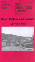
Gathurst And Crooke 1907
Gathurst and Crooke in 1907 in a fascinating series of reproductions of old Ordnance Survey plans in the Alan Godfrey Editions, ideal for anyone interested in the history of their neighbourhood or family. Selected towns in Great Britain and Ireland are covered by maps showing the extent of urban development in the last decades of the 19th and early 20th century.In this title: the map covers the Gathurst and Crooke area, west of Wigan; coverage stretches from Crooke westward to Dean Cottages, and from John Pit Colliery southward to Ackhurst Hall. Features include LYR Wigan-Southport line with Gathurst station, Branckers Siding, mineral railway to canal, Leeds & Liverpool Canal, River Douglas, Crooke village, Crooke Hall, Otters Croft Wood, remains of Tunnel Canal, John Pit
colliery with mineral railway, John Pit Houses, Gathurst Mount, Roburite Explosives Works and tramways, Ackhurst Hall, Gathurst Fold, Milk House Cottage, Dean Locks, Gathurst Farm.About the Alan Godfrey Editions of the 25
colliery with mineral railway, John Pit Houses, Gathurst Mount, Roburite Explosives Works and tramways, Ackhurst Hall, Gathurst Fold, Milk House Cottage, Dean Locks, Gathurst Farm.About the Alan Godfrey Editions of the 25
Product Description
Reviews/Comments
Add New
Intelligent Comparison
Archived Product
Gathurst And Crooke 1907 Stanfords
£3.50
Vouchers
No voucher codes found.
Do you know a voucher code for this product or supplier? Add it to Insights for others to use.
Do you know a voucher code for this product or supplier? Add it to Insights for others to use.
 Denmark