
 United Kingdom
 France
 Germany
 Netherlands
 Sweden
 USA
USA
 Italy
Italy
 Spain
Spain
More From Contributor


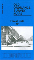
Forest Gate 1894
Forest Gate in 1894 in a fascinating series of reproductions of old Ordnance Survey plans in the Alan Godfrey Editions, ideal for anyone interested in the history of their neighbourhood or family. Two versions of this map have been published to show how the area developed across the years, as reflected by the change of the title. The maps cover an area stretching from Fairland Road and West Ham Park eastward to Woodgrange Park Cemetery, and from the GER railway southward to Plashet Road. The 1894 map is more built up and features now include Forest Gate School, Forest Gate Junction, Woodgrange Park station, tramway along Romford Road, and the northern fringe of Upton Park. Churches include St Anthony`s RC church, St James`s Forest Lane, All Saints Romford Road. Streets (many only
half built up in 1894) include Romford Road, Red Post Lane, Earlham Grove, Gipsy Lane, Boleyn Road and many more. Each map has selected extracts from a contemporary street directory.About the Alan Godfrey Editions of the 25” OS Series:Selected towns in Great Britain and Ireland are covered by maps showing the extent of urban development in the last decades of the 19th and early 20th century. The plans have been taken from the Ordnance Survey mapping and reprinted at about 15 inches to one mile (1:4, 340). On the reverse most maps have historical notes and many also include extracts from contemporary directories. Most maps cover about one mile (1.6kms) north/south, one and a half miles (2.4kms) across; adjoining sheets can be combined to provide wider coverage.FOR MORE INFORMATION
AND A COMPLETE LIST OF ALL AVAILABLE TITLES PLEASE CLICK ON THE SERIES LINK.

Product Description
Reviews/Comments
Add New
Vouchers
No voucher codes found.
Do you know a voucher code for this product or supplier? Add it to Insights for others to use.
Do you know a voucher code for this product or supplier? Add it to Insights for others to use.
 Denmark