More From Contributor

£14.99
DUE OUT JUNE 2014
- Florida Eyewitness travel guide from Dorling Kindersley is a lavishly illustrated book concerned with providing
...
Archived Product
£10.99
Florida at 1: 500, 000 on a double-sided, indexed road map from Freytag & Berndt with place names in larger print than found on most other maps of the state & icons prominently highlighting various places of interest, plus panels with street plans of central Orlando, Miami Beach & Jacksonville. The map divides the state north
- south, with the southern half starting well north of Palm Coast & Daytona Beach, so covering all the Florida’s most visited locations & attractions, but PLEASE NOTE: the way the publishers have marked Disney World makes it very difficult to find it on this map! The map shows the state’s road network with driving distances (in miles) on main routes. County boundaries & names are prominently marked. National/state parks, forests & other protected areas are highlighted. Large icons indicate numerous places of interest, including campsites. Latitude & longitude lines are drawn at 20’ intervals. Multilingual map legend

Includes::
English. Also provided are large panels with street plans of central Orlando, Miami Beach & Jacksonville.


...
Archived Product
£4.99
Florida on a laminated, tear-resistant Insight Flexi Map, with a double-sided road map of the state, street plans of Miami, Miami Brach & Tampa, all indexed, a detailed plan of the Disney World, plus extensive tourist information. The map main map covers Florida at 1:1, 000, 000, with the panhandle shown as an inset on the reverse. Florida ...
Archived Product
£5.99
Florida on an Insight Flexi Pocket Map in their new format introduced to provide more convenient access to the special features of this series: various additional maps and/or street plans plus tourist information including a list of must-see sights. The map is tear-resistant, waterproof, & can be written on with non-permanent marker pens. On one side is a road map at 1:1, 200, 000 showing the main part of the state; the north-west panhandle is on the reverse at the same scale. The map presents the road & rail networks on a base showing numerous swamps & marshes; national parks or protected areas are highlighted. The map has no geographical coordinates. Accompanying index lists places & points of interest. Next to the main & on the reverse are this title’s additional

Features:
- A panel extending the coverage of the main map to north-western Florida.- A map at 1:90, 000 covering Miami with Miami Beach, including access to the city’s international airport.
- 35 main sights, neatly grouped into sections covering Urban Attractions, Natural Wonders, Top Beaches, Theme Parks & Other Thrills, plus Museums & Cultural Highlights are given brief descriptions & are prominently highlighted on the relevant maps.- Information about Getting Around to/from airports, by car, by bus, etc, plus monthly climate charts. To see the list of other Insight Flexi titles in this series please click on the series link.


...
Archived Product
£9.99
This double-sided sheet carries a great amount of information on Florida: on one side is a map of the larger part of the State & in an inset an administrative map showing counties & population per county. On the reverse, the Western part of the State, with a distance chart in miles, maps showing average temperatures & precipitation, a list of festivals & events, casinos & race tracks, baseball events, State Parks with facilities, universities & a brief history of Florida. The main map shows relief through colour shading & contour lines, roads are marked according to type & clearly named. Text highlights places of natural or historical interest on the map. To see other regional titles from ITMB covering USA please click on the series link. ...
Archived Product
£8.95
Double-sided sheet with main mapping (at 1:120, 000) showing Key Largo & Upper Keys on one side & Key West & the Lower Keys on the other. Marquesas Keys & the Dry Tortugas lying west of Key West, are shown in insets. The overseas highway is clearly marked & various amenities & features of tourist interest are indicated eg. accommodation, beaches, boat ramps, fishing areas, dive sites, campgrounds, medical centres, gas stations & car parking. Larger scale insets, at 1:30, 000, 1:35, 000 & 1:40, 000 show the main Keys & other selected localities in greater detail. These show & name the roads & streets. Protected area boundaries are shown, also the Intracoastal Waterway. Bathymetric contours are included & many channels & shoals are identified. Latitude & longitue margin ticks are marked. Indexed for streets. ...
Archived Product
£4.95
Two heavily-annotated tourist maps ideal for visitors to this popular area. On the reverse is a street map of Key West detailing the restaurants, hotels, etc. The main map, meanwhile, is of the Keys themselves &

Includes::
recreational facilities, good places to eat & cool places to stay for all budgets. All the Keys are named for & dive sites are clearly shown.

...
Archived Product
£9.99
Florida Keys on a waterproof & tear-resistant map/guide from Franko Maps, presenting on one side the whole of the Keys, plus on the reverse more detailed enlargements for popular locations, with details of numerous diving sites including ship wrecks, a street plan of Key West, beautiful drawings of local reef creatures, etc. On one side the area from Homestead on the mainland to the islands beyond Key West is presented at approx. 1:333, 000, highlighting locations of numerous diving sites, most annotated with details of depth, currents, fauna, etc. Additional panels provide descriptions of main locations on the islands including Islamorada, Marathon & the Lower Keys. On the reverse an enlargement shows Key Largo in greater detail at 1:100, 000, with a street plan of central Key Largo plus a map of the John Pennekamp State Park, both highlighting various places of interest & diving-related facilities. Two more panels show: a street plan of Key West with brief descriptions of various places of interest facilities, plus a map the Dry Tortugas National Park. The map also

Includes::
lovely drawings of local reef creatures.

...
Archived Product
£9.99
Florida Keys at 1:120, 000 on a double-sided, indexed map from ITMB with several insets showing most visited resorts, islands and/or nature reserves in greater detail. Numerous small islands are named. On one side are the Upper Keys, from the mainland to the Seven Mile Bridge, accompanied by insets showing at 1:35, 000 plans of Key Largo, the Grayvik area, Upper Matecumbe Key – Plantation Key, Lower Matecumbe, Layton, Grassy Key – Duck Key, & Vaca Key – Key Colony beach. On the reverse a map of the Lower Keys has enlargement panels with Bahai Honda Key, Big Pine Key with the nearby islands, Cudjoe Keys – Summerland Keys, Perky – Sugerloaf Sound, Bay Point, Boca Chica Key, & Key West. Two more panel cover locations within the Gulf of Mexico: the Dry Tortugas with an enlargement for the Fort Jefferson, plus the Marquesas Keys. All the maps are annotated to show numerous tourist facilities, including selected accommodation, beaches, fuel supply points, etc. Areas which are national/state parks or nature reserves are highlighted, & all the panels have latitude & longitude margin ticks. ...
Archived Product

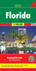
Florida Insight Travel Map

Insight Guides Travel Map: has a fold up map of the country ideal for planning routes or taking on holiday.This Florida Travel Map is drawn to a scale of 1:800, 000 and shows the entire country complete with a comprehensive index. This is an ideal on-the-move companion when you`re exploring FloridaIt includes detailed street plan of Miami, with its own separate indexOutlines Top Attractions and places of interestPictorial symbols for instant recognitionShows countries roads, rail networks and ferry routesIncludes distance indicators Detailed topography Legend shown in eight languages
RIP - This product is no longer available on our network. It was last seen on 25.09.2019

This page now acts as a permanent archive for this product. Add more information using the comments box below to ensure it can still be found by future generations.

Use our search facility to see if it is available from an alternative contributor.
  • Availability: Out Of Stock
  • Supplier: Stanfords
  • SKU: 9781786719072
Availability: In Stock
£6.99

Product Description

Insight Guides Travel Map: has a fold up map of the country ideal for planning routes or taking on holiday. This Florida Travel Map is drawn to a scale of 1:800, 000 & shows the entire country complete with a comprehensive index. This is an ideal on-the-move companion when you`re exploring Florida It

Includes::
detailed street plan of Miami, with its own separate index Outlines Top Attractions & places of interest Pictorial symbols for instant recognition Shows countries roads, rail networks & ferry routes
Includes: distance indicators Detailed topography Legend shown in eight languages

Reviews/Comments

Add New

Intelligent Comparison

Oooops!
We couldn't find anything!
Perhaps this product's unique.... Or perhaps we are still looking for comparisons!
Click to bump this page and we'll hurry up.

Price History

Vouchers

No voucher codes found.
Do you know a voucher code for this product or supplier? Add it to Insights for others to use.

Facebook

Jargon Buster

Ideal - Something that satisfies a perfect criteria.

Supplier Information

Stanfords
Stanfords was established in 1853 and opened their iconic Covent Garden flagship store in 1901. They have become the top retailer of maps, travel books and accessories in the UK and arguably offer the largest selection of maps and travel books worldwide. Famous names such as Captain Robert Falcon Scott, Ranulph Fiennes and Michael Palin have purchased from Stanfords. They now have a shop in Bristol and both stores together with other venues operate a calendar of events including talks, book signings and exhibitions. As a specialist map retailer, the map selection is comprehensive and includes road maps, street maps and walking maps from worldwide destinations, as well as a selection of world atlases and wall maps. Books include travel guides and travel literature. Stanfords also stock globes, from miniatures made of blue marble to magnificent floor-standing globes. The website features a selection of interesting articles on travel topics.
Page Updated: 2023-11-12 20:15:36

Community Generated Product Tags

Oh No! The productWIKI community hasn't generated any tags for this product yet!
Menu