
 United Kingdom
 France
 Germany
 Netherlands
 Sweden
 USA
USA
 Italy
Italy
 Spain
Spain
More From Contributor


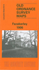


Fazakerley 1906
Fazakerley in 1906 in a fascinating series of reproductions of old Ordnance Survey plans in the Alan Godfrey Editions, ideal for anyone interested in the history of their neighbourhood or family. Selected towns in Great Britain and Ireland are covered by maps showing the extent of urban development in the last decades of the 19th and early 20th century.In this title: the map covers the Fazakerley area and the northerly part of Walton on the Hill, on the outskirts of Liverpool. Coverage stretches from Rice Lane and Walton Vale eastward to Higher Lane Farm, and from Sandy Lane southward to Firdale Road. Features include Everton Cemetery, part of City Hospital, Fazakerley Annexe, Birch Tree House, Rosebank Farm, Hartley's Village and Hartley's Jam Factory, tramways, stretch of
Cheshire Lines Railway with Fazakerley North Junction and MR Bootle Goods Branch, Donard Lodge, Knowles House, stretch of LYR railway with east end of Preston Road station, etc. On the reverse is a selection of street directory entries, including Cedar Road, Fazakerley Road, Higher Lane, Long Lane, Longmoor Lane, Second Avenue, Walton Vale, Warbeck Moor. About the Alan Godfrey Editions of the 25
Cheshire Lines Railway with Fazakerley North Junction and MR Bootle Goods Branch, Donard Lodge, Knowles House, stretch of LYR railway with east end of Preston Road station, etc. On the reverse is a selection of street directory entries, including Cedar Road, Fazakerley Road, Higher Lane, Long Lane, Longmoor Lane, Second Avenue, Walton Vale, Warbeck Moor. About the Alan Godfrey Editions of the 25
Product Description
Reviews/Comments
Add New
Intelligent Comparison
Archived Product

Fazakerley 1906 Stanfords
£3.50
Archived Product

Bardsley 1906 Stanfords
£3.50
Vouchers
No voucher codes found.
Do you know a voucher code for this product or supplier? Add it to Insights for others to use.
Do you know a voucher code for this product or supplier? Add it to Insights for others to use.
 Denmark